K2 Base Camp Height, Distance & Map: Day by Day from Askole
By Imtiyaz Ahmed Shigri, founder of Chogori Adventure, Skardu · Updated November 2026
K2 Base Camp height: about 5,150 m (16,896 ft) above sea level. From Askoli (also spelled Askole), the last village, it is about 97 km on foot up the Baltoro Glacier, through Jhula, Paiju, Khoburtse, Urdukas, Goro II and Concordia (4,691 m). The whole trek, there and back, is about 195 km of walking. Skardu to K2 Base Camp is about 223 km: 126 km by jeep to Askoli, then the walk. Below are the distance, walking time and height for every day, the return route, a route map, the road and flight distances from Islamabad, and the straight-line distance to K2 from the main cities of Pakistan. All trek figures are from our K2 Base Camp Trek itinerary; times are for a fit trekker at a normal pace, and yours may be shorter or longer.
K2 Base Camp height and distance at a glance
| Figure | |
|---|---|
| K2 Base Camp height | About 5,150 m (16,896 ft) |
| K2 summit | 8,611 m (28,251 ft), 3,461 m above base camp |
| Askoli to K2 Base Camp | About 97 km on foot, 8 days including a rest day |
| Whole trek on foot | About 195 km, Askoli to K2 Base Camp and back |
| Skardu to Askoli | About 126 km, 5–7 hours by jeep |
| Skardu to K2 Base Camp | About 223 km: 126 km by jeep and 97 km on foot |
| Islamabad to Skardu | About 1 hour by air (about 300 km in a straight line), or about 640 km by road |
| Islamabad to K2, straight line | About 400 km |
| Highest camp | Broad Peak Base Camp, about 4,850 m (we sleep here on day 12) |
| Trek length | 21 days from Islamabad and back, 14 of them on the trail (days 5 to 18) |
How high is K2 Base Camp above sea level?
K2 Base Camp is at about 5,150 m (16,896 ft) above sea level, at the head of the Godwin-Austen Glacier, right under the south face of K2. That is 459 m higher than Concordia (4,691 m) and 3,461 m (11,355 ft) below the summit of K2 (8,611 m). It is the highest point of the trek. You do not sleep there on our itinerary: after a visit to the camp and the Gilkey Memorial, you walk back down to Broad Peak Base Camp (about 4,850 m) for the night.
Why you see different heights for K2 Base Camp
Books, maps and websites give K2 Base Camp anywhere from about 4,950 m to 5,150 m. There are three reasons. First, base camp is not one fixed spot: in the climbing season the expedition tents spread along the moraine at the foot of the mountain, and the upper and lower tents can be more than 100 m apart in height. Second, the camp sits on a moving glacier whose surface is slowly getting lower as the ice melts, so a height measured twenty years ago is not quite right today. Third, many figures come from phone or watch GPS, which can be 20–50 m out in steep valleys.
For comparison, a weather station that an Italian–Pakistani research team set up on the glacier near the camp in 2014 stands at about 4,970 m, and the SRTM and Copernicus satellite maps read about 5,000–5,100 m on the glacier below the mountain. We use 5,150 m on every page of our website, so that our itinerary, map and this article all agree. Whichever figure you use, plan for a camp at roughly 5,000–5,150 m, where the air holds about half the oxygen of sea level.
What 5,150 m means for your body
At 5,150 m the air pressure is about 53 kPa, roughly 52% of the pressure at sea level. Every breath brings in about half as much oxygen as it would on a beach. Water boils at about 83 °C, so tea is never really hot and food takes longer to cook. Most trekkers feel short of breath on any uphill stretch, sleep lightly and lose some appetite above Concordia. These are normal reactions. A pounding headache that does not go away, vomiting, confusion or unusual breathlessness at rest are not normal, and you must tell your guide at once.
K2 Base Camp compared with other famous heights
| Place | Height | Compared with K2 Base Camp |
|---|---|---|
| K2 Base Camp | About 5,150 m (16,896 ft) | – |
| Everest Base Camp (south side, Nepal) | About 5,364 m (17,598 ft) | About 214 m higher |
| Everest Camp 2 (Western Cwm) | About 6,400 m (21,000 ft) | About 1,250 m higher; climbers only |
| Kilimanjaro summit | 5,895 m (19,341 ft) | About 745 m higher |
| Mont Blanc summit | About 4,806 m (15,768 ft) | About 344 m lower |
| Concordia | 4,691 m (15,390 ft) | 459 m lower |
| Gondogoro La | 5,585 m (18,323 ft) | 435 m higher; on the K2 Gondogoro La Trek |
So K2 Base Camp is a little lower than Everest Base Camp, but the walk to it is longer and much more remote: there are no villages, lodges or roads for the eight days after Askoli. How this affects difficulty is covered in our guide to difficulty, best time and preparation.
K2 Base Camp Trek route map
The map shows every camp with its height and the days you sleep there, the way up and the way back, and the flight and jeep legs. It is a schematic: not to scale. The map uses the spellings on our trip page (Paju, Khoburse, Goro 1, Goro 2); in this article we write Paiju, Khoburtse, Goro I and Goro II, the forms most trekking maps use.
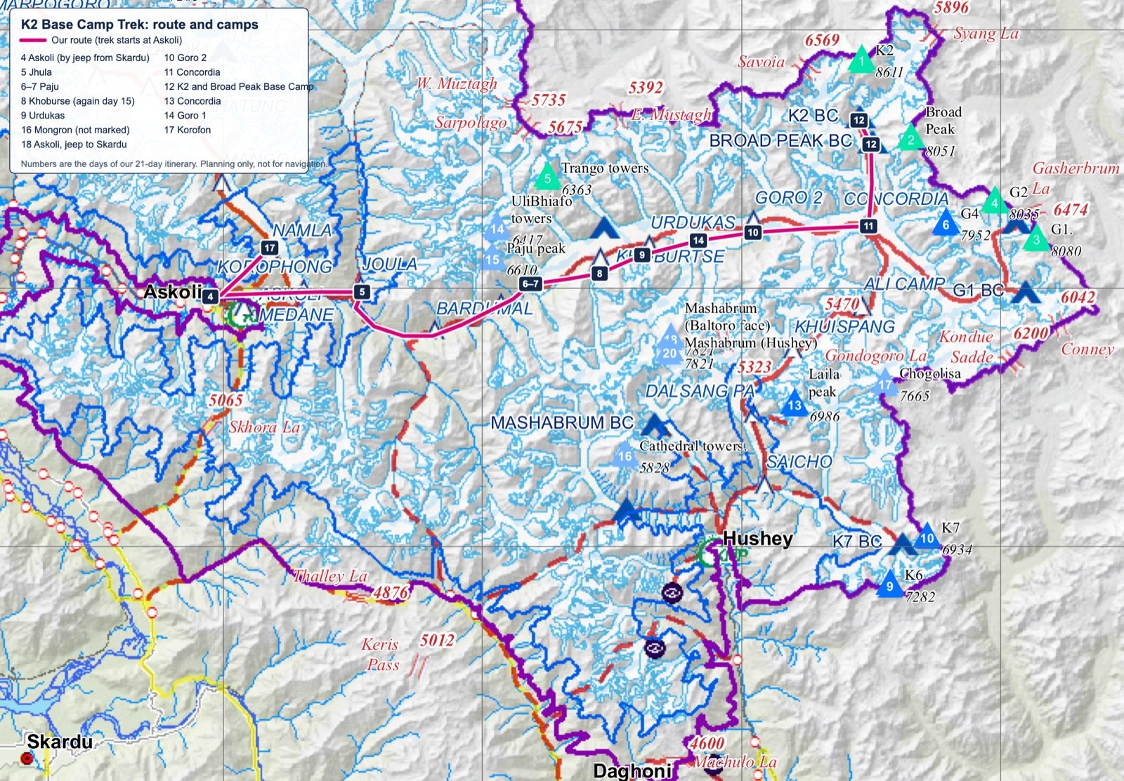
Base map: Central Karakorum National Park (CKNP) Tourism Map, March 2014, by CKNP with SEED and Ev-K2-CNR. Route, camps and day numbers added by Chogori Adventure.
Reading the map: the shape of the route
The route is shaped like a long hook. From Skardu (2,230 m) the jeep road runs north up the Shigar valley and then east up the Braldu valley to Askoli. From Askoli you walk east along the Braldu River to Paiju, then onto the Baltoro Glacier, which you follow east for about 63 km to Concordia. At Concordia the route turns sharply north, up the Godwin-Austen Glacier, for the last 12 km to K2 Base Camp. On the way back you retrace the glacier, but sleep at different camps.
The straight-line distance from Askoli to K2 Base Camp is only about 67 km. On foot it is about 97 km, because the trail follows the river and then weaves across the glacier between ridges of rock, meltwater streams and ice towers. This is why straight-line distances, such as those that phone map apps show, are of little use for planning the trek.
Glaciers and peaks along the route
These are the main features you pass, from Askoli to K2 Base Camp. Heights of peaks are the commonly quoted survey figures.
| Feature | Height or size | Where you see it |
|---|---|---|
| Biafo Glacier | About 67 km long | Its snout is crossed on day 5, between Korofon and Jhula; it leads north to Snow Lake |
| Paiju Peak | 6,610 m | Above Paiju camp, days 6–7 |
| Trango Towers | Great Trango about 6,286 m | From the Trango viewpoint near Paiju, and at lunch at Liligo on day 8 |
| Uli Biaho and the Cathedrals | Uli Biaho about 6,417 m | Lower Baltoro, days 8–9, best from Urdukas |
| Baltoro Glacier | About 63 km long | You walk on it from day 8 to day 11, and again on days 13–16 |
| Masherbrum (K1) | 7,821 m | To the south from Goro I and Goro II, days 10 and 14 |
| Muztagh Tower | 7,276 m | To the north from the middle Baltoro, day 10 |
| Gasherbrum IV | 7,932 m | Straight ahead up the glacier from Urdukas and Goro II |
| Broad Peak | 8,051 m | From Concordia and on the walk to K2 Base Camp |
| Mitre Peak and Chogolisa | About 6,010 m and 7,665 m | Around Concordia, to the south |
| Godwin-Austen Glacier | About 12 km from Concordia to K2 Base Camp | Day 12, the last stage |
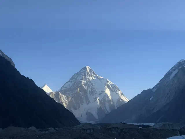
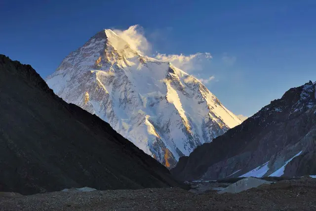
| K2 | 8,611 m | From Concordia (weather permitting) and from base camp |
Concordia is the meeting point of the Baltoro, Godwin-Austen and other glaciers, and the only place on the trek where four peaks above 8,000 m are close together: K2, Broad Peak and, partly hidden, Gasherbrum I and II. All of this lies inside the Central Karakoram National Park, about 10,000 km² of protected mountains; the park fee is included in our trek price.
K2 camps map: the climbing camps above base camp
Some people searching for a "K2 camps map" want the climbing camps, not the trekking camps. On the usual climbing route, the Abruzzi Spur, climbers use four high camps above K2 Base Camp, at about 6,050 m, 6,700 m, 7,200 m and 7,800 m, before the summit day. Trekkers do not go above base camp. The climbing route, camp by camp, is in our article on how K2 is climbed, camp by camp.
Skardu to K2 distance, and Islamabad to K2 distance
Skardu to K2 Base Camp is about 223 km: about 126 km by jeep to Askoli (5–7 hours), then about 97 km on foot (8 days). Islamabad to K2 Base Camp is about 1 hour by air to Skardu (or about 640 km by road), then the same jeep ride and walk. In a straight line, K2 is about 100 km from Skardu and about 400 km from Islamabad.
Road and flight distances
| Route | Distance | Time | Notes |
|---|---|---|---|
| Islamabad → Skardu by air | About 300 km in a straight line | About 1 hour | Daily flights in good weather; the flight follows the mountains past Nanga Parbat |
| Islamabad → Skardu by road, via the Babusar Pass | About 640 km | About 16–18 hours of driving, usually two days | Shortest road; the Babusar Pass (4,173 m) is usually open only in summer, roughly June to October |
| Islamabad → Skardu by road, via Besham on the Karakoram Highway | About 750 km | About 20 hours of driving, usually two days | The year-round road, used when the Babusar Pass is closed |
| Skardu → Askoli by jeep | About 126 km | 5–7 hours | Through Shigar and up the Braldu valley; the last part is a narrow jeep road |
| Askoli → K2 Base Camp on foot | About 97 km | 8 days, including a rest day | No roads, villages or shops after Askoli |
| Islamabad → K2 Base Camp, in all | About 1 hour by air + 223 km, or about 863 km by road and on foot | 12 days on our itinerary | Arrive day 1, reach K2 Base Camp on day 12 |
Road distances depend on where in Islamabad and Skardu you start and which route you take, so sources quote anything from about 600 km to 750 km for Islamabad to Skardu. The roads through the mountains are slow: landslides, road works and checkposts can add hours, which is why we fly whenever the weather allows.
Straight-line distance to K2 from cities in Pakistan
If you searched for "K2 distance from my location", this table gives the distance as the crow flies from the main cities to the summit of K2. The real journey is always longer, because roads and trails follow the valleys.
| From | Straight line to K2 | How you actually travel |
|---|---|---|
| Askoli | About 67 km | About 97 km on foot to base camp |
| Skardu | About 100 km | 126 km by jeep + 97 km on foot |
| Gilgit | About 200 km | By road to Skardu (about 5–6 hours), then as from Skardu |
| Islamabad | About 400 km | Flight or road to Skardu, then as from Skardu |
| Peshawar | About 500 km | Via Islamabad |
| Lahore | About 525 km | Via Islamabad |
| Karachi | About 1,525 km | Flight to Islamabad or Skardu |
Getting to Askoli
| Leg | Distance | Time | How |
|---|---|---|---|
| Islamabad → Skardu | About 300 km in a straight line | About 1 hour | Flight. If it is cancelled by weather, the drive on the Karakoram Highway takes about 20 hours. |
| Skardu → Askoli | About 126 km | 5–7 hours | Jeep, on a rough road along the Shigar and Braldu valleys |
Skardu is at 2,230 m and Askoli at 3,000 m. Our itinerary keeps a rest day in Skardu (day 3) before the jeep ride. Our team completes the permit formalities in Skardu, and on the rest day you can take a short walk up to Kharpocho Fort above the town.
The jeep ride from Skardu to Askoli
The drive is about 126 km and takes 5–7 hours, usually with a stop on the way. Half an hour from Skardu the road enters the green Shigar valley, the valley that leads towards K2. After the Shigar fields it narrows and turns into the Braldu valley, where a narrow jeep road is cut into the side of the gorge high above the river. In wet weather, or after a storm, landslides can close this road for some hours; drivers clear small ones by hand, and on a bad day the jeeps wait or the crew carries loads across a slide on foot. This is one reason our plan has a spare day at the end.
K2 lies in a restricted zone, so foreigners need a trekking permit and a national park entry permit, and the trekking permit is checked on the way. Our team handles the paperwork, but keep your passport with you, not packed deep in a porter bag. For more about the village and the valley, see our page on Askoli, the last village before K2.
Askoli to K2 Base Camp: distance and altitude day by day
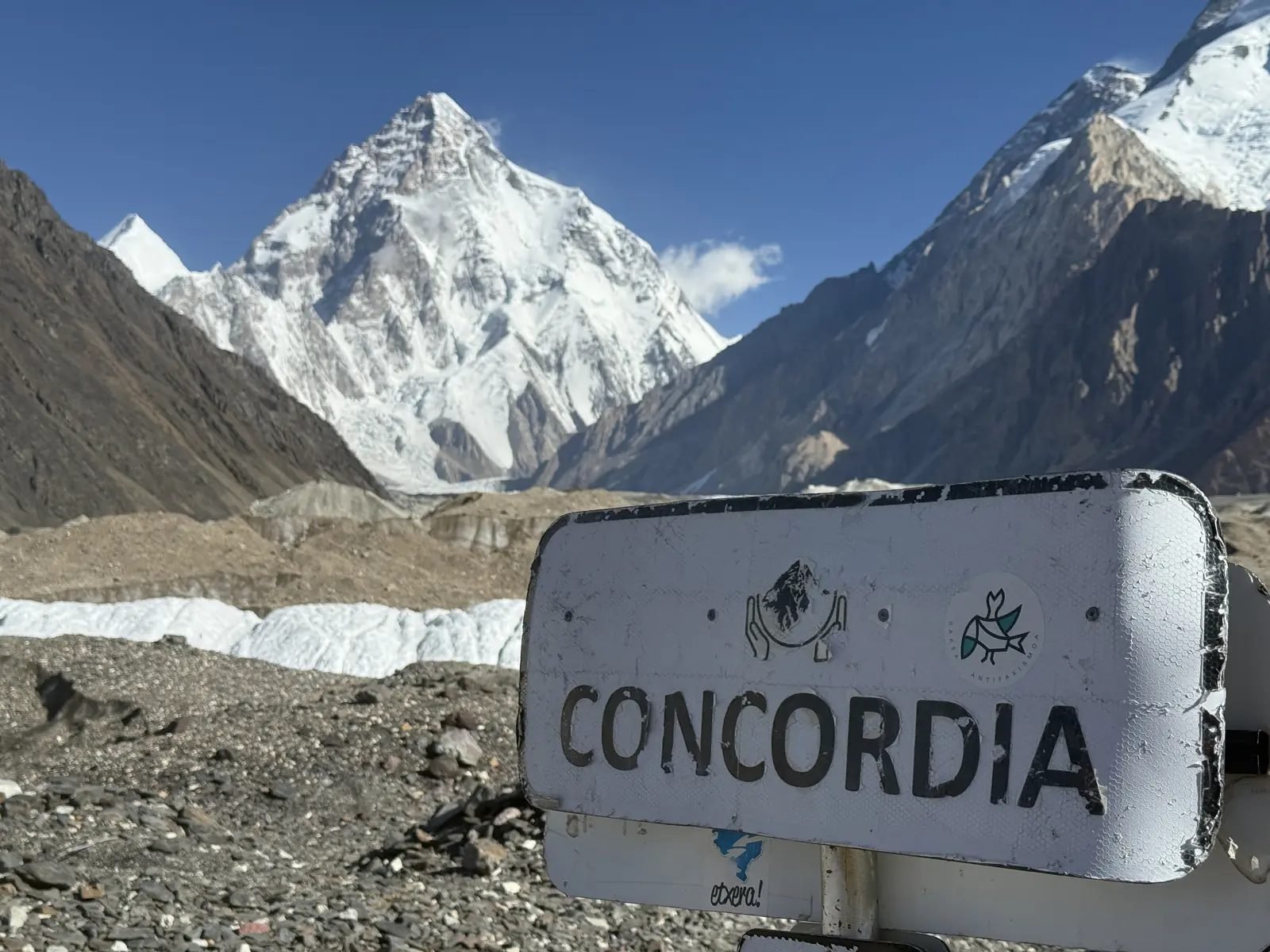
The Concordia signpost on the Baltoro glacier with K2 behind
| Day | Stage | Distance | Walking time | Camp height | Height gain |
|---|---|---|---|---|---|
| Day 5 | Askoli → Jhula | 20 km | 5–8 hours | 3,200 m (10,499 ft) | +200 m |
| Day 6 | Jhula → Paiju | 20.5 km | 7–8 hours | 3,400 m (11,155 ft) | +200 m |
| Day 7 | Rest day at Paiju | – | – | 3,400 m (11,155 ft) | – |
| Day 8 | Paiju → Khoburtse | 14.7 km | 5–6 hours | 3,800 m (12,467 ft) | +400 m |
| Day 9 | Khoburtse → Urdukas | 6.2 km | 4–5 hours | 4,000 m (13,123 ft) | +200 m |
| Day 10 | Urdukas → Goro II | 12.2 km | 7–8 hours | 4,300 m (14,108 ft) | +300 m |
| Day 11 | Goro II → Concordia | 11.8 km | 5–6 hours | 4,691 m (15,390 ft) | +391 m |
| Day 12 | Concordia → K2 Base Camp | 11.8 km | 4–6 hours | 5,150 m (16,896 ft) | +459 m |
That is about 97 km and 2,150 m of height gain from Askoli to K2 Base Camp. From Askoli to Concordia alone is about 85 km over six walking days. The real climbing is more than 2,150 m, because the glacier trail goes up and down over ridges of moraine all day.
What each stage is like
- Askoli to Jhula: along the Braldu River, past Korofon (about 12 km, where the Biafo Glacier comes in) and across the Biafo snout to Jhula. Facing the camp is Bakhordas peak, the first big peak on the way.
- Jhula to Paiju: a long day on the river bank, crossing small side streams, with the first views of the Baltoro Glacier and the Paiju peaks. The rest day at Paiju helps you acclimatise, and a 20–30-minute walk takes you to the Trango viewpoint.
- Paiju to Khoburtse: onto the Baltoro Glacier, up and down over rock-covered ice, with lunch at Liligo facing the Trango Towers. Let horses and donkeys pass when they cross your path.
- Khoburtse to Urdukas: the shortest day, ending at the last camp on solid ground, high above the glacier, with views of the Trango group, Uli Biaho, the Cathedrals and, in good weather, Gasherbrum IV.
- Urdukas to Goro II: in the middle of the glacier, with Masherbrum on the right and Muztagh Tower on the left, stopping at Goro I for lunch. Goro II is windy and cold.
- Goro II to Concordia: a gradual climb to the meeting of the Baltoro and Godwin-Austen glaciers, with K2, Broad Peak and the Gasherbrums all around. It often snows at Concordia, even in summer.
- Concordia to K2 Base Camp: across glacial streams near camp, then up the Godwin-Austen Glacier, about three hours to Broad Peak Base Camp for lunch and about two more to K2 Base Camp and the Gilkey Memorial.
Distance versus walking time: why glacier kilometres are slow
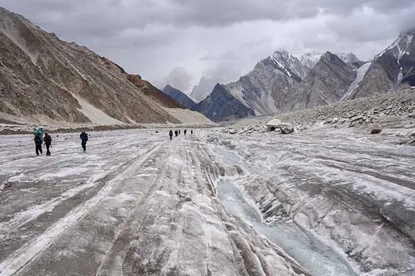
On the glacier, 1 km can take as long as 3 km on a good trail. Compare two days on our plan. Day 5, Askoli to Jhula, is 20 km in 5–8 hours on a river trail: about 3 km an hour. Day 9, Khoburtse to Urdukas, is only 6.2 km but takes 4–5 hours: about 1.3 km an hour. The difference is the ground. On the Baltoro the trail climbs over mounds of loose rock lying on ice, drops into hollows, and winds around crevasses and meltwater pools, and its line changes from year to year as the glacier moves.
So plan by hours, not kilometres. A useful rule on this trek: count on about 3 km an hour on the river trail below Paiju, and about 1.5–2 km an hour on the glacier, plus stops. Afternoons are usually warmer and the streams higher, which is one reason our guides start early on the glacier days.
The way back: Mongron and Korofon
We come back down the Baltoro Glacier, but stop at different camps from the way up, so the return is not the same walk twice.
| Day | Stage | Distance | Walking time | Camp height |
|---|---|---|---|---|
| Day 12 | K2 Base Camp → Broad Peak Base Camp | 5 km | Same day, after K2 Base Camp | 4,850 m (15,912 ft) |
| Day 13 | Broad Peak Base Camp → Concordia | 7 km | about 3 hours | 4,691 m (15,390 ft) |
| Day 14 | Concordia → Goro I (Biango) | 18 km | 5–6 hours | 4,100 m (13,451 ft) |
| Day 15 | Goro I → Khoburtse | 12 km | 5–6 hours | 3,800 m (12,467 ft) |
| Day 16 | Khoburtse → Mongron | 24 km | 7–9 hours | 3,300 m (10,827 ft) |
| Day 17 | Mongron → Korofon | 20 km | 6–7 hours | 3,100 m (10,171 ft) |
| Day 18 | Korofon → Askoli, then jeep to Skardu | 12 km | 3–4 hours on foot | 2,230 m (7,316 ft) |
The return is about 98 km on foot. Day 16 to Mongron is the longest day of the trek: you leave the Baltoro Glacier, walk past Paiju with the Trango Towers in view again, and continue about 9 km along the river. From Askoli the jeep takes you back to Skardu the same day.
The way down is faster than the way up for two reasons: you are walking downhill, and your body has adjusted to the altitude. On the way up the plan covers about 97 km in eight days; on the way down about 98 km in seven. Goro I, where you sleep on day 14, is the same camp that older maps call Biango.
Total distance and time, from Islamabad to K2 Base Camp and back
Our 21-day K2 Base Camp Trek covers about 195 km on foot, about 252 km by jeep (Skardu to Askoli and back) and two flights of about 1 hour each between Islamabad and Skardu. Of the 21 days, 14 are on the trail (days 5 to 18), counting the rest day at Paiju.
| Part of the trip | Days | Distance | Highest point |
|---|---|---|---|
| Islamabad and the flight to Skardu | Days 1–2 | About 300 km by air | Skardu, 2,230 m |
| Rest day and drive to Askoli | Days 3–4 | About 126 km by jeep | Askoli, 3,000 m |
| Walk up to K2 Base Camp | Days 5–12 | About 97 km on foot | K2 Base Camp, 5,150 m |
| Walk back to Askoli, drive to Skardu | Days 12–18 | About 98 km on foot + 126 km by jeep | Broad Peak Base Camp, 4,850 m (night) |
| Flight to Islamabad, spare day, departure | Days 19–21 | About 300 km by air | – |
A worked example: if you land in Islamabad on 5 July, you fly to Skardu on 6 July, start walking from Askoli on 9 July, stand at K2 Base Camp on 16 July, walk out to Askoli on 22 July, and fly home from Islamabad on 25 July. Day 20 is a spare day for a late flight or a road closure; if it is not needed, it is a free day in Islamabad. If you are short of time and want to join the group in Skardu, the trek-only K2 Base Camp trek from Skardu follows the same days on the trail in 15 days. If you would like shorter walking days, the K2 Base Camp Trek for Beginners adds five days to the same route.
Heights of every camp
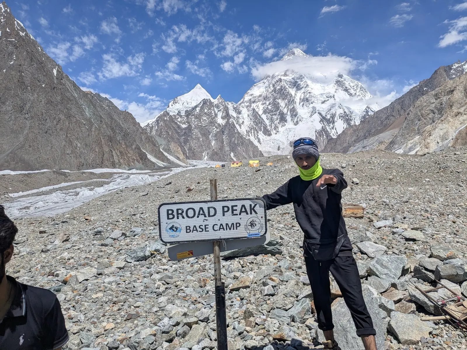
A trekker at the Broad Peak Base Camp sign
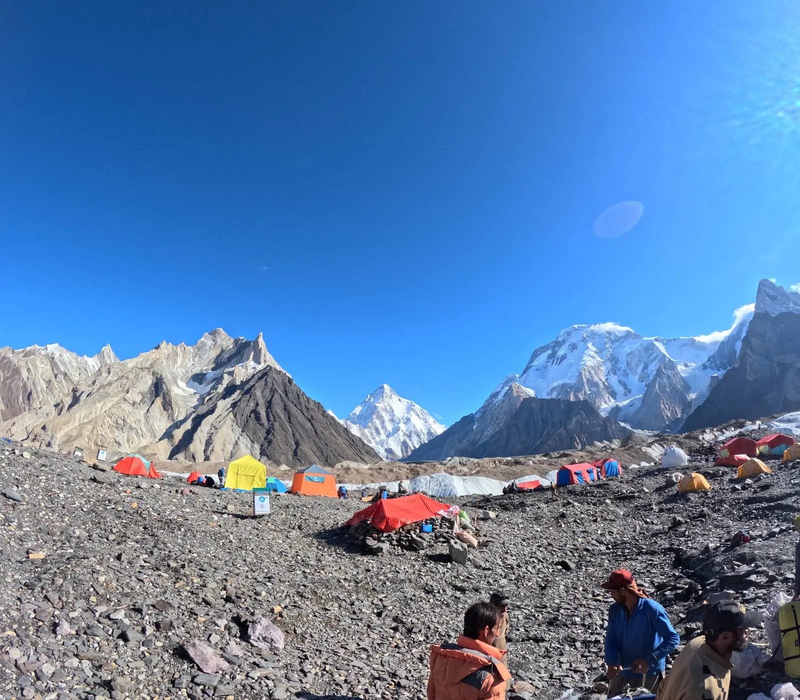
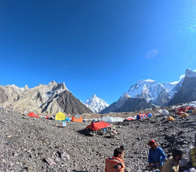
Tents at Concordia with K2 and Broad Peak behind, Baltoro glacier
| Place | Height | Note |
|---|---|---|
| Islamabad | 540 m (1,772 ft) | Start and end of the trip |
| Skardu | 2,230 m (7,316 ft) | Gateway town, rest day |
| Askoli | 3,000 m (9,843 ft) | Last village; the walk starts |
| Korofon | 3,100 m (10,171 ft) | Camp on the way back |
| Jhula | 3,200 m (10,499 ft) | First camp |
| Mongron | 3,300 m (10,827 ft) | Camp on the way back |
| Paiju | 3,400 m (11,155 ft) | Rest and acclimatisation day |
| Khoburtse | 3,800 m (12,467 ft) | First camp on the glacier |
| Urdukas | 4,000 m (13,123 ft) | Last camp on solid ground |
| Goro I | 4,100 m (13,451 ft) | Camp on the way back |
| Goro II | 4,300 m (14,108 ft) | Camp in the middle of the glacier |
| Concordia | 4,691 m (15,390 ft) | Meeting of the Baltoro and Godwin-Austen glaciers |
| Broad Peak Base Camp | 4,850 m (15,912 ft) | Highest night of the trek |
| K2 Base Camp | 5,150 m (16,896 ft) | Highest point of the trek |
| K2 summit | 8,611 m (28,251 ft) | For climbers only, about 50-day expedition |
Glacier camps move a little every year, and different maps and GPS devices read them differently, so you will see figures 50–100 m higher or lower elsewhere. The heights above are the ones we use on all our pages, checked against two satellite height maps and published survey figures.
Names you will see on other maps
Balti place names are written in several ways in English. If you compare our map with others, these are the same places:
- Askoli: also Askole or Askoly.
- Jhula: also Jhola or Jola.
- Paiju: also Paju or Paiyu.
- Khoburtse: also Khoburse.
- Goro I and Goro II: also Goro 1 and Goro 2; Goro I is the camp older maps call Biango.
- Khuspang: also Khuispang, the first camp after the Gondogoro La.
- K2: also Chogori, the Balti name, meaning "big mountain".
How the height rises, and acclimatisation
Once you start walking at Askoli (3,000 m), the sleeping height never rises by more than about 400 m in a day, and there are two rest days on the way up. The biggest jump comes before that, by jeep: day 4 takes you from Skardu (2,230 m) to Askoli, 770 m higher, after a rest day in Skardu. That is in line with the advice of mountain-medicine experts: above 3,000 m, raise your sleeping height by no more than about 500 m a day, and take a rest day every three to four days.
- After Askoli, the sleeping height never rises by more than about 400 m in a day, the step from Paiju to Khoburtse.
- Two rest days help your body adjust: day 3 in Skardu (2,230 m) and day 7 at Paiju (3,400 m).
- You reach K2 Base Camp (5,150 m) on day 12 and sleep lower, at Broad Peak Base Camp (about 4,850 m), then start down the next day.
- Drink plenty of water, walk slowly and tell your guide about any headache, dizziness or nausea. More in our K2 Base Camp Trek guide, including a 12-week training plan.
The biggest single height gain on foot is day 12, when you climb 459 m from Concordia to K2 Base Camp. Because you sleep 300 m lower, at Broad Peak Base Camp, the climb follows the old mountaineers' rule: climb high, sleep low. The real test of acclimatisation is the night at Concordia (4,691 m), on day 11. If you feel unwell there, the best treatment is to go down, and the glacier lets you lose height quickly towards Goro II.
A short history of the route to K2 Base Camp
The route you walk was mapped step by step between 1856 and 1909. In 1856 Thomas Montgomerie of the Great Trigonometrical Survey of India sighted the Karakoram peaks from far to the south and labelled them K1, K2 and so on; K2 kept its survey name. In 1861 Henry Haversham Godwin-Austen surveyed the Baltoro area, and the glacier below K2 now carries his name.
In 1892 the British explorer Martin Conway led the first major expedition up the Baltoro Glacier. The name Concordia is usually credited to him, after the Konkordiaplatz, where glaciers meet on the Aletsch Glacier in the Swiss Alps. In 1909 the Italian expedition of the Duke of the Abruzzi studied the routes on K2 and gave its name to the Abruzzi Spur, the route still used by most climbers; the expedition's photographer, Vittorio Sella, made the first great pictures of K2 from base camp.
The Gilkey Memorial, a 10–15-minute walk above K2 Base Camp, began in 1953 as a stone cairn built by an American team for Art Gilkey, who died on the mountain during that expedition. Since then plaques for climbers who lost their lives in the Karakoram have been added. A year later, on 31 July 1954, Lino Lacedelli and Achille Compagnoni of an Italian expedition made the first ascent of K2. More on the mountain itself is on our K2 page.
Mistakes to avoid when planning K2 distances and heights
Most planning mistakes come from treating the trek like a walk with a road at the end. These are the most common ones:
- Treating Concordia as K2 Base Camp. Concordia (4,691 m) is a day's walk from K2 Base Camp, about 11.8 km and 459 m lower. You see K2 from Concordia, but base camp is at the foot of the mountain.
- Planning with straight-line distances. Askoli to K2 Base Camp is about 67 km in a straight line but about 97 km on foot, and the glacier makes every kilometre slow.
- Booking international flights too tightly. The Skardu flight depends on the weather in the mountains. If it is cancelled, the road takes about 20 hours of driving. Book your flight home after the spare day, not before it.
- Trusting a GPS height. A watch can read 100 m differently from the map on the same spot. Use the planned camp heights for your acclimatisation, and how you feel for your decisions.
- Forgetting the walk out. Reaching K2 Base Camp is only half the walking. The return is about 98 km, including the longest day of the trek (24 km on day 16).
- Expecting a phone signal. There is no mobile network or internet after Askoli. Concordia has a solar-powered signal tower that works only some of the time. We carry a satellite phone for emergencies.
What our team does on the ground
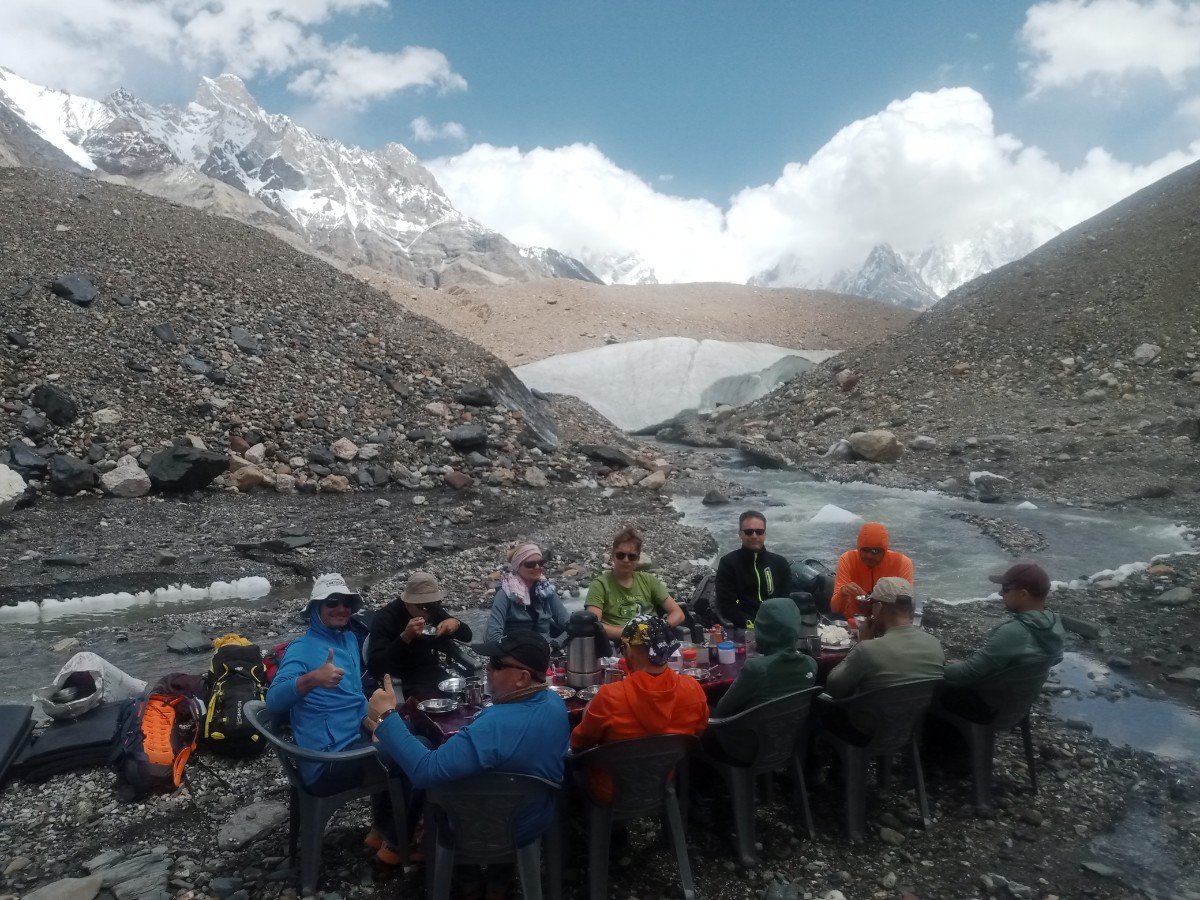
On our trips, the crew walks ahead with the loads and sets up camp before you arrive, so most days end with tents up and tea ready. A porter carries up to 16 kg of your personal luggage, and you carry only a day pack with water, a warm layer, a rain jacket and snacks. Our cooks prepare all meals on the trek, and boiled water, biscuits and dried fruit are given out every day.
On the glacier days our guides usually set the pace for the slowest member of the group, pick the line across the moraine, and plan the start time so that streams are crossed while they are low. They carry a first aid kit and the satellite phone, and most of them are trained in first aid. If a trekker shows signs of altitude illness, the usual first step is to go down, and the guide arranges it. The trekking permit, government fees and the national park fee are arranged in Skardu and included in the price. For what the price covers and the extras, see our K2 Base Camp Trek cost guide; for travel advice before you go, read Before you trek in Pakistan.
Going over the Gondogoro La instead
On the K2 Gondogoro La Trek you walk the same route up to Concordia and K2 Base Camp, then go to Ali Camp and cross the Gondogoro La (5,585 m) to Hushe instead of walking back down the Baltoro. Distances for that route: Gondogoro La Trek daily distance and altitude.
Key points on the pass route:
| Place | Height | Day | Note |
|---|---|---|---|
| Ali Camp | 4,950 m (16,240 ft) | Day 14 | Camp below the pass, about 12 km from Concordia |
| Gondogoro La | 5,585 m (18,323 ft) | Day 15 | The high pass, crossed at night on fixed ropes |
| Khuspang | 4,680 m (15,354 ft) | Day 15 | First camp after the pass |
| Saicho | 3,350 m (10,991 ft) | Day 16 | Camp in the Hushe valley |
| Hushe | 3,150 m (10,335 ft) | Day 17 | Village where the walk ends |
The pass route is shorter on foot than the walk back down the Baltoro, but it adds the highest and most technical point of any of our K2 treks. It depends heavily on snow and weather. If conditions on the pass are too risky, we do not cross, and the group walks back down the Baltoro to Askoli instead. What the crossing involves is explained in how hard the Gondogoro La is, and the end of the walk in our page on the Hushe valley.
Frequently asked questions
How high is K2 Base Camp?
K2 Base Camp is at about 5,150 m (16,896 ft) above sea level, at the head of the Godwin-Austen Glacier below K2. Concordia, the last camp before it, is at 4,691 m, and Broad Peak Base Camp, where we sleep on the way back, is at about 4,850 m. Other sources give 4,950–5,150 m, because the camp spreads over moving glacier.
What is the altitude of K2 Base Camp in feet?
About 16,896 ft, which is 5,150 m. Concordia is at 15,390 ft (4,691 m) and the K2 summit at 28,251 ft (8,611 m), so the summit rises about 11,355 ft above base camp. The highest night on our trek is Broad Peak Base Camp, at about 15,912 ft (4,850 m).
How far is the K2 Base Camp Trek?
About 97 km on foot from Askoli to K2 Base Camp, and about 195 km for the whole walk there and back. Our K2 Base Camp Trek takes 21 days from Islamabad, with 14 days on the trail: eight days up, including a rest day at Paiju, and seven days back to Askoli.
How far is Skardu from K2 Base Camp?
About 126 km by jeep from Skardu to Askoli (5–7 hours), then about 97 km on foot from Askoli to K2 Base Camp: about 223 km in all. In a straight line, K2 is only about 100 km from Skardu, but there is no road beyond Askoli, so the last part always takes eight days of walking.
How far is Islamabad from K2?
About 400 km in a straight line. To reach K2 Base Camp you fly from Islamabad to Skardu (about 1 hour), or drive about 640 km via the Babusar Pass or about 750 km via the Karakoram Highway. Then it is 126 km by jeep to Askoli and 97 km on foot. On our plan you reach K2 Base Camp on day 12.
How far is Islamabad to Skardu by road?
About 640 km via the Babusar Pass, which is usually open only in summer, or about 750 km via Besham on the Karakoram Highway, the year-round road. Either way it is a long drive, usually split over two days. If the Skardu flight is cancelled by weather, our team drives you on the Karakoram Highway instead.
How many days does it take to walk from Askoli to K2 Base Camp?
Eight days on our itinerary: seven walking days and a rest day at Paiju. You start walking on day 5 and reach K2 Base Camp on day 12 of the trip. The way back to Askoli takes seven more days, because you walk downhill and are already used to the altitude.
How far is Concordia from K2 Base Camp?
About 11.8 km and 4–6 hours on foot, with a gain of 459 m, up the Godwin-Austen Glacier. On the way you pass Broad Peak Base Camp, about three hours from Concordia, where we stop for lunch. We sleep at Broad Peak Base Camp on the way back down, about 5 km below K2 Base Camp.
How much higher is the K2 summit than base camp?
The summit, at 8,611 m, is 3,461 m (11,355 ft) above K2 Base Camp. Climbing it is a mountaineering expedition of about 50 days, with four high camps between about 6,050 m and 7,800 m, not part of the trek. Trekkers go no higher than base camp and the Gilkey Memorial just above it.
How many camps does K2 have?
On the usual climbing route, the Abruzzi Spur, climbers use four high camps above K2 Base Camp, at about 6,050 m, 6,700 m, 7,200 m and 7,800 m. The trek to K2 Base Camp has its own camps: Jhula, Paiju, Khoburtse, Urdukas, Goro II and Concordia on the way up, and Broad Peak Base Camp for the night after base camp.
Is K2 Base Camp higher than Everest Base Camp?
No. K2 Base Camp, at about 5,150 m, is about 200 m lower than Everest Base Camp on the Nepal side, at about 5,364 m. The K2 trek is still longer and more remote: about 97 km each way, with no villages or lodges after Askoli and many days on rough, rock-covered glacier.
Is the K2 Base Camp Trek hard?
Yes, it is a strenuous trek. You walk about 195 km in 14 days on the trail, mostly on rough glacier, and spend several nights above 4,000 m. You do not need climbing skills for the classic route, but you need good fitness and, ideally, an earlier trek to high altitude. Our guide to difficulty and preparation includes a 12-week training plan.
Can you drive to K2 Base Camp?
No. The road ends at Askoli, the last village, about 126 km from Skardu. From there the only way to K2 Base Camp is on foot, about 97 km over eight days, with porters, horses or donkeys carrying the loads. There is no road, airstrip or lodge on the Baltoro Glacier, and helicopters fly only for rescues.
What is the hardest day for distance?
Day 16, from Khoburtse to Mongron on the way back: about 24 km and 7–9 hours, leaving the Baltoro Glacier and walking down the river. On the way up, Jhula to Paiju (20.5 km) and Urdukas to Goro II (7–8 hours on the glacier) are the longest. Day 12, to K2 Base Camp and back to Broad Peak Base Camp, is the highest.
Is there a map of the K2 Base Camp Trek?
Yes. The route map on this page shows every camp, its height and the days you sleep there, from Islamabad to K2 Base Camp and back, with the flight and jeep legs. It is a schematic, not to scale. The tables below the map give the distance and walking time for each day, so you can plan with both.
Plan your K2 trek
- K2 Base Camp Trek: dates, itinerary and price
- K2 Base Camp Trek guide: difficulty, best time, weather and preparation
- K2 Base Camp Trek cost
- Baltoro Glacier trekking tips
- Gondogoro La Trek daily distance and altitude
- Want to go beyond base camp? See the K2 Climbing Expedition or the Broad Peak Expedition.
- Things to see before or after the trek: places to visit in Skardu
- All our K2 treks, prices and guides in one place: the K2 hub
About the author
Imtiyaz Ahmed Shigri founded Chogori Adventure in Skardu in 2015. Our guides are local, government-licensed and English-speaking, and most of them are trained in first aid. We are licensed by the Department of Tourist Services (licence no. 2494) and the Gilgit-Baltistan tourism department (licence DTS-GB-055), and we are a member of the Pakistan Association of Tour Operators, with offices in Skardu and Islamabad.
Rated 4.9 out of 5 from 47 reviews on Google (November 2026). Read our reviews on Google