Nanga Parbat: Height, the Rupal and Diamir Faces, History and Where to See It
By Imtiyaz Ahmed Shigri, founder of Chogori Adventure, Skardu · Updated November 2026
Nanga Parbat is 8,126 m (26,660 ft) high, the ninth-highest mountain in the world and the second-highest in Pakistan after K2. It stands at the western end of the Himalaya in Gilgit-Baltistan, on the border of the Diamer and Astore districts, just south-east of the great northern bend of the Indus. It has three huge faces: the Rupal Face to the south, the Diamir Face to the west and the Raikot Face to the north. Hermann Buhl reached the summit first, alone, on 3 July 1953. You do not need to be a climber to see it: the mountain fills the sky above Fairy Meadows, it towers over the Karakoram Highway, and its Rupal Face rises straight out of the Rupal valley. If you would like to stand below it, our Nanga Parbat Base Camp Trek takes a week from Islamabad.

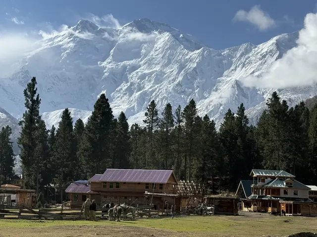
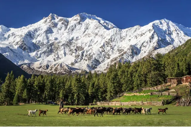
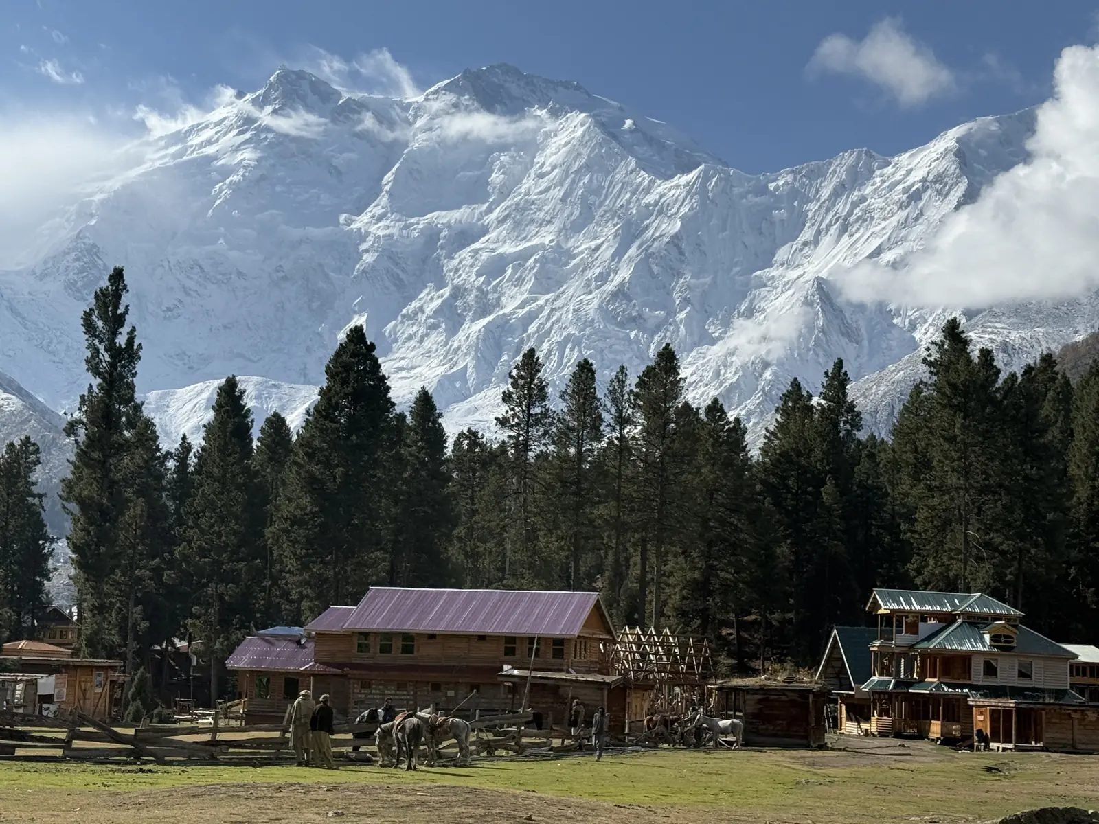
The Raikot (north) face of Nanga Parbat above the huts of Fairy Meadows.
We are a local company from Skardu, and we have run journeys through these valleys since 2015. Visitors to Nanga Parbat usually come for the view, not the summit, and they tend to ask the same questions: how high is it, which face are we looking at, who climbed it first, and why is it called the Killer Mountain? This guide answers those questions in one place. It covers the height and position of Nanga Parbat, the meaning of its names, its three faces and its base camps, the climbing history from 1895 to the first winter ascent in 2016, the best places to see it, how to get there and the best months to go.
Nanga Parbat at a glance
Nanga Parbat is an 8,126 m peak in Gilgit-Baltistan, Pakistan, the western anchor of the Himalaya and one of the 14 mountains on Earth above 8,000 m. Here are the key facts in one table. Heights of places around the mountain are rounded, as they are on all our pages.
| Item | Details |
|---|---|
| Height | 8,126 m (26,660 ft). Climbing records and Pakistan's permit lists often round it to 8,125 m. |
| World rank | 9th highest mountain on Earth; the westernmost of the 14 eight-thousanders |
| Rank in Pakistan | 2nd highest, after K2 (8,611 m) |
| Mountain range | Western end of the Himalaya; the Karakoram begins just to the north |
| Location | Gilgit-Baltistan, Pakistan, on the border of Diamer district (north and west sides) and Astore district (Rupal side) |
| Coordinates | About 35.2375° N, 74.5892° E |
| Prominence | 4,608 m, the 14th most prominent peak on Earth |
| Main faces | Rupal (south), Diamir (west), Raikot or Rakhiot (north) |
| First ascent | 3 July 1953, Hermann Buhl (Austria), alone and without bottled oxygen, by the Raikot side |
| First winter ascent | 26 February 2016, Ali Sadpara (Pakistan), Alex Txikon (Spain) and Simone Moro (Italy) |
| Standard climbing route | Kinshofer route on the Diamir Face, first climbed on 22 June 1962 |
| Nearest towns | Chilas (about 1,250 m), Astore and Gilgit; airports at Gilgit and Skardu |
| Protected area | Nanga Parbat National Park (2021); Fairy Meadows became a national park in 1995 |
| Best months to see it | June to September, when the trails are free of snow |
Two numbers explain why this mountain feels so big when you stand below it. Its prominence of 4,608 m means it rises a very long way above the lowest col that links it to any higher peak; among the 100 highest mountains, only Everest stands out more. And on its north side the ground drops about 7,000 m from the summit to the Indus river. Few places on Earth show you so much mountain in one view.
How high is Nanga Parbat?
Nanga Parbat is 8,126 m (26,660 ft) high, which makes it the ninth-highest mountain in the world. You will also see 8,125 m in climbing records and on Pakistan's permit lists. Both numbers come from the same survey figure, so they are not two different measurements.
Height in metres and feet
The long-standing survey height is 26,660 ft. Converted exactly, that is 8,125.97 m. Rounded in the normal way it becomes 8,126 m, which is the figure used by Britannica, by the Gilgit-Baltistan tourism department's own page on the mountain and on every page of our website. If you cut off the decimals instead of rounding, you get 8,125 m, which is why the American Alpine Journal, the statistics sites for eight-thousanders and the Gilgit-Baltistan expedition permit system use that number. No modern survey has given a different height for the summit. So when someone asks "how tall is Nanga Parbat?", the right answer is 8,126 m, or 26,660 ft.
Satellite height models read the summit at about 8,000 m, but that is a known weakness of those models on sharp summits, not a new height. They are useful for valleys and meadows, which is how we checked the heights of the viewpoints later in this guide.
How Nanga Parbat compares with K2 and the other 8,000 m peaks in Pakistan
Pakistan has five of the world's 14 peaks above 8,000 m. Four of them, K2, Gasherbrum I, Broad Peak and Gasherbrum II, stand close together around Concordia (4,691 m) at the head of the Baltoro Glacier in the Karakoram. Nanga Parbat stands alone, about 190 km away at the western end of the Himalaya. Our K2 guide covers the Baltoro peaks in detail.
| Peak | Height | World rank | Range and area |
|---|---|---|---|
| K2 | 8,611 m | 2nd | Karakoram, Baltoro (Shigar) |
| Nanga Parbat | 8,126 m | 9th | Himalaya, Diamer and Astore |
| Gasherbrum I | 8,080 m | 11th | Karakoram, Baltoro |
| Broad Peak | 8,051 m | 12th | Karakoram, Baltoro |
| Gasherbrum II | 8,035 m | 13th | Karakoram, Baltoro |
K2 and Nanga Parbat are the two best-known mountains of Pakistan, and people often compare them. This table shows the main differences.
| K2 | Nanga Parbat | |
|---|---|---|
| Height | 8,611 m | 8,126 m (26,660 ft) |
| World rank | 2nd | 9th |
| Range | Karakoram | Himalaya (western end) |
| First ascent | 31 July 1954, Lino Lacedelli and Achille Compagnoni | 3 July 1953, Hermann Buhl, alone |
| First winter ascent | 16 January 2021, a Nepali team of ten | 26 February 2016, Ali Sadpara, Alex Txikon and Simone Moro |
| Nearest view for trekkers | K2 Base Camp (5,150 m), at the end of the Baltoro Glacier trek | Fairy Meadows (about 3,300 m), a few hours' walk from the jeep road |
| Difficulty for climbers | Among the most demanding 8,000 m peaks | Among the most demanding 8,000 m peaks |
Why Nanga Parbat looks taller than it is
Nanga Parbat is 485 m lower than K2, yet many visitors say it looks bigger. The reason is the valley floor. K2 rises from glaciers that are already above 5,000 m. Nanga Parbat rises from the Indus, which flows at about 1,200 m at Raikot Bridge. On the north side the Raikot flank climbs about 7,000 m from the Indus valley to the summit in a horizontal distance of only about 25 km. On the south side the Rupal Face rises about 4,600 m from its base in one wall.
The mountain is also still rising. Geologists measure the rock here coming up about 1 cm a year, one of the fastest rates on Earth, while rivers and glaciers wear it down. Nanga Parbat contains some of the youngest granites exposed anywhere, as young as about 700,000 years. The massif sits at the sharp western bend of the Himalaya, where old continental rock of the Indian plate has been pushed up from beneath the rocks of Kohistan.
Where is Nanga Parbat?
Nanga Parbat is in Gilgit-Baltistan, in the far north of Pakistan, about 27 km west-south-west of the town of Astore. Its north and west faces lie in Diamer district and its south (Rupal) side in Astore district. The nearest town on the Karakoram Highway is Chilas, and the nearest airport is Gilgit.
Gilgit-Baltistan: the Diamer and Astore districts
The main ridge of Nanga Parbat runs from south-west to north-east and forms the boundary between two districts. Diamer district, with Chilas as its main town, holds the Raikot valley and Fairy Meadows on the north side, and the Diamir valley on the west. Astore district holds the Rupal valley and the village of Tarashing on the south side, and the Rama valley on the east. Diamer district takes its name from the mountain's local name, Diamer.
Since 2021 the mountain and its valleys are protected as Nanga Parbat National Park, which covers 178,561 hectares in Diamer and Astore. Fairy Meadows had already been declared a national park in 1995 and is now part of the larger park. For the wider region, read our Gilgit-Baltistan travel guide.
The western anchor of the Himalaya
Namcha Barwa marks the eastern end of the Himalaya; Nanga Parbat marks its western end, which is why geographers call it the "western anchor" of the range. The Indus river wraps around its northern and western foot. Just north of the mountain the western Karakoram begins, and a short way north-west, near the meeting of the Gilgit and Indus rivers below Jaglot, three great ranges meet: the Himalaya, the Karakoram and the Hindu Kush. There is a roadside viewpoint for this junction on the Karakoram Highway, and on a clear day you can see Nanga Parbat from it.
This position also explains why Nanga Parbat is so lonely. Its nearest higher neighbour in the Himalaya is Dhaulagiri, more than 1,000 km away. The nearest eight-thousanders of any range are the Baltoro peaks of the Karakoram, about 190 km to the east.
Nearest towns and distances
| Place | Height | Distance and direction |
|---|---|---|
| Raikot Bridge (Karakoram Highway) | about 1,200 m | At the foot of the north side; start of the jeep road to Tato |
| Chilas | about 1,250 m | About 57 km by road west of Raikot Bridge |
| Jaglot (Juglot) | about 1,400 m | About 30 km north of Raikot Bridge; the road to Astore and Skardu branches here |
| Gilgit | about 1,500 m | Gilgit airport is about 75 km by road from Raikot Bridge |
| Astore | about 2,450 m | About 27 km east-north-east of the summit; gateway to the Rupal and Rama valleys |
| Skardu | 2,230 m | Further east, over the Deosai plateau or by the Skardu road; airport |
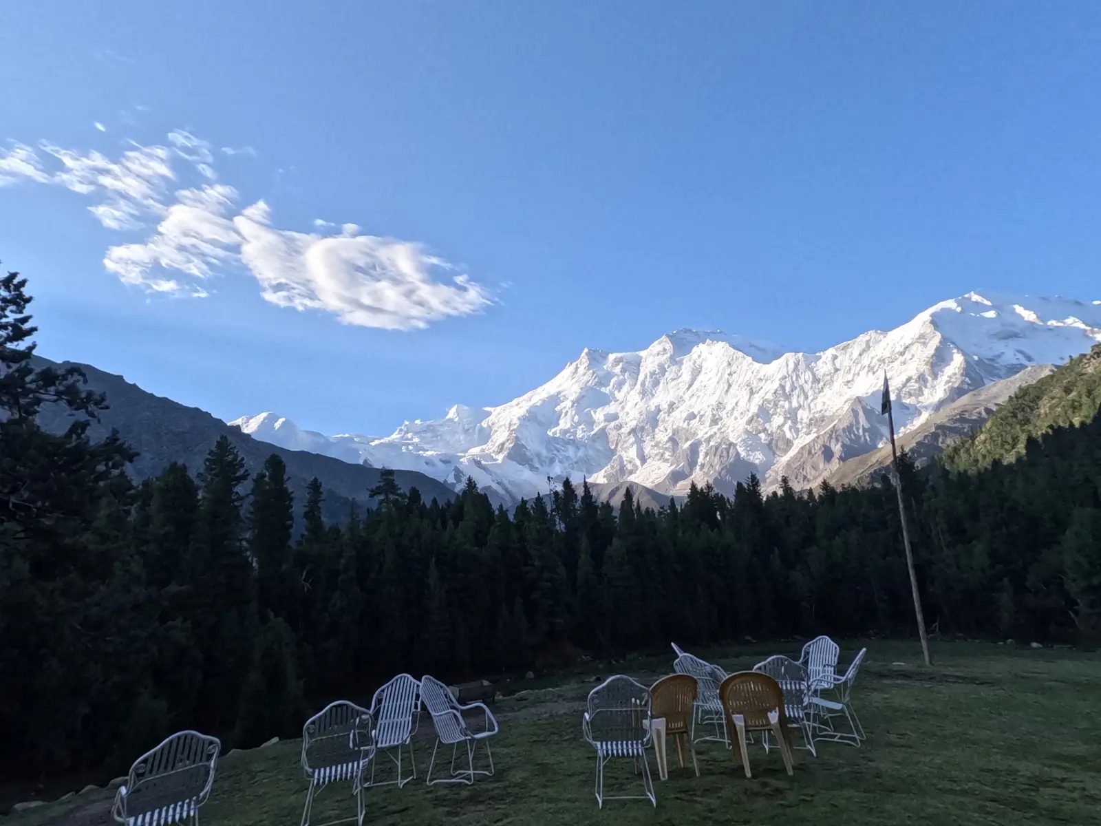
The whole massif above the forest of Fairy Meadows on a clear morning.
What does the name Nanga Parbat mean?
Nanga Parbat means "naked mountain", from the Sanskrit words nagna (naked) and parvata (mountain), and the same words are used in Urdu today. The usual explanation is the south face: the Rupal Face is so steep that much of its rock cannot hold snow, so it looks bare.
People who live around the mountain have their own name for it: Diamer, also written Diamir or Deo Mir, in the Shina language. It is usually translated as "mountain of the gods" or "king of mountains". The first comes from the old Sanskrit words deva (god) and meru (mountain); the second is the translation given by Britannica. The district, the valley on the west side and the west face all carry this name.
Other names grew out of the climbing history. German climbers in the 1930s called the meadow below the north face Märchenwiese, the "fairy-tale meadow", which became Fairy Meadows in English; local people call it Joot. Germans still call the south face the Rupalwand, the Rupal wall. And the north side has two spellings: Rakhiot in the old climbing books, and Raikot, the local and government spelling, which we use on our pages. Both mean the same valley, glacier and face.
Why is Nanga Parbat called the Killer Mountain?
Climbers gave Nanga Parbat the nickname "Killer Mountain" after more than 30 people died on its slopes before the first ascent in 1953. The first loss came in 1895, when the British climber Albert Mummery and two Gurkha companions disappeared. Ten men died in the storm of 1934 and sixteen in the avalanche of 1937, many of them Sherpa high-altitude porters. The name comes from that early era of expeditions, long before modern equipment, weather forecasts and today's standard route on the Diamir side. Trekkers do not go on the climbing routes: the trails to Fairy Meadows, Beyal and the base camps stay far below the mountain's glaciers and ice walls.
The three faces of Nanga Parbat
Nanga Parbat has three main faces: the Rupal Face to the south, the Diamir Face to the west and the Raikot (Rakhiot) Face to the north. Each face has its own valley, its own base camp and its own place in climbing history. Trekkers can see the Raikot and Rupal faces; the Diamir side is mostly visited by climbers.
| Face | Side | Size of the wall | First climbed | Valley and base camp | Can trekkers see it? |
|---|---|---|---|---|---|
| Rupal Face | South (Astore) | Rises about 4,600 m from its base; often called the highest mountain face in the world | 27 June 1970, Reinhold and Günther Messner | Rupal valley; Herrligkoffer Base Camp, about 3,550 m | Yes: from Tarashing, Herrligkoffer Base Camp and Latbo |
| Diamir Face | West (Diamer) | Steep rock and ice above the Diamir Glacier | 22 June 1962, Kinshofer, Löw and Mannhardt | Diamir valley; Diamir Base Camp, about 4,200 m | Rarely: it is the climbers' side, and we run no trips there |
| Raikot (Rakhiot) Face | North (Diamer) | The flank rises about 7,000 m from the Indus valley | 3 July 1953, Hermann Buhl | Raikot valley; Nanga Parbat Base Camp, about 3,950 m | Yes: from Fairy Meadows, Beyal and the base camp |
The Rupal Face (south)
The Rupal Face rises about 4,600 m (15,000 ft) above its base, from the Rupal valley at about 3,500 m to the summit. It is often called the highest mountain face in the world. Germans call it the Rupalwand. The wall is so steep that much of it stays bare, which is where the name "naked mountain" is thought to come from. The Rupal Glacier, also called the Toshain Glacier, flows from its foot and feeds the Rupal River.
The first ascent of the face was in 1970, and few teams have climbed it since (see the history below). For walkers, the classic close view is from Herrligkoffer Base Camp and the meadow of Latbo. You can stand below it at Herrligkoffer Base Camp on our Nanga Parbat from Both Sides trek.
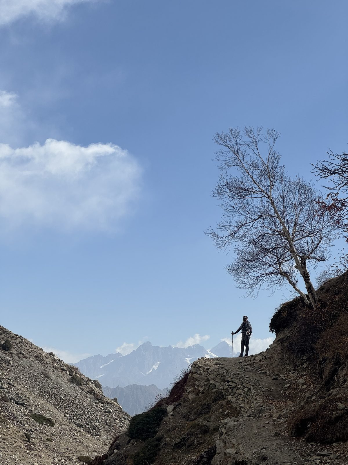
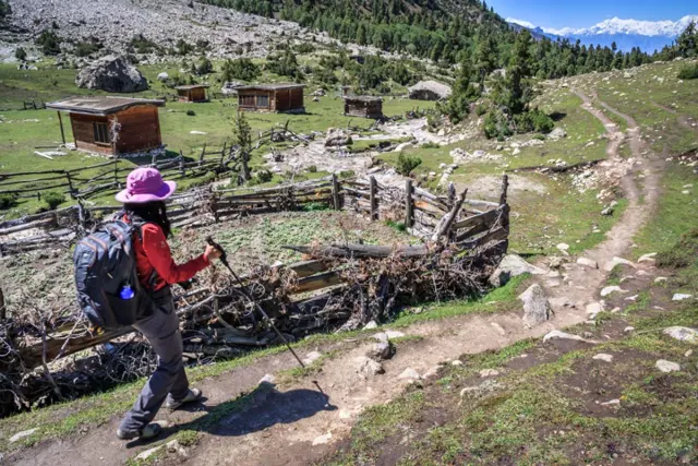
On a trail in the Rupal valley, the quieter south side of Nanga Parbat.
The Diamir Face (west)
The Diamir Face looks west over the Diamir valley and its glacier. It was here that Albert Mummery made the first attempt on any eight-thousander in 1895, reaching about 6,100 m on the rib that now carries his name, the Mummery Rib. On 22 June 1962 Toni Kinshofer, Siegfried Löw and Anderl Mannhardt reached the summit from this side, without bottled oxygen. Their line, the Kinshofer route, is today's standard route: most expeditions climb it, and the first winter ascent in 2016 followed it too. The route has a steep wall of rock and ice low down and rockfall in warm weather. The climbers' base camp lies at about 4,200 m, reached from Chilas through the Diamir valley.
The Raikot (Rakhiot) Face (north)
The Raikot Face is the north side of the mountain, above the Raikot valley and the Raikot Glacier, whose stream runs down to the Indus. It is the face you see from Fairy Meadows. All the German expeditions of the 1930s tried this side, and Hermann Buhl made the first ascent from here in 1953, by way of Rakhiot Peak (7,070 m) and the snow plateau of the Silver Saddle. One surprise for visitors: the top you see from Fairy Meadows is not the main summit. It is the North Peak (7,816 m), about 3 km north of the summit, which hides the true top behind it and the Silver Saddle.
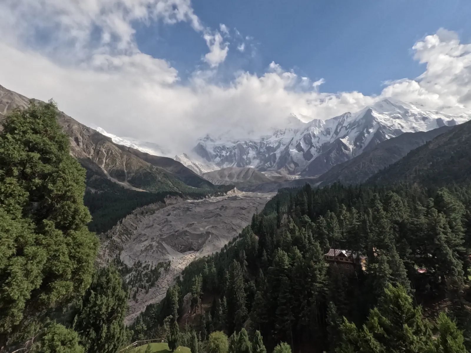
The Raikot Glacier flows from the north face past the forest of Fairy Meadows.
Ridges and other summits
Nanga Parbat is not a single peak but a whole massif. To the south-west runs the Mazeno Ridge, about 13 km long from the Mazeno Pass to the Mazeno Col, the longest ridge on any eight-thousander. It carries eight subsidiary peaks over about 6,800 m, the highest being Mazeno Peak (7,120 m). The Mazeno Pass (about 5,360 m) links the Rupal valley with the Diamer side and is a semi-technical crossing for mountaineers. To the north-east the ridge turns at Rakhiot Peak, and at the eastern end of the massif stands Chongra Peak (6,830 m), above Tarashing.
How many base camps does Nanga Parbat have?
Nanga Parbat has three base camps, one below each face. The north base camp, usually just called Nanga Parbat Base Camp, is at about 3,950 m below the Raikot Face, above Fairy Meadows and Beyal (about 3,500 m). Herrligkoffer Base Camp, on the Rupal side, is at about 3,550 m below the Rupal Face; it is named after Karl Herrligkoffer, who led many German expeditions to the mountain. Diamir Base Camp, on the west side, is at about 4,200 m and is used mainly by climbers on the Kinshofer route.
The north base camp is the one most trekkers reach, as a long day walk from Fairy Meadows. To plan or book that walk, see our Nanga Parbat Base Camp Trek.
History of climbing on Nanga Parbat
People first tried to climb Nanga Parbat in 1895, and Hermann Buhl reached the summit first on 3 July 1953. Its story runs from the early British and German expeditions to Reinhold Messner and, in 2016, the first winter ascent with a Pakistani climber in the team. Here are the main dates.
| Year | What happened |
|---|---|
| 1895 | Albert Mummery, with Geoffrey Hastings and Norman Collie, makes the first attempt, reaching about 6,100 m on the Diamir Face. Mummery and two Gurkhas, Ragobir Thapa and Goman Singh, disappear in late August. |
| 1932 | A German-American expedition led by Willy Merkl reaches Rakhiot Peak (7,070 m) and shows that the Raikot side can be climbed. |
| 1934 | Merkl's second expedition: two climbers reach about 7,895 m, then a storm traps the team high on the mountain. Ten men die, including Merkl and six Sherpas. |
| 1937 | An avalanche buries Camp IV below Rakhiot Peak; 16 men die, seven Germans and nine Sherpas. |
| 1938 | An expedition led by Paul Bauer turns back in bad weather. |
| 3 July 1953 | First ascent: Hermann Buhl, alone and without bottled oxygen, by the Raikot side. |
| 22 June 1962 | Second ascent and first by the Diamir Face: Toni Kinshofer, Siegfried Löw and Anderl Mannhardt. The Kinshofer route becomes the standard route. |
| 27 June 1970 | First ascent of the Rupal Face, by Reinhold and Günther Messner, and first traverse of the mountain. |
| 1976 | A second route on the Rupal Face, by an Austrian team led by Hanns Schell. |
| 1978 | Reinhold Messner makes the first fully solo ascent of an 8,000 m peak, by the Diamir Face. |
| 1984 | Liliane Barrard of France becomes the first woman to climb Nanga Parbat. |
| 1985 | A Polish team, including Jerzy Kukuczka, climbs the Southeast Pillar on the Rupal side. |
| 2005 | Vince Anderson and Steve House climb a new direct line on the Rupal Face in alpine style. |
| 2012 | Sandy Allan and Rick Allen complete the first traverse of the full Mazeno Ridge to the summit. |
| 26 February 2016 | First winter ascent: Ali Sadpara, Alex Txikon and Simone Moro, by the Kinshofer route. |
Mummery, 1895: the first attempt
The British climber Albert Mummery came to Nanga Parbat in 1895 with Geoffrey Hastings and Norman Collie. He climbed high on the Diamir Face, reaching about 6,100 m on the rock rib now called the Mummery Rib. Around 24 August 1895 he set out with two Gurkhas, Ragobir Thapa and Goman Singh, to cross towards the Raikot side. None of the three was seen again.
The German expeditions of the 1930s
In the 1930s German expeditions came back to Nanga Parbat again and again, always on the long Raikot side. In 1932 Willy Merkl led a German-American team that reached Rakhiot Peak and proved that the long Raikot side could lead to the summit. In 1934 he returned with a strong team. On 6 July two climbers, Peter Aschenbrenner and Erwin Schneider, reached about 7,895 m, close to the top. From the next day a storm trapped the climbers high on the ridge. Ten men died, among them Merkl, Willo Welzenbach, Uli Wieland and six Sherpas; Ang Tsering was the last survivor to come down. In 1937 an avalanche buried Camp IV below Rakhiot Peak and killed sixteen men. A 1938 expedition led by Paul Bauer turned back in bad weather. By 1953 more than 30 people had died on the mountain, and the nickname "Killer Mountain" had stuck.
Hermann Buhl and the first ascent, 1953
The 1953 German-Austrian expedition was organised by Karl Herrligkoffer, with Peter Aschenbrenner as climbing leader. They followed the old Raikot route over Rakhiot Peak. On 3 July the Austrian climber Hermann Buhl left the top camp in the early hours with Otto Kempter. Kempter turned back near the Silver Saddle, and Buhl went on alone for the last 1,300 m, without bottled oxygen. He reached the summit at about 7 pm. Too late to get down, he spent the night standing on a narrow ledge, and he returned to camp about 40 hours after he had left it. It is still the only first ascent of an eight-thousander made by a climber alone. In Germany, Austria and Italy, Hermann Buhl is still one of the best-known names in mountaineering.
The Diamir Face, 1962
Nine years later another Herrligkoffer expedition tried the west side. On 22 June 1962 Toni Kinshofer, Siegfried Löw and Anderl Mannhardt reached the summit at about 5 pm, again without bottled oxygen. Löw died on the descent. Their line up the Diamir Face is now called the Kinshofer route, and it is the route most expeditions use today.
Reinhold and Günther Messner on the Rupal Face, 1970
In 1970 Karl Herrligkoffer led an expedition to the Rupal Face, the great south wall. Two of its members were the brothers Reinhold and Günther Messner. On 27 June they reached the summit by the south-south-east spur, now called the Messner route. They did not go back down the Rupal Face: they descended the Diamir Face, making the first traverse of the mountain. Günther died in an avalanche on the way down; his remains were found in 2005. The story was told in the 2010 feature film Nanga Parbat. In 1978 Reinhold Messner came back and climbed Nanga Parbat completely alone by the Diamir Face, the first fully solo ascent of any 8,000 m peak.
First winter ascent, 2016
Nanga Parbat was one of the last eight-thousanders to be climbed in winter. About 31 winter teams had tried since the winter of 1988/89. On 26 February 2016 Muhammad Ali Sadpara from Pakistan, Alex Txikon from the Basque Country in Spain and Simone Moro from Italy reached the summit by the Kinshofer route on the Diamir side. Their teammate Tamara Lunger turned back about 100 m below the top. Ali Sadpara came from Sadpara village near Skardu, our home town, and he became the first Pakistani to make the first winter ascent of an 8,000 m peak.
Nanga Parbat today
Today most expeditions climb Nanga Parbat in summer by the Kinshofer route from Diamir Base Camp. Most people who come to Nanga Parbat now are not climbers at all. They are walkers who come to see the Raikot Face from Fairy Meadows and its base camp, or the Rupal Face from the Rupal valley.

Evening light on Nanga Parbat from Fairy Meadows.
Climbing Nanga Parbat
Nanga Parbat is climbed by experienced high-altitude mountaineers, almost always by the Kinshofer route on the Diamir Face, in a short summer season of about June to July. It is one of the most demanding 8,000 m peaks, in the same group as K2, Kangchenjunga and Annapurna, so it is not a first eight-thousander.
Climbers enter Pakistan on a Mountaineering & Trekking visa in the mountaineering category, with a licensed operator as sponsor. The Gilgit-Baltistan government charges a royalty for each foreign climber. For a peak of 8,001–8,500 m such as Nanga Parbat it is USD 2,500 per person in summer (April to September), USD 1,800 in autumn (October and November) and USD 1,200 in winter (December to March), according to the official fee lists for 2025. A liaison officer is required for 8,000 m expeditions, and climbers attend a briefing and debriefing with the tourism authorities. Our letter of invitation is free for our guests.
We do not run a Nanga Parbat expedition page, and we do not sell climbs of this mountain as a package. If you are thinking about your first 8,000 m peak, read our guide to which 8,000 m peak to climb first. If you are an experienced team planning Nanga Parbat itself, contact us with your plans.
Where to see Nanga Parbat
The best places to see Nanga Parbat are Fairy Meadows and Beyal on the north side, the Karakoram Highway around Raikot Bridge, and the Rupal valley on the south side. You can also see it from Rama Lake near Astore, from Sheosar Lake on the Deosai plateau and, on a clear day, from the flight between Islamabad and Skardu.
| Viewpoint | Side and face seen | Height | How you get there | Our trip |
|---|---|---|---|---|
| Fairy Meadows | North: Raikot Face and North Peak | about 3,300 m | Jeep to Tato, then about 5 km on foot | Fairy Meadows Trek |
| Beyal and the German Viewpoint | North: Raikot Face and Raikot Glacier, close up | about 3,500 m and 3,650 m | Walk on from Fairy Meadows | Fairy Meadows Trek |
| Nanga Parbat Base Camp (north) | North: foot of the Raikot Face | about 3,950 m | Day walk from Fairy Meadows | Nanga Parbat Base Camp Trek |
| Karakoram Highway near Raikot Bridge and Talechi | North: the whole Raikot flank from the Indus | about 1,200–1,350 m | By road | Karakoram Highway Tour |
| Tarashing | South: Rupal Face | about 2,900 m | By road from Astore | Nanga Parbat from Both Sides |
| Herrligkoffer Base Camp and Latbo | South: foot of the Rupal Face | about 3,550 m | Walk from Tarashing | Nanga Parbat from Both Sides |
| Rama Lake | East side of the massif | about 3,500 m | By road from Astore, then a walk | Nanga Parbat from Both Sides |
| Sheosar Lake, Deosai | From the east, far away | about 4,100 m | By jeep across Deosai, summer only | Fairy Meadows and Skardu Tour |
| Islamabad–Skardu flight | From the air | cruising height | Scheduled flight, weather permitting | Fairy Meadows and Skardu Tour |
Fairy Meadows and Beyal
Fairy Meadows, at about 3,300 m, is a high meadow in a pine forest directly below the Raikot Face, and it is the classic place to see Nanga Parbat. From the huts you look straight up the Raikot Glacier to the North Peak and the long white flank of the mountain, which turns pink at sunset and gold at dawn. An hour or two beyond, Beyal (about 3,500 m) and the German Viewpoint (about 3,650 m) bring you much closer to the ice. Our trips follow this route; see the Fairy Meadows Trek for the details.
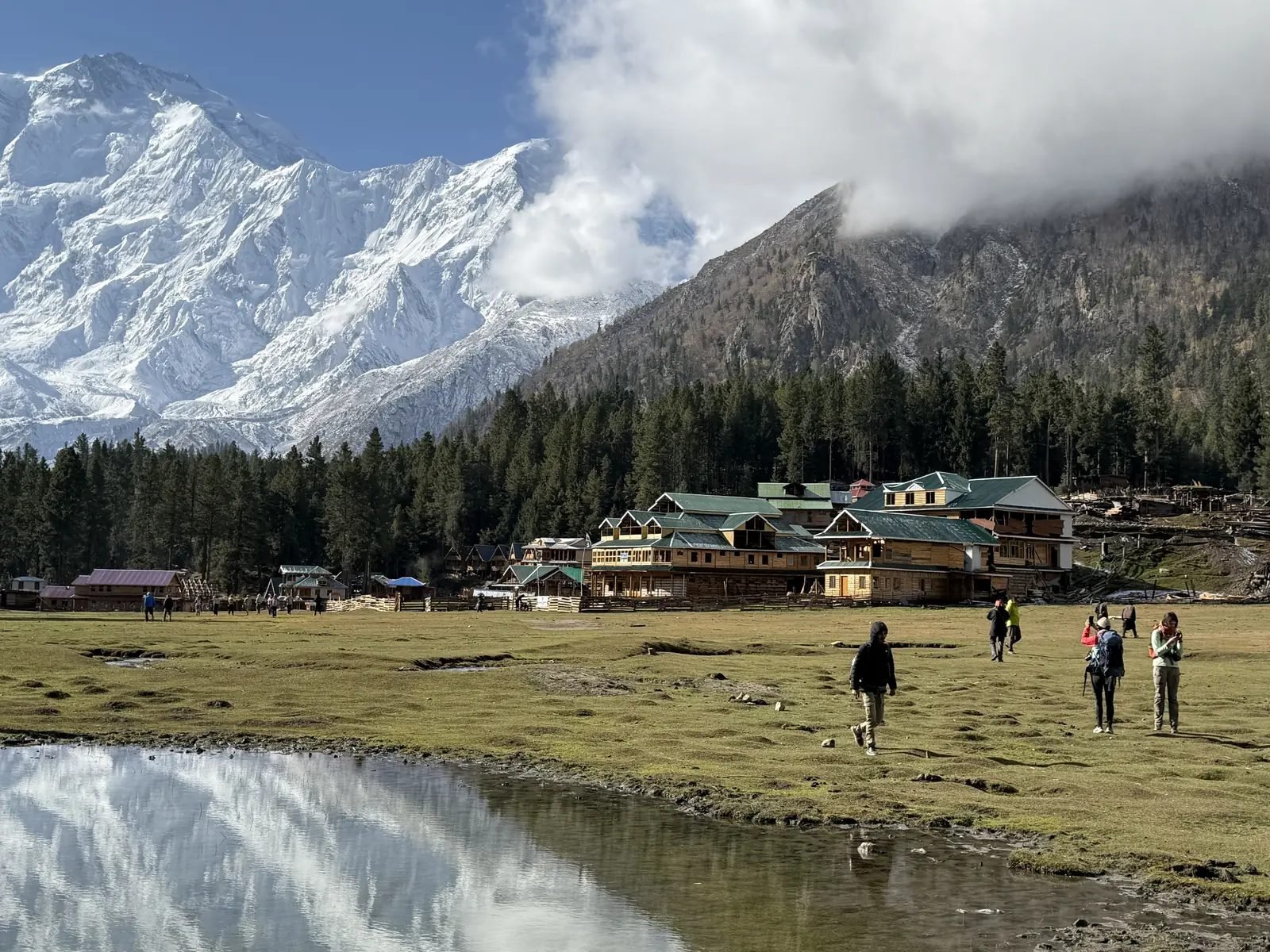
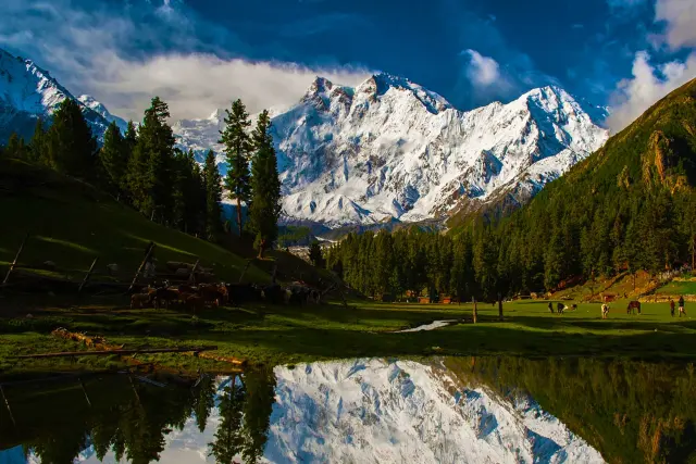
The small pond at Fairy Meadows, a favourite place for photographs of the mountain.
The Karakoram Highway and the Raikot Bridge viewpoint
The Karakoram Highway runs along the Indus at the northern foot of Nanga Parbat, and on a clear day the mountain is plainly visible from the road. The best roadside views are around Raikot Bridge (about 1,200 m) and at the viewpoint near Talechi, a little further north (about 1,350 m), where the whole Raikot flank rises above the river. This is the place to understand the scale of the mountain: you are looking at about 7,000 m of rock and ice from the valley floor to the summit. Nearby, below Jaglot, is the viewpoint where the Himalaya, Karakoram and Hindu Kush meet.
The Rupal valley and Tarashing
Tarashing (also written Tarishing), at about 2,900 m in the Rupal valley, is the gateway to the south side. From the village and the fields beyond it, the Rupal Face fills the end of the valley. A walk up the valley brings you to Herrligkoffer Base Camp (about 3,550 m) and the meadow of Latbo, with its small glacial lake and shepherds' huts, right below the wall. The Rupal side is quieter than Fairy Meadows and feels wilder. Our Nanga Parbat from Both Sides trek visits it.
Astore, Rama and the Deosai side
Astore town, at about 2,450 m, is the main town of the eastern side. Above it, the Rama valley leads to Rama Lake at about 3,500 m, which the Gilgit-Baltistan tourism department describes as lying near the foot of Nanga Parbat. From here you see the eastern side of the massif. Further east, the road from Astore climbs to the Deosai plateau, one of the highest plateaus in the world. From Sheosar Lake, at about 4,100 m on its western edge, Nanga Parbat is visible on a clear day as a distant white wall. Deosai is open only in summer.
From the air: flights to Skardu and Gilgit
The scheduled flights from Islamabad to Skardu and to Gilgit pass close to Nanga Parbat. On a clear day you look across at the mountain from the side, above the lower ranges. These are mountain flights that only operate in good weather, so treat the view as a bonus rather than a plan.
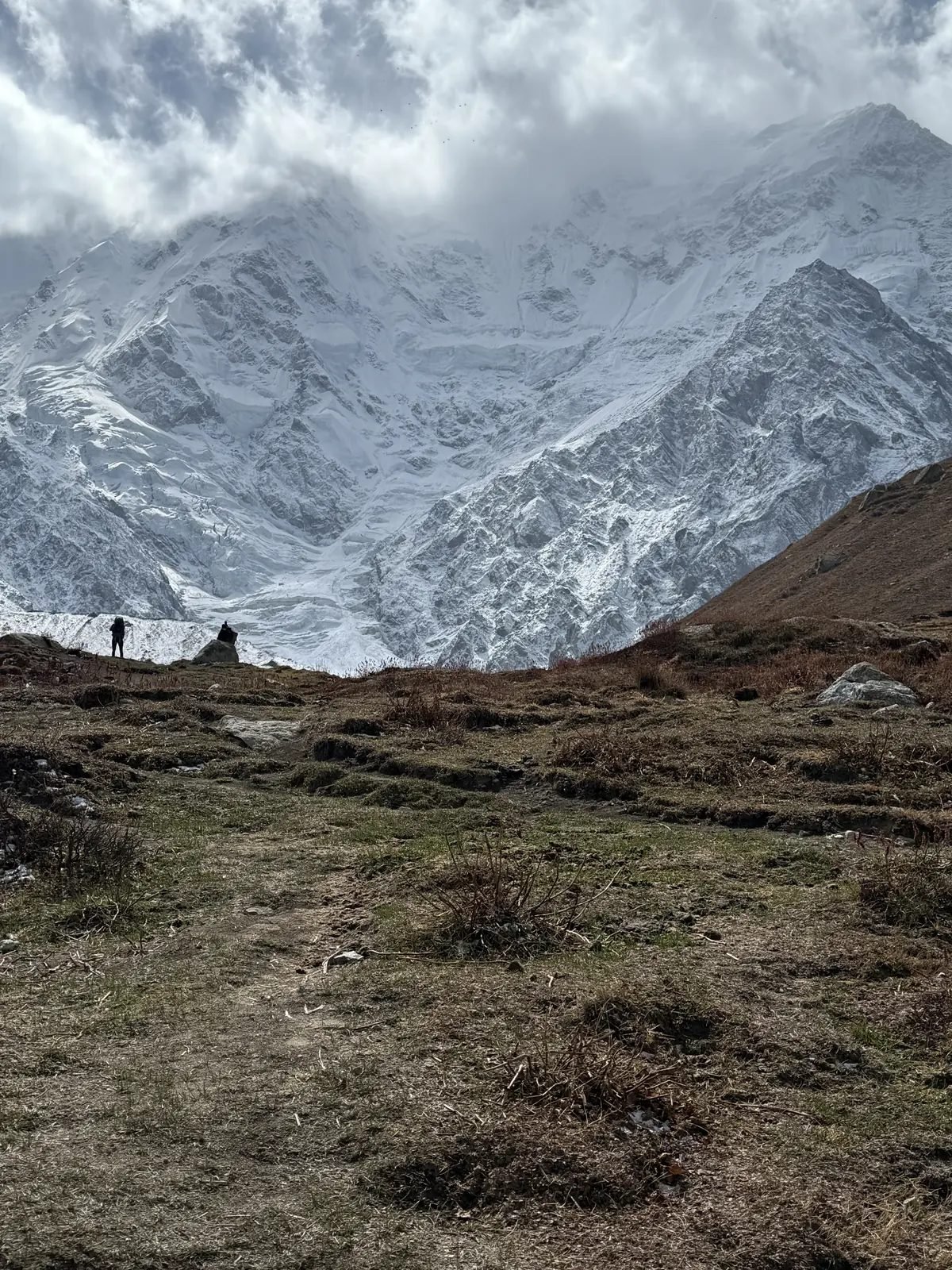
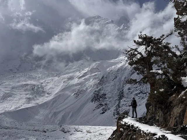
On the trail above Fairy Meadows, the Raikot Face comes much closer.
How to get to Nanga Parbat
To get to Nanga Parbat, travel from Islamabad to Chilas on the Karakoram Highway, continue to Raikot Bridge, take a local jeep to Tato and walk the last part to Fairy Meadows. For the Rupal side, you leave the Karakoram Highway near Jaglot and drive through Astore to Tarashing. Flights to Gilgit or Skardu can shorten the journey when the weather allows.
Islamabad to Chilas by road
Chilas is the usual overnight stop. There are two roads from Islamabad. The Karakoram Highway is open all year and is about 470–480 km to Chilas; it is a long day of roughly 12 to 14 hours. In summer the shorter road over the Babusar Pass (4,173 m) through the Kaghan valley is about 355 km. The Babusar road is usually open from about June to September, sometimes into October; the opening dates change every year with the snow.
Chilas to Fairy Meadows
From Chilas it is about 57 km, roughly an hour or an hour and a half, along the Karakoram Highway to Raikot Bridge (about 1,200 m). Here a rough jeep road of about 15 km climbs the Raikot valley to Tato, ending near 2,600 m; only local jeeps drive it. From the end of the road it is about 5 km on foot, usually 2.5 to 4 hours, to Fairy Meadows. Our trips follow this route; the Fairy Meadows Trek has the day-by-day plan.
To the Rupal side
For the Rupal valley, the road to Astore leaves the Karakoram Highway near Jaglot, about 60 km south of Gilgit. From Astore a side road runs up to Tarashing; from Raikot Bridge it is about 90 km by road. From Gilgit, Astore is about 4 to 5 hours. In summer you can continue east from Astore over the Deosai plateau to Skardu, about 152 km. Our Nanga Parbat from Both Sides trek links the two sides this way.
Flights to Gilgit or Skardu
Flights from Islamabad to Gilgit or Skardu save the long drive but are often delayed by weather. Gilgit is the closer airport for the north side: from Gilgit airport to Raikot Bridge is about 75 km. Skardu is better for the Deosai side and for combining Nanga Parbat with Baltistan. Always plan a spare day in case a flight does not go.
Visa and permits
Visitors from abroad apply for a Pakistan visa online on the official Pakistan Online Visa System. For trekkers to Fairy Meadows and the base camps, the choice is a tourist e-visa or a trekking visa, and we confirm which one when you book. Climbers need the mountaineering visa and permit described above. Our Pakistan visa guide explains each step, and visitor information is published by the Gilgit-Baltistan tourism department. Our letter of invitation is free for our guests.
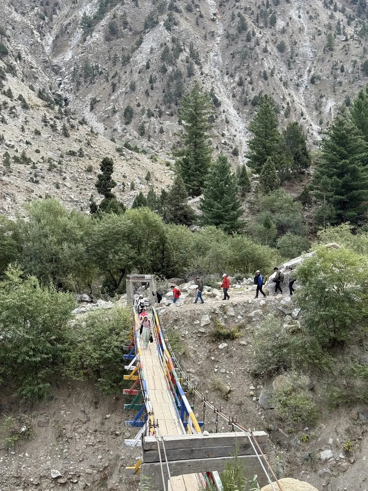
A suspension bridge on the forest trail near Fairy Meadows.
Best time to see Nanga Parbat
The best time to see Nanga Parbat is June to September, when the trails to Fairy Meadows and the Rupal valley are free of snow and the Babusar Pass road is usually open. July and August are the warmest but also the wettest months, and cloud often hides the summit in the afternoon.
There is no weather station at Fairy Meadows or in the Rupal valley. The table below is model data (ERA5 reanalysis, scaled to about 3,300 m and averaged over 2016–2025), so read it as typical conditions rather than a forecast.
| Month | Fairy Meadows day / night | Rain and snow | What to expect |
|---|---|---|---|
| January | -6 / -11 °C | 41 mm | Deep winter; snow and hard frost |
| February | -4 / -10 °C | 45 mm | Deep winter |
| March | -1 / -6 °C | 83 mm | Snow on the trail |
| April | 4 / -2 °C | 107 mm | Season begins; still snow on the trail |
| May | 9 / 3 °C | 110 mm | Snow patches; Babusar road usually still closed |
| June | 14 / 7 °C | 124 mm | Good month; clear mornings, Babusar often opens |
| July | 18 / 11 °C | 192 mm | Warmest and wettest; cloud in the afternoons |
| August | 17 / 10 °C | 163 mm | Warm; wet spells |
| September | 14 / 7 °C | 100 mm | Good month; clearer skies, fewer visitors |
| October | 7 / 0 °C | 62 mm | Cold nights; first snow; Babusar may close |
| November | 1 / -4 °C | 31 mm | Winter begins |
| December | -3 / -9 °C | 20 mm | Winter |
Higher up it is colder. At the north base camp (about 3,950 m) the model gives about 12–13 °C by day in July and August, around 5 °C at night, and nights near freezing in June and September. Snow can fall there in any month except July and August. On the Rupal side, Tarashing (about 2,900 m) is a few degrees warmer than Fairy Meadows, and Herrligkoffer Base Camp (about 3,550 m) is a little colder. Down in the Indus valley, Chilas is very hot in summer, with July days around 35 °C.
In winter the meadow lies under snow, with days below freezing and nights around -10 °C. If you are curious about the cold season, read our winter treks in Pakistan guide.
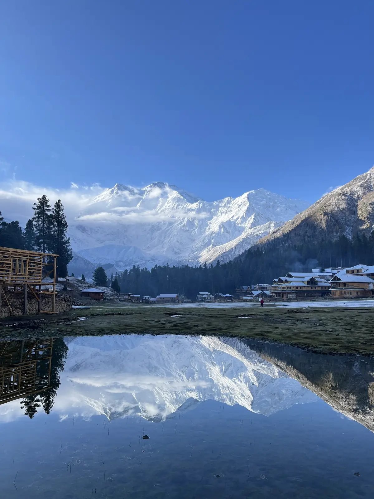
A still morning brings the best reflections of the mountain.
See Nanga Parbat with us
Chogori Adventure is a licensed Gilgit-Baltistan operator (licence DTS-GB-055), founded in Skardu in 2015, with our own local team in Skardu and Islamabad. We are members of the Pakistan Association of Tour Operators and have looked after more than 3,000 guests on more than 500 trips. These are our six Nanga Parbat trips:
| Trip | Days | From (USD per person) | Which side |
|---|---|---|---|
| Fairy Meadows Trek | 7 | $800 | North: Fairy Meadows, Beyal, optional walk to the base camp |
| Nanga Parbat Base Camp Trek | 7 | $800 | North: Fairy Meadows to the base camp at about 3,950 m |
| Nanga Parbat from Both Sides | 12 | $1,800 | North and south: Fairy Meadows, Rama, Tarashing, Herrligkoffer Base Camp, Deosai |
| Rakaposhi and Nanga Parbat Base Camp Trek | 12 | $1,500 | North: see both base camps, Nanga Parbat and Rakaposhi, in one trip |
| Fairy Meadows and Hunza Tour | 10 | $1,200 | North: Fairy Meadows, then the Hunza valley |
| Fairy Meadows and Skardu Tour | 10 | $1,200 | North: Fairy Meadows, then Skardu and Deosai |
Nanga Parbat is also on the way on our longer Karakoram Highway Tour and Gilgit-Baltistan Trekking Adventure. For more ideas, see our beginner-friendly treks in Pakistan, the best treks in northern Pakistan and, if you want to add Hunza, our Hunza valley guide. We can arrange private journeys on these routes and adjust them to your dates. Contact us with your dates and which side of the mountain you would like to see.
Frequently asked questions
How high is Nanga Parbat?
Nanga Parbat is 8,126 m (26,660 ft) high, the ninth-highest mountain in the world and the second-highest in Pakistan after K2. Climbing records and permit lists often round it to 8,125 m.
Where is Nanga Parbat located, and in which country?
Nanga Parbat is in Pakistan, in Gilgit-Baltistan, on the border of the Diamer and Astore districts. It is the western end of the Himalaya, just south-east of the northern bend of the Indus, near Chilas and Astore.
Which is higher, K2 or Nanga Parbat?
K2 is higher: 8,611 m against 8,126 m for Nanga Parbat. K2 is the second-highest mountain on Earth and Nanga Parbat the ninth. See our K2 guide.
Is Nanga Parbat harder to climb than K2?
Both are among the most demanding 8,000 m peaks, together with Kangchenjunga and Annapurna. K2 is higher; Nanga Parbat's standard Kinshofer route has a steep wall of rock and ice low down and rockfall in warm weather, and the mountain rises a very long way above its valleys.
Why is Nanga Parbat called the Killer Mountain?
Climbers gave it the nickname after more than 30 people died on its slopes before the first ascent in 1953, above all in the storm of 1934 and the avalanche of 1937. The name belongs to that early era of expeditions.
How many people died on Nanga Parbat before the first ascent?
More than 30. Albert Mummery and two Gurkha companions disappeared in 1895, ten men died in 1934 and sixteen in 1937, many of them Sherpa high-altitude porters. These losses are the origin of the name "Killer Mountain".
Who first climbed Nanga Parbat?
The Austrian climber Hermann Buhl, on 3 July 1953, on a German-Austrian expedition. He climbed the last 1,300 m alone and without bottled oxygen, reached the top at about 7 pm and spent the night standing on a ledge on the way down.
What is the Rupal Face, and how high is it?
The Rupal Face is the south face of Nanga Parbat. It rises about 4,600 m (15,000 ft) from the Rupal valley to the summit and is often called the highest mountain face in the world. Reinhold and Günther Messner first climbed it on 27 June 1970. You can see it on our Nanga Parbat from Both Sides trek.
Who made the first winter ascent of Nanga Parbat?
Ali Sadpara from Pakistan, Alex Txikon from Spain and Simone Moro from Italy, on 26 February 2016, by the Kinshofer route on the Diamir side.
What does "Nanga Parbat" mean?
It means "naked mountain", from the Sanskrit words for naked and mountain, probably because the steep Rupal Face holds little snow. The local name, Diamer or Diamir, is usually translated as "mountain of the gods" or "king of mountains".
Can you trek to Nanga Parbat without climbing it?
Yes. Walkers reach Fairy Meadows (about 3,300 m) and the north base camp (about 3,950 m) without any climbing; see our Fairy Meadows Trek and Nanga Parbat Base Camp Trek.
About the author
Imtiyaz Ahmed Shigri founded Chogori Adventure in Skardu in 2015. Our guides are local, government-licensed and English-speaking, and most of them are trained in first aid. We are licensed by the Department of Tourist Services (licence no. 2494) and the Gilgit-Baltistan tourism department (licence DTS-GB-055), and we are a member of the Pakistan Association of Tour Operators, with offices in Skardu and Islamabad.
Rated 4.9 out of 5 from 47 reviews on Google (November 2026). Read our reviews on Google