Gondogoro La Difficulty: How Hard Is the Pass?
By Imtiyaz Ahmed Shigri, founder of Chogori Adventure, Skardu · Updated November 2026
The Gondogoro La (5,585 m, 18,323 ft) is the hardest day of any K2 trek, but you do not need mountaineering experience to cross it. From Ali Camp (4,950 m) you start around midnight, climb about 635 m on steep snow with fixed ropes, and then descend about 905 m on an even steeper slope of snow or loose rock to Khuspang (4,680 m): about 8 km in 9 to 12 hours. What you need most is good fitness, a steady head on steep ground, and the right gear. Trekkers also call it the Gondogoro Pass, the Gondogoro La pass or simply "GGLA". Here is what the crossing is really like, what makes it hard, and what our team does to keep the risks as low as possible.
The Gondogoro La at a glance
| Fact | |
|---|---|
| Height | 5,585 m (18,323 ft) |
| Other names | Gondogoro Pass, Gondogoro La pass, GGLA, GG La ("La" means pass in Balti and Tibetan) |
| Where | The Karakoram of Gilgit-Baltistan, between the Vigne Glacier (Baltoro side) and the Gondogoro Glacier (Hushe side) |
| Pass day | Ali Camp → Gondogoro La → Khuspang: about 8 km, 9–12 hours |
| Climb | About 635 m, about 3 hours, steep snow with fixed ropes |
| Descent | About 905 m to Khuspang, the hardest part: steep snow early in the season, loose rock later |
| Steepness | Snow and ice slopes of up to about 50 degrees in places near the top |
| Gear | Crampons, harness, helmet, jumar, carabiners, descender or figure-8, shoe covers (gaiters) and mittens; good hiking boots. No ice axe needed |
| Fixed ropes | Usually in place from mid to late June; the crossing depends on snow and weather |
| Night temperature | About −10 to −16 °C before dawn at the top in July, colder in June and September (estimate, not a measurement) |
| Grade | Challenging, with one technical day; no mountaineering experience needed |
Where the Gondogoro La is, and why the route matters
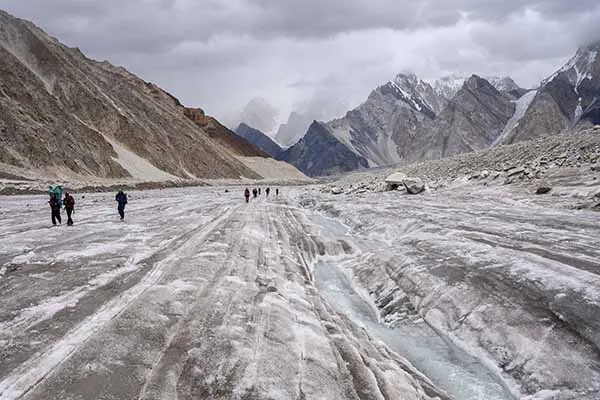
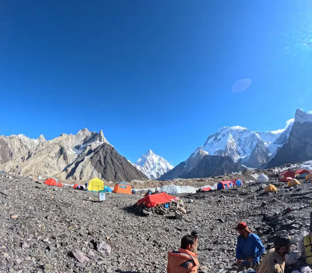
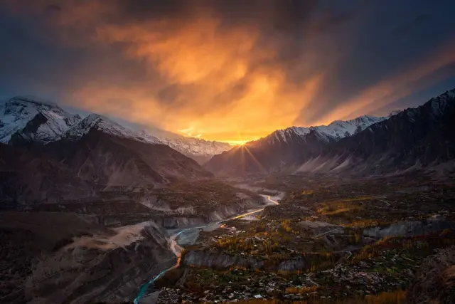
The Gondogoro La is a glacier pass at 5,585 m on the ridge that separates the Baltoro Glacier system from the Hushe valley, about 25 km northeast of Hushe village in the Ghanche District of Gilgit-Baltistan. On its north-east side the Vigne Glacier runs down to the upper Baltoro near Concordia (4,691 m); on its south-west side the Gondogoro Glacier falls towards Dalchangpa, Saicho and Hushe. The pass turns the K2 trek into a loop: instead of walking the roughly 97 km of the Baltoro twice, you come out through a second valley.
The trekking route over the pass is young by Karakoram standards. The Baltoro has been explored since the 19th century (the Vigne Glacier carries the name of Godfrey Vigne, an English traveller who visited Baltistan in the 1830s), but a regular route from Concordia over the Gondogoro La to Hushe was only established in 1986. Since then, local climbers from the Hushe valley have usually fixed the ropes each season. The pass is not open every year in the same way: in 2007 a large crevasse below the top stopped most crossings, and local teams reopened the route in 2008. That history is the honest background to everything below: the Gondogoro La is a real mountain crossing whose condition changes from season to season.
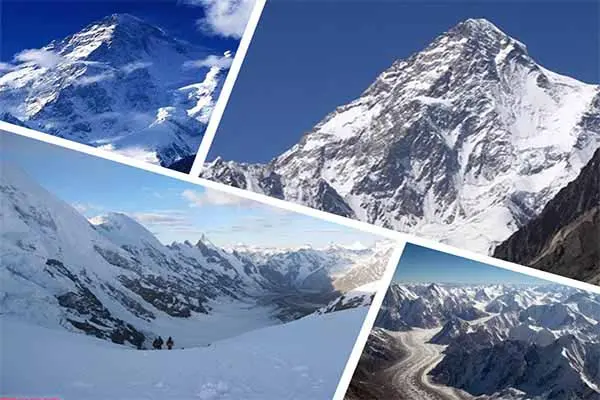
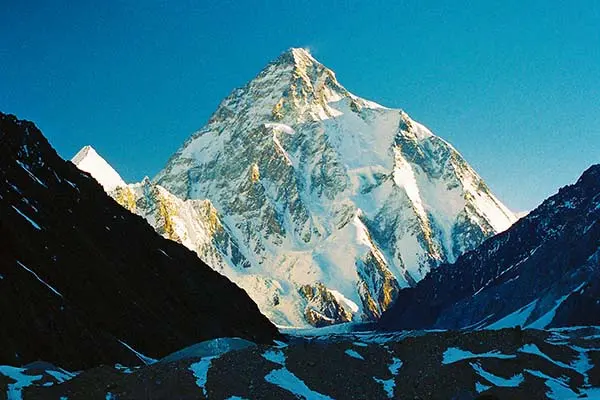
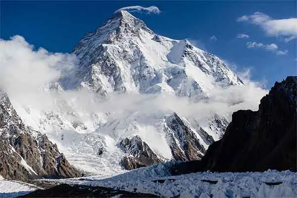
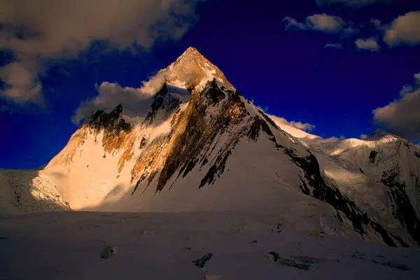
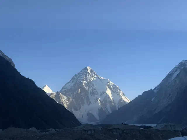
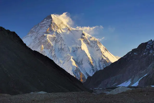
The ridge itself is part of the Masherbrum group. From the top you look north to K2 (8,611 m), Broad Peak, Gasherbrum I and Gasherbrum II, the peaks around Concordia that the photographer Galen Rowell called the "Throne Room of the Mountain Gods". To the south you see Laila Peak (6,096 m) and the Gondogoro valley, with Masherbrum (7,821 m) to the west. Gondogoro Peak (5,650 m), a separate summit above Khuspang, on the Hushe side of the pass, is climbed as its own expedition: see the Gondogoro Peak climbing expedition.
How hard is the Gondogoro La pass? The difficulty in numbers
On our grading, the K2 trek over the Gondogoro La is challenging, with one technical day. The pass day is not the longest walk of the trek in kilometres, but it is the highest, the steepest and the only one on fixed ropes, and it starts in the dark after 10 days on the trail, a week of it on the glacier. These are the four days around the crossing on our 21-day trek:
| Day | Stage | Distance | Time | Height change |
|---|---|---|---|---|
| 14 | Concordia (4,691 m) → Ali Camp (4,950 m) | About 12 km | 5–6 hours | About +260 m |
| 15 | Ali Camp → Gondogoro La (5,585 m) → Khuspang (4,680 m) | About 8 km | 9–12 hours | About +635 m, −905 m |
| 16 | Khuspang → Dalchangpa → Saicho (3,350 m) | About 18 km | 6–8 hours | About −1,330 m |
| 17 | Saicho → Hushe (3,150 m) | About 7 km | 3–4 hours | About −200 m |
Eight kilometres in 9 to 12 hours means an average of well under 1 km an hour. That tells you the nature of the day: slow, careful movement on steep ground, with waiting at rope sections, not fast walking. For the full trek, stage by stage, see Gondogoro La Trek daily distance and altitude.
What makes the pass hard
- Altitude: at 5,585 m the air holds roughly half the oxygen of sea level, so every step on the ropes is slow and breathing is hard.
- The night start: you get up around midnight after a short sleep at the highest camp of the trek, and climb by head torch in the cold.
- Steep ground: slopes of up to about 50 degrees near the top, where you climb with a jumar on a fixed rope.
- The descent: about 905 m down, steeper than the climb, on tired legs, with loose stones later in the season.
- Length: 9 to 12 hours on the move, after 10 days on the trail, a week of it on rough glacier moraine.
- Changing conditions: the same slope can be firm snow one week and wet snow or bare rock the next.
What does not make it hard: you do not lead any climbing, place any protection or carry a heavy load. Porters carry your bag of up to 16 kg, and you carry a daypack with water, food, warm layers and your gear.
The pass day, hour by hour
A typical crossing in July looks like this. The times change with the group, the snow and the queue on the ropes, so treat them as a guide, not a timetable.
- About 23:30: wake-up call at Ali Camp. Hot drinks and a light breakfast in the mess tent. Harness on in camp, so you do not fumble with buckles in the cold later.
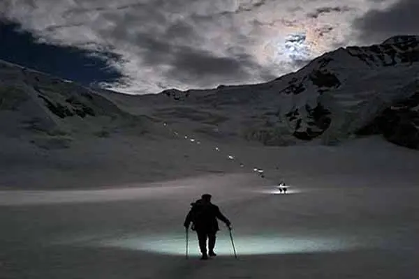
- About midnight to 00:30: start walking by head torch up the western Vigne Glacier, roped or close together behind the guide, on a track the crew and the rescue team have checked.
- About 01:30 to 02:30: the foot of the steep section. Crampons on, jumar and safety carabiner clipped to the fixed rope.
- About 02:30 to 05:30: the climb on the ropes, about 3 hours, slowly and with short rests at the anchors.
- Around dawn: the top. Sunrise in late June and July is around 05:00 local time, and around 05:30 in early September. A short stop for photos and warm clothes, then down before the sun reaches the slope.
- About 06:00 to 09:00: the steep descent on fixed ropes towards the Gondogoro Glacier.
- Late morning to early afternoon: the easier walk down to Khuspang (4,680 m). Hot lunch, rest, and an early night facing Laila Peak.
The climb from Ali Camp
We get up around midnight, have breakfast and leave Ali Camp with our guide, our crew and the local rescue team who look after the fixed ropes on the pass. First we walk up the western Vigne Glacier to the foot of the pass. There we put on harnesses and crampons and climb slowly on the fixed ropes, clipped in with a jumar. The slope gets steeper towards the top, and it usually takes about 3 hours to reach it. On a clear morning you arrive at dawn, with K2, Broad Peak, Gasherbrum I and Gasherbrum II behind you and Laila Peak and the Gondogoro valley ahead.

How a jumar works on the climb
A jumar (also called an ascender) is a handle with a toothed cam that slides up a rope but locks when you pull down on it. On the pass it does two jobs: it gives you something to hold and pull on, and it holds you if you slip. You clip it to your harness with a short sling, push it up the fixed rope as far as your arm reaches, take two or three steps up in your crampons, and push it up again. A second sling with a carabiner, your "safety", stays clipped to the same rope. At each anchor, where one length of rope ends and the next begins, you move the safety first and the jumar second, so you are always attached. Before the crossing, ask your guide to check your harness, crampons and carabiners, and to show you the rope work if you are unsure.
The descent: the hardest part
After a short rest and photos on top, we start down before the sun warms the slope. The descent to Khuspang drops about 905 m and is steeper than the climb. Fixed ropes are used on the steep sections, and you go down slowly and carefully, one step at a time, taking care not to knock stones onto people below. Below the steep part the trail becomes easy, down to Khuspang camp facing Laila Peak.
Snow or rock: it depends on the month
- June and July: more snow on both sides. The snow is firm in the cold of the night, and crampons stay on for most of the descent.
- August and later: the snow melts on the descent and the slope turns to loose rock and gravel. It is more slippery and there is more risk of falling stones, so the early start matters even more; crampons usually come off on the rock.
How to go down the fixed ropes
On the steepest parts you go down with a descender or figure-8: the rope runs through it, and the friction lets you control your speed with one hand below the device. On easier parts the guide may ask you to walk down facing out, holding the rope with one hand and the safety carabiner clipped in. Keep these rules in mind:
- Keep your feet apart and your knees soft, and put your whole crampon down flat on snow; on rock, step on solid stones and test them first.
- Only one person moves on each length of rope between two anchors, unless the guide says otherwise.
- If you knock a stone loose, shout "rock" at once so people below can take cover.
- Do not hurry to catch up. A steady pace with fewer stops is quicker than rushing and resting.
How cold is the pass?
Expect well below freezing for the first hours of the crossing. In July the air on the top of the Gondogoro La is about −10 to −16 °C before dawn and about 5 °C by day; in June and September it is about 3–4 °C colder, and wind on the pass at night can make it feel 10 °C colder still. These are estimates from the Skardu weather station averages and the measured temperature fall on the Baltoro, not measurements on the pass.
For the difficulty of the day, the cold matters in two ways. First, it is the reason for the night start: frozen snow is firm under crampons, and frozen stones stay in place on the descent. Second, you need real warmth for a few hours on a metal jumar: mittens over thin gloves, a down jacket, a warm hat and spare batteries kept close to your body. The best time to cross is from the end of June to the end of August, and the crossing is still feasible from mid-June to the end of September. Month by month, with the snow and weather on both sides: Best time for the Gondogoro La.
Do you need climbing skills?
No. You do not need mountaineering experience. Many trekkers cross the Gondogoro La who have never used crampons or fixed ropes before; the guide and crew show you how to use the gear and stay with you on the steep sections. It helps a lot if you have practised walking in crampons and using a harness and jumar before the trip, and you must be comfortable on steep, exposed ground.
What matters most is fitness and a calm, positive attitude: the pass day is long, starts in the night and comes after 10 days on the trail, a week of it on the glacier. You should already have trekked to at least 4,000 m.
Who should think twice
The pass is a poor fit if you have a strong fear of heights or steep drops, knee problems that make long descents painful, or no experience of multi-day trekking at all. If you have never been above 4,000 m, start with a shorter high trek first, or choose the K2 Base Camp Trek, which reaches K2 Base Camp (5,150 m) without the pass. If you want shorter walking days on the Baltoro, our K2 Base Camp Trek for Beginners takes 29 days instead of 21, with shorter walking days. Our faster 19-day private trek over the pass asks for at least one previous trek above 5,000 m.
Fitness and training
- Build endurance for long days: 3 to 4 months of regular hiking with a loaded backpack, including long, steep days.
- Train your legs for steep descents: stairs, step-downs and downhill hiking.
- Practise with crampons, a harness and a jumar if you can, on a guided course or a snow slope at home.
- Our K2 guide has a full 12-week training plan: K2 Base Camp Trek guide.
A simple fitness test
A practical benchmark: before you book, you should be able to walk 8 to 10 hours in a day on hilly ground with a 6 to 8 kg daypack, climb about 1,000 m and come down again, and do it again the next day without serious pain. If you can, the pass day will be hard but within reach once you are acclimatised. Long descents are where most people struggle, so include them in your training: walk down steep hills, not only up, and try trekking poles, which take some load off the knees on the moraine before and after the pass. For an idea of the whole trek's walking load, see K2 Base Camp Trek daily distance and altitude and our Baltoro trekking tips.
Gear you need for the pass
On top of your normal trekking gear, the Gondogoro La needs crampons, a climbing harness, a helmet, a jumar (rope ascender), carabiners, a descender or figure-8, shoe covers (gaiters) and mittens. Good, sturdy hiking boots are also very useful. A head torch with spare batteries is essential for the night start, and warm gloves, a down jacket and good sunglasses for the top. Climbing gear is not included in the price of our treks: bring your own, or ask us to arrange it in Skardu.
| Item | What it does on the pass |
|---|---|
| Crampons | Grip on hard snow and ice on the climb and the snowy descent. Fit them to your boots at home or in Skardu, not at 2 am |
| Harness | Connects you to the fixed ropes through the jumar and safety slings |
| Helmet | Protects against stones and ice knocked loose from above, mainly on the descent |
| Jumar | Slides up the rope and locks under load: your handhold and backup on the climb |
| Carabiners | Locking carabiners for the jumar, the safety sling and the descender |
| Descender or figure-8 | Controls your speed when you go down the steepest ropes |
| Shoe covers (gaiters) | Keep snow out of your boots in deep snow on the glacier |
| Mittens | Warmer than gloves in the night cold; wear thin gloves under them for handling gear |
| Hiking boots | Sturdy boots that take crampons and support the ankle on rock and moraine |
You do not need an ice axe for the crossing: the fixed ropes and the jumar do that job. Pack a head torch with spare batteries, about 1.5 litres of water in an insulated bottle (tubes freeze), snacks you can eat with cold hands, sunglasses and sun cream for the bright descent.
Altitude and acclimatisation before the pass
By the day you cross the Gondogoro La you have spent about ten days above 3,000 m, slept at Concordia (4,691 m) and walked to K2 Base Camp (5,150 m), so your body has had time to adapt. Ali Camp (4,950 m) is the highest night of the trek, and you sleep there only one night before the crossing. This order, high camp after K2 Base Camp and not before, is why the pass comes near the end of the trek and not the start.
Altitude still affects everyone on the pass. Mild headache and breathlessness are normal. Severe headache, vomiting, confusion, loss of balance or breathlessness at rest are not, and you must tell the guide at once. The treatment for serious altitude sickness is to go down, and the guide decides whether someone is fit to start the crossing. On our 19-day private trek, the lead guide decides if anyone must turn back, and that decision is final.
How we reduce the risks on the crossing
- Night start: we cross before sunrise, while the snow is firm and the stones on the descent are still frozen, which reduces the risk of rockfall.
- Fixed ropes and rescue team: a local rescue team fixes and looks after the ropes on the pass each season and helps trekkers on the crossing. Their rope fee is included in our price.
- Acclimatisation: by the time you reach the pass you have spent about ten days above 3,000 m and have already been to K2 Base Camp.
- The guide decides: the crossing always depends on snow and weather. If conditions on the pass are too risky, we do not cross: the group walks back down the Baltoro Glacier to Askoli instead.
- Gear check: before the crossing, ask your guide to check your harness and crampons; the guide and crew stay with you on the steep sections.
- Communication: our team carries a satellite phone for emergencies, as there is no reliable phone signal on the pass.
- More on safety and rescue: Before you trek in Pakistan

What happens if the Gondogoro La is closed
If the pass cannot be crossed, the group walks back down the Baltoro Glacier to Askoli, the same way the K2 Base Camp Trek returns. This is the only practical alternative: there is no other trekking route out of the upper Baltoro to Hushe.
The reasons for not crossing are usually one of these: fresh heavy snow and avalanche risk, a storm or high wind on the pass, ropes not yet fixed early in the season, a crevasse or icefall that has changed the route, or a trekker who is not well enough for a 9 to 12 hour day at 5,585 m. The decision is made by our guide, on the day.
The walk back takes longer than the way out through Hushe. From Ali Camp you return to Concordia, then follow the Baltoro down past Goro, Urdukas, Khoburtse and Paiju to Askoli (also written Askole), about five to six walking days, compared with three days from the pass to Hushe. The 21-day trek has a contingency day in Islamabad, which helps absorb some of the difference. The upside: you still see the whole Baltoro a second time, in a different light. More about the trailhead village: Askoli valley guide.
Common mistakes on the Gondogoro La
- Using the gear for the first time on the pass. Try your crampons, harness and jumar at home, or at least on the glacier in daylight before Ali Camp.
- Crampons that do not fit the boots. Check the fit in Skardu; a loose crampon on a 50-degree slope is a real problem.
- Carrying too much. Your daypack needs water, food, a warm layer and the gear, not a camera bag and spare boots. Porters carry the rest.
- Too little food and water. At 5,000 m you lose a lot of water through breathing. Eat small snacks at every rest, even if you are not hungry.
- Cold hands. Gloves alone are not enough at −10 °C or colder on a metal jumar. Keep mittens in reach and warm your hands before they go numb.
- Staying too long on top. The view is the reward, but the descent gets riskier as the sun warms the slope. Ten to twenty minutes is enough.
- Hiding symptoms. A trekker who says nothing about a bad headache at Ali Camp puts the whole group at risk. Tell the guide.
Gondogoro La compared with other high treks
The Gondogoro La is higher and more technical than the best-known trekking passes of Nepal, and the K2 trek around it is more remote. Here is a short comparison of high points, for orientation only:
| Trek or pass | High point | Fixed ropes? | Lodges on the way? |
|---|---|---|---|
| Gondogoro La (K2 trek) | 5,585 m | Yes, both sides | No: camping from Askoli to Hushe |
| K2 Base Camp (return the same way) | 5,150 m | No | No: camping |
| Everest Base Camp trek, Nepal | 5,364 m (base camp), 5,644 m (Kala Patthar) | No | Yes: teahouses |
| Thorong La, Annapurna Circuit, Nepal | 5,416 m | No | Yes: teahouses |
So is K2 base camp harder than Everest Base Camp? In most ways, yes: the high points are similar, but the K2 trek has no villages or teahouses between Askoli and Hushe, about 155 km on foot, long days on glacier moraine and, if you take the Gondogoro La, one technical day on fixed ropes. In return you get far fewer people and a wilder setting. If you want a technical summit rather than a pass, our trekking peaks in Pakistan are the next step up.
Is the Gondogoro La worth it?
For most fit trekkers, yes. The view at dawn from the top, with four 8,000 m peaks in one sweep, is a view few treks can match, and you come down through a new valley to the villages of Hushe instead of walking the Baltoro twice. If you would rather not cross a pass, the K2 Base Camp Trek returns the same way.
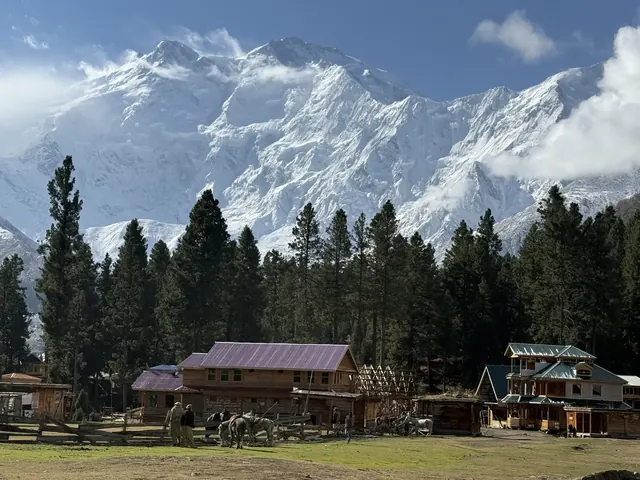
The Hushe side is a reward of its own: green pastures at Dalchangpa and Saicho, views of Masherbrum and Laila Peak, and the first village since Askoli, 13 days earlier. Read more in our Hushe valley guide. If you want to see this side without crossing the pass, the Laila Peak Base Camp Trek walks in from Hushe.
Treks over the Gondogoro La
- K2 Gondogoro La Trek: 21 days from Islamabad, fixed departures
- K2 Base Camp and Gondogoro La Pass Trek: 15 days, trek only from Skardu
- Karakoram K2 Trek: 19 days, private, faster pace
- Day by day: Gondogoro La Trek daily distance and altitude. When to go: Best time for the Gondogoro La. All K2 treks: the K2 hub.
Fixed departures of the 21-day K2 Gondogoro La Trek cost $2,300 per person from Islamabad, with the trekking permit, government fees and park fees included; the 15-day trek-only version from Skardu costs $2,000. What the price covers, and what it does not: K2 Base Camp Trek cost.
Frequently asked questions
How hard is the Gondogoro La?
It is the hardest day of a K2 trek: 9 to 12 hours from Ali Camp to Khuspang, starting around midnight, with about 635 m of steep climbing and about 905 m of steeper descent on fixed ropes. We grade the trek challenging, with one technical day. With good fitness, acclimatisation and the right gear, most trekkers manage it well.
Do I need mountaineering experience to cross the Gondogoro La?
No. Our guide and crew show you how to use crampons, a harness and a jumar and stay with you on the steep sections. Practising with the gear before the trip helps, and you should have trekked to at least 4,000 m before. You never lead any climbing: you move on ropes that the local team has fixed.
How high is the Gondogoro La?
The Gondogoro La is 5,585 m (18,323 ft) high, the highest point of the K2 Gondogoro La Trek. Map data from the SRTM survey gives 5,588 m at the pass, which confirms the figure. For comparison, K2 Base Camp is about 5,150 m and Ali Camp, the last camp before the pass, is 4,950 m.
How long does it take to cross the Gondogoro La?
About 3 hours from the foot of the pass to the top, and 9 to 12 hours in all from Ali Camp to Khuspang, about 8 km. Most groups leave around midnight, reach the top around dawn and arrive at Khuspang between late morning and early afternoon, depending on the snow and the queue on the ropes.
How steep is the Gondogoro La?
Near the top, the snow and ice slopes are up to about 50 degrees in places, and the descent towards Khuspang is steeper than the climb. Fixed ropes are used on both sides. You climb with a jumar and go down the steepest parts with a descender or figure-8, always clipped to the rope.
What gear do I need for the Gondogoro La?
Crampons, a climbing harness, a helmet, a jumar (rope ascender), carabiners, a descender or figure-8, shoe covers (gaiters) and mittens, plus a head torch for the night start and good hiking boots. They are not included in the trek price: bring your own or ask us to arrange them in Skardu.
When is the Gondogoro La open?
The best time to cross is from the end of June to the end of August; from mid-June to the end of September the crossing is still feasible. The fixed ropes are usually in place from mid to late June. Our fixed departures run from June to early October, and the crossing always depends on snow and weather.
What happens if the pass cannot be crossed?
Our guide decides on the day. If conditions on the pass are too risky, we do not cross: the group walks back down the Baltoro Glacier to Askoli instead, as on the K2 Base Camp Trek. This is the only practical alternative, and it takes about five to six walking days from Ali Camp.
What is the GGLA pass?
GGLA, or GG La, is the short name trekkers use for the Gondogoro La, the 5,585 m pass between the Vigne Glacier near Concordia and the Gondogoro Glacier above Hushe. It is also called the Gondogoro Pass. Crossing it turns the K2 trek into a loop, so you walk out through the Hushe valley instead of returning along the Baltoro.
Do I need an ice axe for the Gondogoro La?
No. An ice axe is not on the gear list for the crossing. On the steep sections you are clipped to fixed ropes with a jumar on the way up and a descender or figure-8 on the way down, so your hands are on the rope, not on an axe. Trekking poles help on the glacier before and after the ropes.
Can beginners cross the Gondogoro La?
Beginners in climbing, yes; beginners in trekking, not really. You need no rope experience, but you should have trekked to at least 4,000 m, be able to walk 8 to 10 hours on steep ground, and be comfortable with exposure. If this would be your first high trek, the K2 Base Camp Trek without the pass is the better choice.
How cold is it on the Gondogoro La?
Expect well below freezing at the start. In July the top of the pass is about −10 to −16 °C before dawn and about 5 °C by day; June and September are about 3–4 °C colder, and wind can make it feel 10 °C colder still. These are estimates, not measurements, so bring mittens, a down jacket and a warm hat.
Is the Gondogoro La harder than K2 Base Camp?
Yes. The walk to K2 Base Camp (5,150 m) is long but non-technical. The Gondogoro La is 435 m higher, starts at midnight and has steep fixed-rope sections of up to about 50 degrees on both sides, with a descent of about 905 m. Most of the K2 Gondogoro La Trek is the same as the K2 Base Camp Trek; the pass adds the one technical day.
Is the Gondogoro La harder than the Everest Base Camp trek?
Yes. The Everest Base Camp trek reaches about 5,364 m on a teahouse trail with no fixed ropes. The Gondogoro La is 5,585 m, with fixed ropes on steep snow, and the K2 trek around it has no lodges between Askoli and Hushe: you camp every night from Askoli to Hushe, with a week of the walking on the glacier. The scenery is wilder and the trail far quieter.
About the author
Imtiyaz Ahmed Shigri founded Chogori Adventure in Skardu in 2015. Our guides are local, government-licensed and English-speaking, and most of them are trained in first aid. We are licensed by the Department of Tourist Services (licence no. 2494) and the Gilgit-Baltistan tourism department (licence DTS-GB-055), and we are a member of the Pakistan Association of Tour Operators, with offices in Skardu and Islamabad.
Rated 4.9 out of 5 from 47 reviews on Google (November 2026). Read our reviews on Google