Baltoro Glacier: Facts, Trekking Difficulty, Best Time and Tips
By Imtiyaz Ahmed Shigri, founder of Chogori Adventure, Skardu · Updated November 2026
The Baltoro Glacier is about 63 km long, one of the longest glaciers outside the polar regions, in the Karakoram of Shigar District, Gilgit-Baltistan, Pakistan. It is the road to K2: every trek to K2 Base Camp walks up the Baltoro from Paiju to Concordia (4,691 m), where it meets the Godwin-Austen Glacier below K2, Broad Peak and the Gasherbrums. Below are the key facts about the glacier itself (where it is, how big it is, its side glaciers and peaks, how fast the ice moves and what scientists have found), then what walking on it is like, how hard it is, the weather, the best time to go and our practical tips.
Baltoro Glacier facts
| Fact | |
|---|---|
| Length | About 63 km, one of the longest glaciers outside the polar regions |
| Where | Central Karakoram National Park, Gilgit-Baltistan, northern Pakistan |
| District | Shigar District, in the Baltistan region of Gilgit-Baltistan |
| Mountain range | Central Karakoram: the Baltoro Muztagh to the north and the Masherbrum Mountains to the south |
| Basin area | About 1,500 km² of glacier, side glaciers and mountain walls |
| Lower end (snout) | Just above Paiju camp, about 3,400 m, half an hour's walk from camp |
| Concordia | 4,691 m, where the Baltoro meets the Godwin-Austen Glacier |
| Above Concordia | The Upper Baltoro leads on towards the Gasherbrum peaks |
| Ice speed | Up to about 180–200 m a year just below Concordia; under 20 m a year near the snout |
| Debris cover | Most of the lower glacier is buried under rock, from a few centimetres at Concordia to over 1 m near the snout |
| Meltwater | Feeds the Biaho river, then the Braldu, the Shigar River and the Indus |
| 8,000 m peaks around it | K2 (8,611 m), Broad Peak (8,051 m), Gasherbrum I (8,080 m) and Gasherbrum II (8,035 m) |
| Other famous peaks | Masherbrum (7,821 m), the Trango Towers, Gasherbrum IV, Mitre Peak and Chogolisa |
| Nearest village | Askoli (3,000 m), two days' walk below the snout |
| Trekking season | June to early October |
| World Heritage? | No. It is inside a Pakistani national park, but it is not a UNESCO World Heritage site |
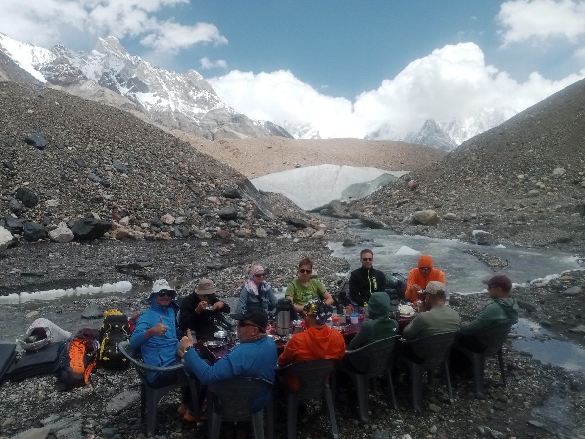
Where is the Baltoro Glacier?
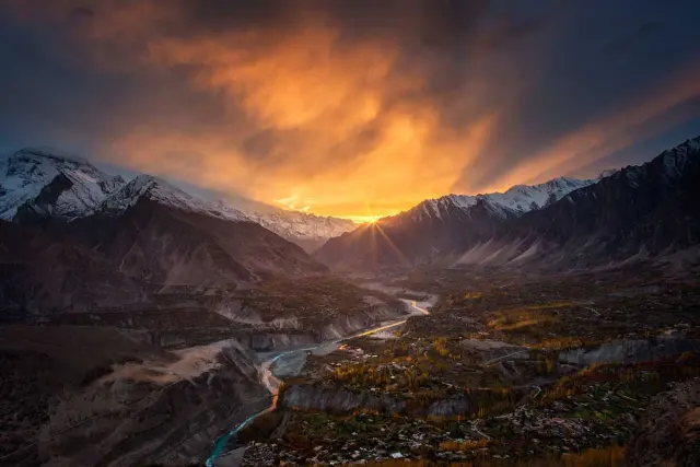
The Baltoro Glacier lies in the central Karakoram range in Shigar District, Gilgit-Baltistan, in the far north of Pakistan, about 80 km in a straight line north-east of Skardu. It sits inside the Central Karakoram National Park, the largest protected area in Pakistan, close to the border with China. K2 itself stands on that border at the head of the Godwin-Austen Glacier, a branch of the Baltoro.
Until 2015 the area was part of Skardu District, so older books and exam questions often say "Skardu". Today the Braldu valley, Askoli village and the whole Baltoro are in Shigar District, whose main town, Shigar, sits about an hour's drive north of Skardu. Both districts are in Baltistan, the land of the Balti people.
The glacier runs roughly from east to west. Its upper end is a wide basin of snow below the Gasherbrums and Baltoro Kangri; its lower end, the snout, is a wall of grey ice and rubble just above Paiju. North of the glacier stands the Baltoro Muztagh, the chain that holds K2, Broad Peak, the Gasherbrums and the Trango Towers. South of it are the Masherbrum Mountains, with Masherbrum, Mitre Peak and Chogolisa. To the north-east, the Conway Saddle at the head of the Abruzzi Glacier separates the Baltoro basin from the Siachen Glacier.
How do you get to the Baltoro Glacier?
You reach the Baltoro in three stages: a flight or a two-day drive from Islamabad to Skardu (2,230 m), a 5–7 hour jeep ride to Askoli (3,000 m), and two days on foot to Paiju (3,400 m), where the glacier begins.
Askoli (Askole) is the last village and the end of the road; read more about it in our guide to Askoli, the gateway to the Karakoram giants. From Askoli the trail follows the Braldu river to Jhola (3,200 m) and Paiju, then climbs onto the ice. If you have spare days in Skardu before or after the trek, see what to see in and around Skardu.
How long and how high is the Baltoro Glacier?
The Baltoro Glacier is about 63 km long, and its surface rises from about 3,400 m at the snout to about 4,691 m at Concordia and over 5,500 m in the snowfields of the upper glacier, below peaks of more than 8,000 m.
Published lengths range from 62 to 63 km, depending on where the measurer puts the top of the glacier; a long-term Italian research study gives about 62 km and a 2009 glacier velocity study about 63 km. Some old trekking pages say 65 km, which is too long. The glacier and all the mountain walls that drain into it cover about 1,500 km².
| Glacier | Region | Length (about) |
|---|---|---|
| Fedchenko | Pamir, Tajikistan | 77 km |
| Siachen | Eastern Karakoram | 70–76 km |
| Biafo | Central Karakoram, Pakistan | 67 km |
| Baltoro | Central Karakoram, Pakistan | 63 km |
The Biafo, its neighbour to the west, is the other giant of Baltistan; our Snow Lake, Biafo and Hispar La Trek crosses it. Figures for the longest glaciers vary from source to source, so treat the table as a rough comparison, not a ranking.
Baltoro Glacier height at each point
| Point on the glacier | Height |
|---|---|
| Snout, above Paiju | about 3,400 m (11,155 ft) |
| Khoburtse camp, beside the ice | 3,800 m (12,467 ft) |
| Urdukas camp, on the south bank | 4,000 m (13,123 ft) |
| Goro II camp, on the ice | 4,300 m (14,108 ft) |
| Concordia | 4,691 m (15,390 ft) |
| Snow line (equilibrium line) | about 5,500 m (18,045 ft) |
The snow line, which glaciologists call the equilibrium line, is the height where the snow that falls in a year equals the snow and ice that melts. Above about 5,500 m the Baltoro gains ice; below it, the glacier loses ice every summer. Everything a trekker walks on between Paiju and Concordia is in the melting zone, which explains the rubble, streams and lakes.
Tributary glaciers of the Baltoro
More than a dozen side glaciers flow into the Baltoro. The biggest are the Godwin-Austen from K2, the Abruzzi and South Gasherbrum from the Gasherbrums, the Vigne from Chogolisa, and the Yermanendu from Masherbrum.
The Baltoro is a glacier system, not a single river of ice. Each side glacier adds its own band of ice and its own stripe of rock, the dark lines (medial moraines) you see running down the glacier from Concordia. From the top down, the main ones are:
| Tributary glacier | Joins the Baltoro | Comes from |
|---|---|---|
| Abruzzi and South Gasherbrum (Baltoro South) | Upper Baltoro, above Concordia | Gasherbrum I, II and IV, Baltoro Kangri |
| Vigne | Upper Baltoro, just above Concordia; Ali Camp lies on it | Chogolisa and Baltoro Kangri; the way to the Gondogoro La |
| Godwin-Austen | Concordia | K2 and Broad Peak |
| Younghusband | North bank, below Concordia | The Muztagh Tower area |
| Biarchedi | South bank | Biarchedi peak, above Goro |
| Yermanendu | South bank, about 19 km above the snout | Masherbrum |
| Dunge and Trango | North bank, opposite Khoburtse and Urdukas | The Trango Towers |
| Uli Biaho | North bank, near the snout | Uli Biaho Tower |
| Liligo | South bank, near Khoburtse | Paiju Peak and its neighbours |
Because these side glaciers flow at different speeds, the bands of ice and rock bend and fold where they meet. On the walk from Urdukas to Goro you cross several of these stripes, each a slightly different colour of rock: grey granite from the Trango side, darker rock from the south. Guides often follow the smoother ice between two moraine stripes, because it is easier underfoot than the moraine itself.
Peaks along the Baltoro Glacier
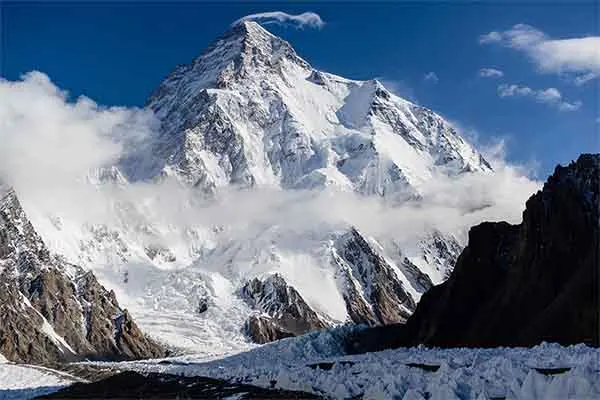
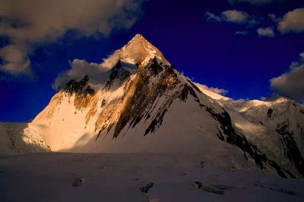
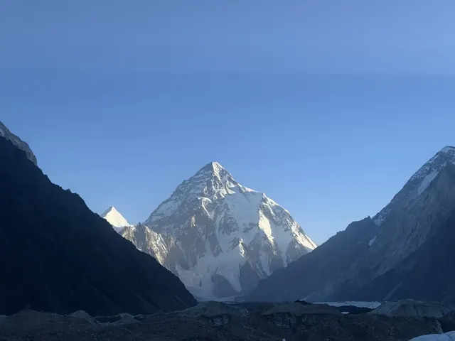
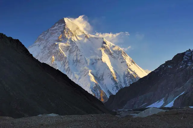
Four of the world's 14 peaks over 8,000 m stand at the head of the Baltoro: K2 (8,611 m), Gasherbrum I (8,080 m), Broad Peak (8,051 m) and Gasherbrum II (8,035 m). Few places on Earth have so many 8,000 m peaks within about 20 km of Concordia.
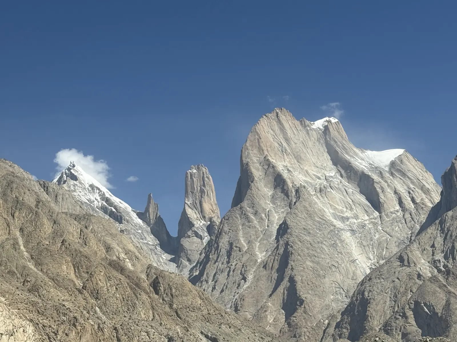
Great Trango and the Nameless Tower above the Baltoro
| Peak | Height | Where you see it best | First climbed |
|---|---|---|---|
| K2 | 8,611 m (28,251 ft) | Concordia, Goro II, K2 Base Camp | 1954, Italian expedition |
| Gasherbrum I (Hidden Peak) | 8,080 m | Upper Baltoro, Gasherbrum Base Camp | 1958, American expedition |
| Broad Peak | 8,051 m | Goro II, Concordia | 1957, Austrian team |
| Gasherbrum II | 8,035 m | Upper Baltoro, Gasherbrum Base Camp | 1956, Austrian expedition |
| Gasherbrum IV | 7,932 m | Goro I, Goro II, Concordia | 1958, Italian expedition |
| Masherbrum (K1) | 7,821 m | Urdukas, Goro I | 1960, American-Pakistani expedition |
| Chogolisa | 7,665 m | Concordia, Ali Camp | 1958, Japanese expedition |
| Baltoro Kangri | 7,312 m | Upper Baltoro | 1963, Japanese expedition |
| Muztagh Tower | 7,273 m | Goro I, Goro II | 1956, British team |
| Paiju Peak | 6,610 m | Paiju, Khoburtse | 1976 |
| Great Trango Tower | 6,286 m | Khoburtse, Urdukas | 1977, American team |
| Mitre Peak | 6,010 m | Concordia | not well recorded |
The lower glacier is famous for rock: the granite walls of the Trango Towers, Uli Biaho and the Cathedral group rise more than 1,000 m straight above the ice, and big-wall climbers come from all over the world for them. The upper glacier is famous for height: from Concordia you can turn on the spot and see K2, Broad Peak, the Gasherbrums, Chogolisa and Mitre Peak.
Climbing these peaks is a separate world from trekking. If you are thinking about it, see our K2 Climbing Expedition, the Broad Peak Expedition, the Trango Tower Expedition for the granite, and our guide to 8,000 m peaks by difficulty.
How the Baltoro Glacier moves: ice flow and research
The Baltoro moves all the time: satellite and GPS studies show the ice flowing at up to about 180–200 m a year just below Concordia, about 75–100 m a year near Urdukas and only 15–20 m a year near the snout.
The best-known measurements come from an international team of glaciologists, published in the Journal of Glaciology in 2009. They tracked surface features on radar satellite images from 1993 to 2008 and checked them with GPS stakes on the ice in 2004 and 2005. Their main findings:
- Fastest near Concordia: the ice moved at up to about 180 m a year just below Concordia on yearly averages, and over 200 m a year in summer. Near Goro II, GPS points moved at a rate of about 240 m a year during one week in July 2005.
- Faster in summer: around Concordia the glacier moved up to 65% faster in summer than in winter, because meltwater reaches the bed of the glacier and lets the ice slide.
- "Block" flow: across much of the upper melting zone the whole width of the glacier moves almost as one block in summer, sliding on its bed, instead of flowing fastest in the middle like a river.
- A slight speed-up: the glacier sped up gradually in the early 2000s; winter 2007/08 was up to 25% faster than winter 2003/04.
- Slow at the snout: under its thick rock cover near Paiju the ice creeps forward at only 15–20 m a year.
Put simply: a stone that lands on the ice near Concordia travels about half a metre a day. A stone at the snout may need decades to move one kilometre. The path changes every year for this reason.
Is the Baltoro Glacier retreating?
No clear retreat has been measured: the snout of the Baltoro has moved back and forth by only about 200 m since records began in 1913. It advanced about 200 m in the early 20th century and has drawn back by a similar distance since 1954.
This fits the wider "Karakoram anomaly". A 2012 study in Nature Geoscience compared satellite height maps of 2000 and 2008 over 5,615 km² of the central Karakoram and found glaciers there were roughly in balance, even slightly gaining ice (+0.11 m of water a year, with an error larger than the gain), while most glaciers in the Himalaya were shrinking. Scientists still debate why; more winter snow carried by westerly weather and the thick rock cover are two of the explanations put forward. It does not mean the Baltoro is untouched: researchers who compared photographs from 2001 to 2011 saw less snow and ice cover near Concordia, and surface lakes and ice cliffs on the lower glacier change from year to year.
Why the Baltoro matters: water for the Indus
The Baltoro is one of the main water stores of the upper Indus. Its meltwater forms the Biaho river below the snout, which joins the Braldu, then the Shigar River, which meets the Indus near Skardu. Glaciers like the Baltoro hold winter snow as ice and release it in the hot months of July and August, when the farms of Baltistan and the plains downstream need it most. Researchers estimate that around 1.8 km³ of rain and snow falls on the Baltoro catchment each year.
Debris cover: why the Baltoro looks grey
For most of its length the Baltoro is covered with rock: about 70% of the surface near Concordia carries a thin layer of 5–15 cm, the area around Urdukas is almost fully covered with 30–40 cm, and near the snout the rock is more than 1 m thick.
The rock comes from the steep walls above. Frost, rockfall and avalanches drop stones onto the ice, and the ice carries them down. As the ice melts from below the rock, the stones stay behind, so the rock layer thickens towards the snout. Rock cover starts below about 5,000 m.
The layer works in two ways. A thin layer of a few centimetres darkens the surface and makes the ice melt faster in the sun. A thick layer insulates the ice and slows the melt. Italian researchers who measured melting near Urdukas and Concordia in July 2004 found typical melt rates of about 4 cm of ice a day under thin rock, with 3–6 cm a day across their test field. Under 40 cm of rock the melt rate was several times lower.
For a trekker this explains the landscape:
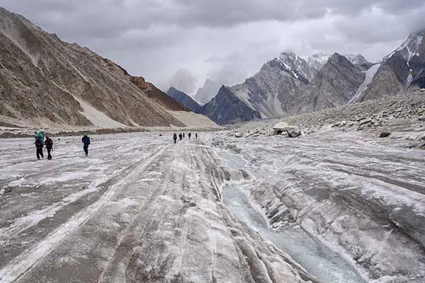
- Ice ridges and hollows: where the rock layer is uneven, the ice melts unevenly, leaving grey hills of rubble up to tens of metres high with bare ice walls between them.
- Lakes and streams: meltwater collects in hollows. Some surface ponds reach 100 m by 100 m. They can drain or appear within a few days.
- White ice towers: around Goro and below Concordia, where the rock cover is thin, the ice shows through as white towers and ridges, the "ice pinnacles" of trekkers' photographs.
- Loose rock on ice: stones resting on bare ice slide easily underfoot. This is why poles and careful foot placing matter more here than on any normal mountain path.
Baltoro Glacier weather
In the trekking season (June to early October), Baltoro Glacier weather is mostly dry and sunny, with strong sun by day and cold nights: around 0 to −10°C at the high camps. Storms with snow can arrive at any time, and they last from a few hours to several days.
The Karakoram sits in the rain shadow of the Himalaya. Most of the snow that feeds the Baltoro falls high up in winter and spring, brought by weather systems from the west; the summer monsoon reaches it only weakly. In summer you get long dry spells broken by unsettled days with cloud, wind and snow above about 4,500 m.
Two research weather stations, at Urdukas (4,022 m) and K2 Base Camp (the station stood at about 5,030 m, a little below the camp), recorded summer 2004 in detail. Air temperature dropped by about 7.5°C for every 1,000 m of height. Rain and snow at Urdukas added up to 85 mm between 18 June and 1 August, and only 17 mm between 8 and 27 July, a three-week dry spell. The air was drier at Urdukas (53.6% average humidity) than at K2 Base Camp (70.7%), and average wind was light, about 2 m a second, with gusts up to 10 m a second. Incoming sunshine reached over 1,200 watts per square metre at midday, which is why the glacier feels hot in the sun and freezing in the shade.
A worked example: Concordia (4,691 m) is about 700 m higher than Urdukas (4,000 m). At the same hour it is therefore about 5°C colder, and K2 Base Camp, about 1,150 m above Urdukas, is roughly 8–9°C colder. Plan layers by height, not by the date.
| Month | What to expect on the glacier |
|---|---|
| June | Snow still lies higher up, especially above Goro and at Concordia. Long days, cold nights, rivers rising. Our first departures start on 5 June. |
| July | Usually the most settled month, with the warmest days. Snow melts fast, so streams on the ice are biggest in the afternoon. |
| August | Warm and mostly stable, though more cloud can build in the afternoon. Meltwater is at its peak; side streams on the lower glacier may need early crossings. |
| September | Clearer air and fewer trekkers. Nights are colder and the first snow can fall on the upper glacier late in the month. |
| Early October | Crisp, often clear, and cold: well below freezing at night at Concordia. Our last departure starts on 5 October. |
| November to March | Deep snow and severe cold. The glacier is not a trekking season. |
For the weather on the pass at the head of the glacier, see the best time and weather for the Gondogoro La.
Walking on the Baltoro Glacier
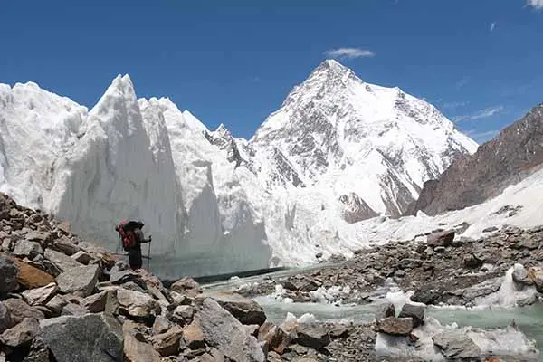
The Baltoro does not look like a white glacier for most of its length. The ice is covered with rock and gravel (moraine), so you walk up and down over stony ridges, around meltwater streams and between ice pinnacles. The path changes every year as the ice moves, and our guides choose the line each day.
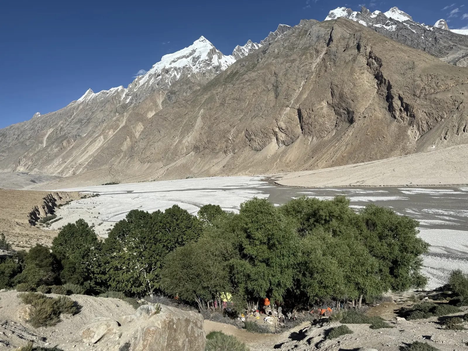
The green trees of Paiju camp beside the Baltoro snout
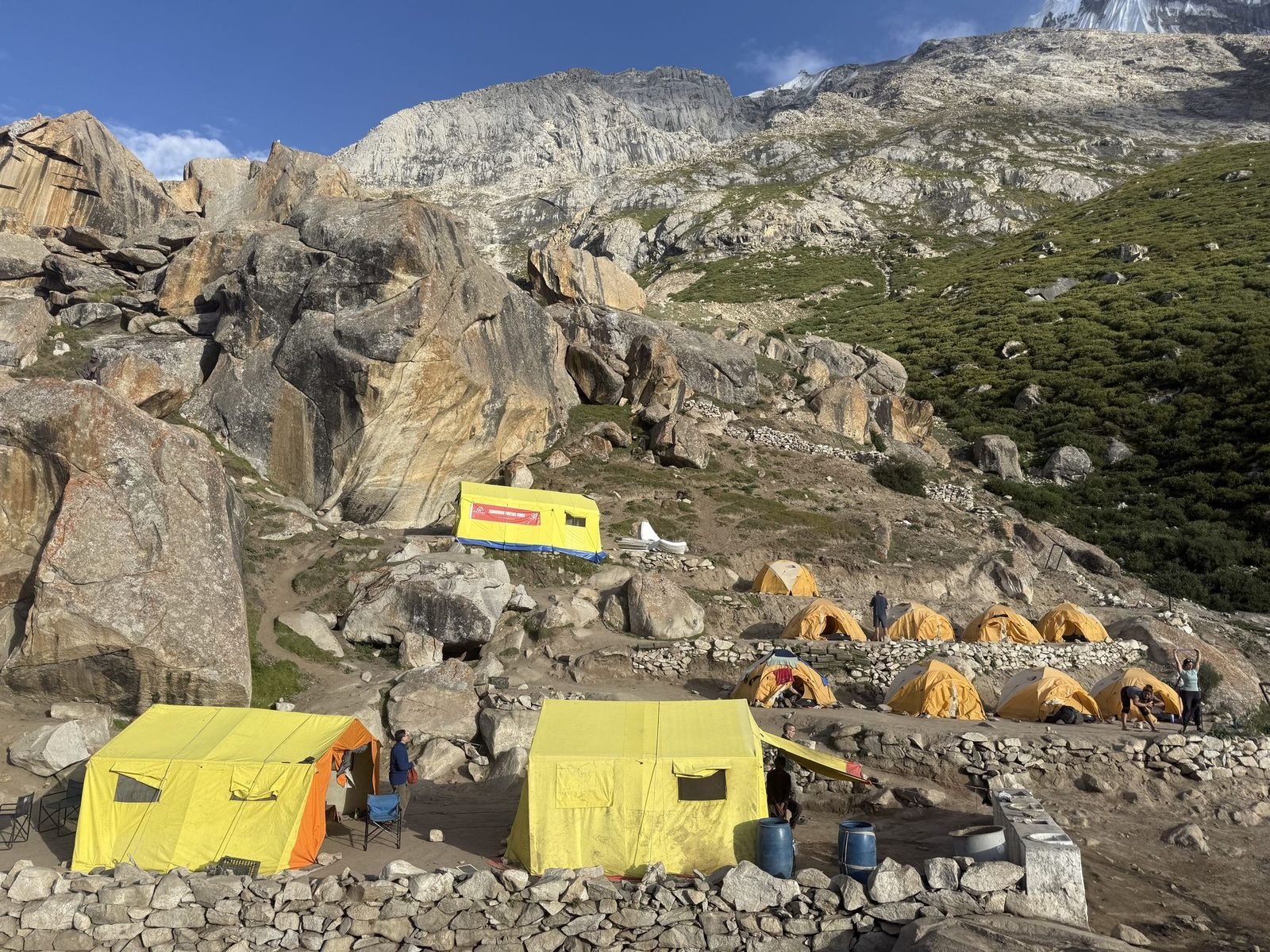
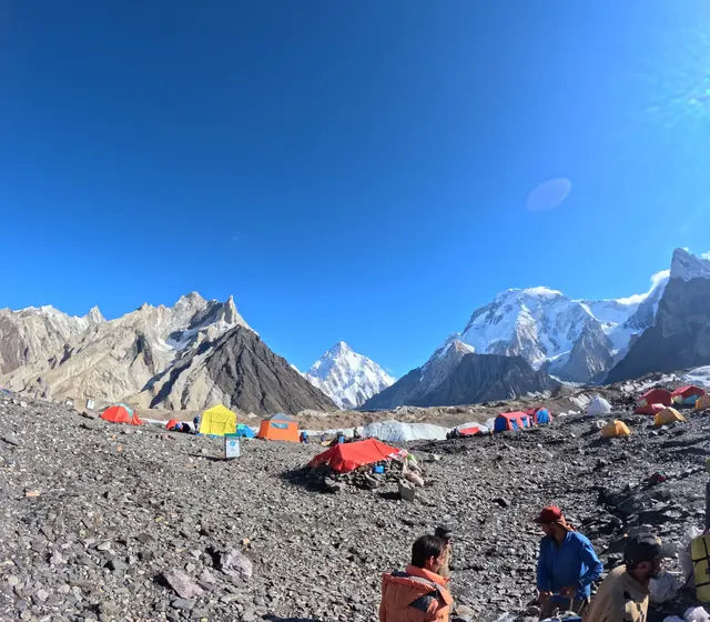
Yellow tents on the terraces of Urdukas camp
On the classic route, you are on the glacier for four walking days from Paiju to Concordia, about 45 km, with camps at these points:
| Camp | Height | Walk from the camp before |
|---|---|---|
| Khoburtse | 3,800 m (12,467 ft) | Paiju → Khoburtse: about 14.7 km, 5–6 hours |
| Urdukas | 4,000 m (13,123 ft) | About 6.2 km, 4–5 hours; the last camp on solid ground, above the glacier |
| Goro II | 4,300 m (14,108 ft) | About 12.2 km, 7–8 hours, past Goro I (4,100 m) |
| Concordia | 4,691 m (15,390 ft) | About 11.8 km, 5–6 hours |
| K2 Base Camp | about 5,150 m (16,896 ft) | About 11.8 km, 4–6 hours, up the Godwin-Austen Glacier |
For every day of the trek, including the way back, see K2 Base Camp height, distance and map.
What a day on the glacier looks like
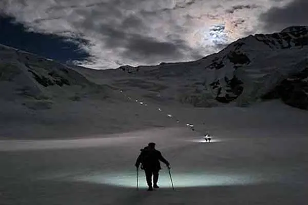
Glacier days on our trips start early, so you walk while the surface is still frozen and the streams are low. You walk at a steady pace with your guide, stopping every hour or so for water and a snack. Most days are 5–8 hours on foot with a lunch stop, so you reach camp in the afternoon. The rest of the day is for rest, washing, warm drinks and, from Urdukas onwards, the views. On the long day from Urdukas to Goro II, plan for 7–8 hours on foot.
Paiju is the last camp before the ice and the place of our rest day: it helps your body adjust to the height before you climb onto the glacier. Urdukas is the only camp between the snout and Concordia that sits on grass and rock above the ice; Goro II and Concordia (and Goro I on the way back) are tent platforms on the moving glacier itself.
How hard is trekking on the Baltoro?
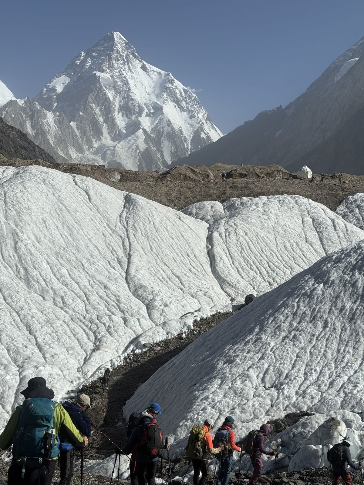
Trekkers walking on the white ice of the upper Baltoro toward K2
- Terrain: the rough moraine is the hardest part: uneven, loose and tiring for the ankles, especially on the lower glacier up to Goro. Good boots and trekking poles help a lot.
- Altitude: the camps rise from 3,800 m to 4,691 m on the glacier. The itineraries climb slowly, with a rest day at Paiju before the glacier, but you should already have trekked to at least 4,000 m.
- Weather: days are usually dry and clear in summer, but storms and cold wind can come quickly, and nights at the high camps fall to around 0 to −10°C.
- Remoteness: there are no villages or teahouses after Askoli. On an organised trek our cooks, porters and crew carry the camp and food; you carry only a daypack.
- It is strenuous but non-technical: no climbing skills are needed to reach Concordia and K2 Base Camp. More in our K2 Base Camp Trek guide.
Who the Baltoro trek suits
The Baltoro suits fit hikers who have already trekked to at least 4,000 m and can walk 6–8 hours on rough ground for several days in a row. It is a good first big glacier trek for people who have done a high multi-day trek before; it is not a first-ever trek. If you want shorter walking days, our K2 Base Camp Trek for Beginners has 8 extra days (29 days in all). If you are very fit and have been above 5,000 m before, the private Karakoram K2 Trek in 19 days is a quicker plan.
How to train for the Baltoro
Train for three to four months before the trek. The best training is long walks on hills with a 6–8 kg pack, building to two 6-hour days back to back. Add stair climbing or step-ups for the uphill legs, and walking on rough ground, scree or rocky beaches to train ankles and balance for the moraine. Strength work for the legs and core helps on the long descents. On the trek, the slow pace and the rest days do the rest.
Can you trek the Baltoro solo?
You cannot trek the Baltoro independently. It lies in a restricted area inside the Central Karakoram National Park, and every trekker needs a trekking permit and a licensed guide, arranged through a licensed company. You can still come on your own: join one of our fixed departures and we put you together with other travellers. The permit, government fees and park fee are included in the price of all our K2 treks. More on safety: Before you trek in Pakistan
Bring your original passport: a copy goes with your trekking permit, and it is checked at the park entry. On our fixed departures, groups have 4 to 12 trekkers, and one person can book a departure that then fills. The K2 Base Camp Trek costs $2,300 per person for fixed departures; what it covers and the extras are explained in K2 Base Camp Trek cost.
Best time to trek the Baltoro Glacier
Our fixed departures run from June to early October. July and August usually have the most settled weather and the warmest days; June can still have snow higher up, and September and early October are clearer but colder at night. From November to March the glacier is under deep snow and very cold, and it is not a trekking season.
Our 2027 departures for the K2 treks start on the 5th, 12th, 20th and 27th of June, July, August and September, plus 5 October. If you plan to cross the Gondogoro La at the end, the best window for the pass is from the end of June to the end of August, when the fixed ropes are in and the snow is firmer early in the morning.
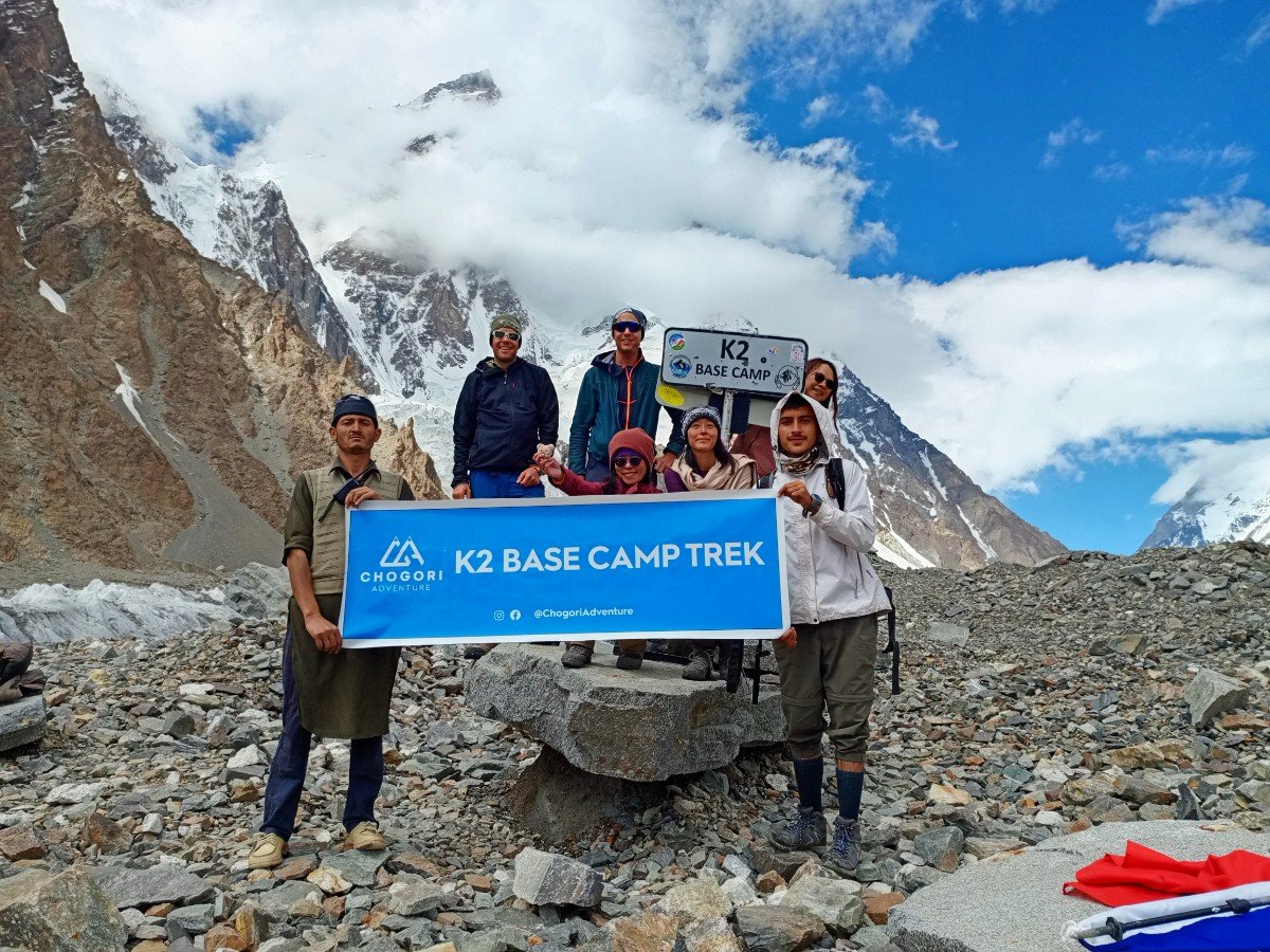
Our tips for the Baltoro
- Boots: wear well broken-in, waterproof trekking boots with good ankle support; the moraine is hard on new boots.
- Poles and gaiters: two trekking poles help with balance on loose rock and stream crossings; gaiters keep out gravel.
- Sun: the glare off ice and snow is strong. Bring good sunglasses, a sun hat and high-factor sunscreen.
- Layers: pack for warm days and freezing nights: a down jacket and a warm sleeping bag are essential.
- Water: drink plenty. On our treks drinking water is boiled for you every day.
- Pace: start early, walk slowly and steadily, and stay close to your guide, who picks the best line across the ice.
- Animals: on narrow sections, let horses and donkeys pass on the uphill side.
- Luggage: a porter carries up to 16 kg of your gear; you carry a daypack with water, layers and snacks.
- Cash: there are no cash machines after Skardu and only a few small shops at Askoli. Tips for the crew are usually USD 100–250 per trekker, paid in cash at the end.
- Phone: there is no internet after Askoli. Concordia has a solar-powered signal tower that works on some sunny days, but do not count on it.
Mistakes to avoid on the Baltoro
The most common mistakes on the Baltoro are walking too fast on the first glacier days, drinking too little, and arriving with new boots or no experience of altitude.
- Rushing to Concordia: the camps are spaced for acclimatisation. Trekkers who race ahead on the Khoburtse and Urdukas days often feel the height at Goro II. Walk at a pace where you can talk.
- Ignoring headaches: tell your guide at once about a headache, dizziness or nausea. The treatment for serious altitude sickness is to go down, and on the Baltoro that means walking, so early action matters.
- Stepping on bare ice: a stone resting on grey ice can hide a slick surface. Step on rock that is set in gravel, and use your poles.
- Walking near ice cliffs and lake edges: ice walls above meltwater lakes collapse without warning, and rocks roll off them in the afternoon. Follow the line your guide picks.
- Crossing streams late in the day: meltwater rises through the afternoon. Cross big side streams early in the day, when they are lowest.
- Packing only for the heat: a sunny morning at Urdukas can turn into snow at Concordia by evening. Keep a warm layer and a shell in your daypack every day.
- Leaving rubbish: nothing rots on a glacier at 4,000 m. Carry out every wrapper and battery.
Protecting the Baltoro Glacier
The Baltoro lies inside the Central Karakoram National Park, created in 1993, and every trekker pays a park fee, which is included in our K2 trek prices.
Trekkers, climbers, porters and pack animals use the glacier every summer, so rubbish and human waste are real problems. You can help: bring a refillable bottle instead of plastic bottles, carry your own small rubbish bag, and use the toilet tents. Leave stones, plants and fossils where they are.
Treks that cross the Baltoro Glacier
- K2 Base Camp Trek: 21 days, up and back down the Baltoro
- K2 Gondogoro La Trek: 21 days, up the Baltoro and over the Gondogoro La to Hushe
- Baltoro Glacier Trek: K2 & Gasherbrum: 23 days, private, adds Gasherbrum Base Camp
- K2 Base Camp Trek for Beginners: 29 days, shorter walking days
- Concordia K2 Base Camp Trek and K2 Base Camp and Gondogoro La Pass Trek: 15 days, trek only from Skardu
- Compare them all in our K2 hub. Crossing the pass? Read Gondogoro La difficulty.
The Gondogoro La (5,585 m) route leaves the Baltoro above Concordia, walks up the Vigne Glacier to Ali Camp (4,950 m), crosses the pass on fixed ropes and comes down to Khuspang and Saicho in the Hushe valley. If the pass is too risky because of snow or weather, we do not cross: the group walks back down the Baltoro to Askoli. Day-by-day figures are in Gondogoro La Trek daily distance and altitude.
Frequently asked questions
How long is the Baltoro Glacier?
About 63 km, from its snout just above Paiju (about 3,400 m) to Concordia (4,691 m) and on towards the Gasherbrums. Published figures range from 62 to 63 km, depending on where the top of the glacier is drawn. It is one of the longest glaciers outside the polar regions, with a basin of about 1,500 km².
Where is the Baltoro Glacier?
In the Karakoram range of Gilgit-Baltistan, northern Pakistan, inside the Central Karakoram National Park and close to the border with China. Treks start from Askoli, a 5–7 hour jeep ride from Skardu, and reach the snout of the glacier at Paiju after two days on foot.
In which district is the Baltoro Glacier located?
Shigar District, in the Baltistan region of Gilgit-Baltistan, Pakistan. Before Shigar became its own district in 2015 the area belonged to Skardu District, so older books and quiz answers often say Skardu. Askoli, the last village before the glacier, is also in Shigar District.
What is the height of the Baltoro Glacier?
The surface rises from about 3,400 m (11,155 ft) at the snout above Paiju to 4,691 m (15,390 ft) at Concordia and over 5,500 m in the snowfields of the upper glacier. The peaks around it reach 8,611 m at K2, the highest point of its basin.
How many days do you walk on the Baltoro Glacier?
On the classic K2 Base Camp Trek, four walking days from Paiju to Concordia (about 45 km), then a day up the Godwin-Austen Glacier to K2 Base Camp, and about three to four days back down to the snout. Add two days from Askoli to Paiju and a rest day at Paiju.
Can I trek the Baltoro Glacier without a guide?
No. The Baltoro lies in a restricted area: every trekker needs a trekking permit and a licensed guide, arranged through a licensed company, and your original passport is checked. You can still travel alone by joining one of our fixed departures, where we put you in a group of 4 to 12 trekkers.
How hard is the Baltoro Glacier trek?
Strenuous but non-technical. The rough, rock-covered ice and the altitude (up to 4,691 m at Concordia and about 5,150 m at K2 Base Camp) are the main challenges, with walking days of 4 to 8 hours. You should already have trekked to at least 4,000 m and be able to walk several long days in a row.
What is the best time to trek the Baltoro?
June to early October. July and August usually have the most settled weather and the warmest days. June can still have snow on the upper glacier, while September and early October are clearer but colder, with hard frosts at night. From November to March the glacier is under deep snow and is not trekked.
What is the weather like on the Baltoro Glacier?
In summer it is mostly dry and sunny, with strong sun by day and nights around 0 to −10°C at the high camps. Temperature drops about 7.5°C for every 1,000 m of height, so Concordia is roughly 5°C colder than Urdukas. Snowstorms can come at any time and last from hours to days.
How fast does the Baltoro Glacier move?
Up to about 180–200 m a year just below Concordia, about 75–100 m a year near Urdukas and only 15–20 m a year near the snout, according to satellite and GPS studies. It moves faster in summer, up to 65% faster around Concordia, when meltwater lets the ice slide on its bed.
Is the Baltoro Glacier melting or retreating?
Its snout has moved only about 200 m back and forth since records began in 1913, and studies of the central Karakoram from 2000 to 2008 found glaciers roughly in balance. The surface still melts every summer below about 5,500 m, and snow and ice cover near Concordia has visibly changed since 2001.
Why is the Baltoro Glacier covered with rocks?
Rockfall and avalanches from the steep walls drop stones onto the ice, which carries them down. As the ice melts, the stones stay on top, so the rock layer thickens from 5–15 cm near Concordia to 30–40 cm near Urdukas and over 1 m at the snout. Thick rock slows the melting of the ice beneath.
Which mountains can you see from the Baltoro Glacier?
K2, Broad Peak, Gasherbrum I and II, Gasherbrum IV, Masherbrum, Mitre Peak, Chogolisa, the Muztagh Tower and the Trango Towers, with the best views from Urdukas, Goro II and Concordia. Four peaks over 8,000 m stand at the head of the glacier, all within about 20 km of Concordia.
Is the Baltoro Glacier a UNESCO World Heritage site?
No. The Baltoro lies in the Central Karakoram National Park, a protected area of Pakistan created in 1993, but it is not a UNESCO World Heritage site. Every trekker pays the park fee, which is included in the price of all our K2 treks, along with the trekking permit and government fees.
About the author
Imtiyaz Ahmed Shigri founded Chogori Adventure in Skardu in 2015. Our guides are local, government-licensed and English-speaking, and most of them are trained in first aid. We are licensed by the Department of Tourist Services (licence no. 2494) and the Gilgit-Baltistan tourism department (licence DTS-GB-055), and we are a member of the Pakistan Association of Tour Operators, with offices in Skardu and Islamabad.
Rated 4.9 out of 5 from 47 reviews on Google (November 2026). Read our reviews on Google