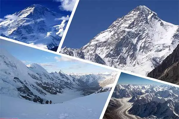
Gondogoro La Trek Daily Distance and Altitude

By Imtiyaz Ahmed Shigri, founder of Chogori Adventure, Skardu · Updated November 2026
The Gondogoro La is 5,585 m (18,323 ft) high, the highest point of the K2 Gondogoro La Trek. The Gondogoro La trek follows the Baltoro Glacier from Askoli (also spelled Askole) to Concordia and K2 Base Camp, then crosses the pass to Hushe instead of walking back the same way. In all it is about 155 km on foot over 13 days on the trail, inside a 21-day trip from Islamabad. Below are the daily distance and altitude for every day, the walking time, a route map, the height gain and loss, and what the pass day is like. All figures are from our K2 Gondogoro La Trek itinerary; times are for a fit trekker at a normal pace, and yours may be shorter or longer.
Gondogoro La Trek at a glance
| Figure | |
|---|---|
| Gondogoro La height | 5,585 m (18,323 ft) |
| Highest camp | Ali Camp, 4,950 m (16,240 ft), the night before the pass |
| K2 Base Camp | About 5,150 m (16,896 ft), day 12 |
| Distance on foot | About 155 km, Askoli to Hushe |
| Pass day | About 8 km and 9–12 hours, from Ali Camp over the pass to Khuspang |
| Start and end | Walk from Askoli (3,000 m); finish in Hushe (3,150 m) and drive to Skardu |
| Height gain and loss | About 3,040 m up and 2,890 m down, camp to camp |
| Trip length | 21 days from Islamabad and back |
| Season | Fixed ropes are usually in place on the pass from mid to late June |
How high is the Gondogoro La?
The Gondogoro La is 5,585 m (18,323 ft) above sea level. That is 435 m higher than K2 Base Camp (5,150 m) and 635 m above Ali Camp (4,950 m), where you sleep the night before the crossing.
The figure is confirmed by two separate radar maps of the earth's surface. The SRTM map, from a NASA survey in 2000, reads 5,588 m at the pass, and the European Copernicus map, from surveys in 2011–2015, reads 5,576 m. Trekkers with GPS watches sometimes record a little more, around 5,600 m, because the line of the fixed ropes reaches the ridge a short way west of its lowest point. We use 5,585 m on every page of our site.
"La" means pass in Balti and Tibetan, so "Gondogoro La" and "Gondogoro Pass" are the same place; "Gondogoro La Pass" is common in English but says "pass" twice. Do not confuse the pass with Gondogoro Peak (5,650 m), a separate summit above the Gondogoro Glacier that is climbed from the Hushe side.
Where the pass is
The Gondogoro La lies at about 35°39′ N, 76°28′ E in Baltistan, in Pakistan's Gilgit-Baltistan region. It is about 25 km south of K2 and about 25 km north-east of Hushe village. The pass is a gap in the ridge between two glaciers: the Vigne Glacier on the north-east side, which you climb from Ali Camp, and the Gondogoro Glacier on the south-west side, which you follow down towards Hushe. The Vigne side is the side most groups climb, because it starts higher and is shorter.
Gondogoro La Trek route map
The map shows every camp with its height and the days you sleep there: up the Baltoro to K2 Base Camp, then Ali Camp, the pass and down to Hushe. It is a schematic: not to scale.
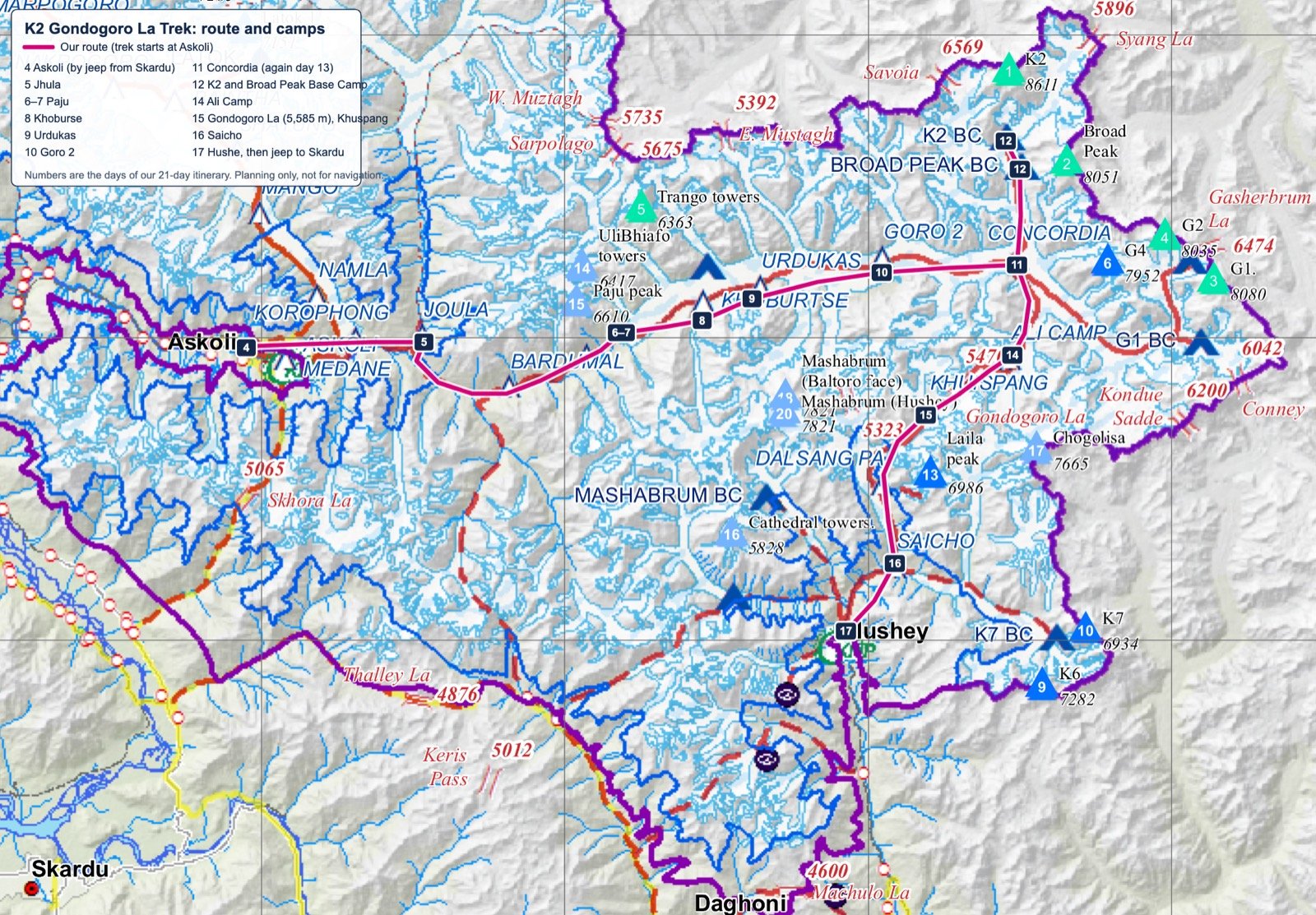
Base map: Central Karakorum National Park (CKNP) Tourism Map, March 2014, by CKNP with SEED and Ev-K2-CNR. Route, camps and day numbers added by Chogori Adventure.
Read the map from left to right. The orange line is the walk on foot, which starts at Askoli on day 5 and ends at Hushe on day 17. The jeep and flight legs at each end connect it to Skardu and Islamabad. The small chart under the map shows your sleeping height each night: it rises in steps up the Baltoro, peaks at K2 Base Camp and the pass, and falls quickly once you are over the top.
The route is a horseshoe. You walk east up the Braldu valley and the Baltoro Glacier to Concordia, turn north for the side trip to K2 Base Camp, then turn south-east up the Vigne Glacier, cross the ridge and walk south-west down the Gondogoro and Hushe valleys. Askoli and Hushe are only about 60 km apart in a straight line, but the road between them goes back through Skardu.
Gondogoro La trek daily distance and altitude, day by day
Days 1 to 4 are Islamabad, the flight to Skardu (2,230 m), a rest day and the 5–7 hour jeep ride to Askoli (3,000 m). The walking starts on day 5 and ends on day 17, with 12 walking days and one rest day.
| Day | Stage | Distance | Walking time | Sleeping height | Height change |
|---|---|---|---|---|---|
| Day 5 | Askoli → Jhola | 20 km | 5–8 hours | 3,200 m (10,499 ft) | +200 m |
| Day 6 | Jhola → Paiju | 20.5 km | 7–8 hours | 3,400 m (11,155 ft) | +200 m |
| Day 7 | Rest day at Paiju | – | – | 3,400 m (11,155 ft) | – |
| Day 8 | Paiju → Khoburtse | 14.7 km | 5–6 hours | 3,800 m (12,467 ft) | +400 m |
| Day 9 | Khoburtse → Urdukas | 6.2 km | 4–5 hours | 4,000 m (13,123 ft) | +200 m |
| Day 10 | Urdukas → Goro II | 12.2 km | 7–8 hours | 4,300 m (14,108 ft) | +300 m |
| Day 11 | Goro II → Concordia | 11.8 km | 5–6 hours | 4,691 m (15,390 ft) | +391 m |
| Day 12 | Concordia → K2 Base Camp → Broad Peak Base Camp | 16.8 km | 4–6 hours, then about 5 km back | 4,850 m (15,912 ft) | up to 5,150 m |
| Day 13 | Broad Peak Base Camp → Concordia | 7 km | about 3 hours | 4,691 m (15,390 ft) | −159 m |
| Day 14 | Concordia → Ali Camp | 12 km | 5–6 hours | 4,950 m (16,240 ft) | +259 m |
| Day 15 | Ali Camp → Gondogoro La → Khuspang | 8 km | 9–12 hours | 4,680 m (15,354 ft) | +635 m, −905 m |
| Day 16 | Khuspang → Saicho | 18 km | 6–8 hours | 3,350 m (10,991 ft) | −1,330 m |
| Day 17 | Saicho → Hushe | 7 km | 3–4 hours | 3,150 m (10,335 ft) | −200 m |
On day 18 a jeep takes you from Hushe back to Skardu, and on day 19 you fly to Islamabad. Days 1 to 13 are the same as on the K2 Base Camp Trek; for those stages in more detail see K2 Base Camp height, distance and map. Camp names are spelled in several ways: on our trip pages you will also see Jhula, Paju, Khoburse and Goro 2.
Distances in short
- Askoli to K2 Base Camp: about 97 km, 8 days including the rest day at Paiju.
- K2 Base Camp to Hushe over the Gondogoro La: about 57 km, 5 days.
- Going over the pass is about 40 km shorter than walking back down the Baltoro Glacier to Askoli, but it is harder.
What each stage is like
The table gives the numbers; this section says what the ground is like, where you stop for lunch and what you see. The trek has three parts: the river valley to Paiju, the Baltoro Glacier to Concordia and K2 Base Camp, and the crossing and descent to Hushe.
Days 1–4: Islamabad to Askoli
You arrive in Islamabad (540 m) on day 1 and fly to Skardu (2,230 m) on day 2. The flight takes you past Nanga Parbat on a clear morning. If it is cancelled because of the weather, we drive on the Karakoram Highway instead. Day 3 is a rest day: a short walk up to Kharpocho Fort above the bazaar, a gear check, and time for our Skardu office to arrange the trekking permit. On day 4 the jeeps drive 5–7 hours through the Shigar valley and up the Braldu River to Askoli, a rise of 770 m in one day without effort on your part. Askoli is the last village, and the first night in tents.
Days 5–7: along the Braldu to Paiju
Day 5 is long in kilometres but not in height: 20 km and only 200 m of gain. After 3–4 hours (about 12 km) you rest at Korofon, where the Biafo Glacier meets the Braldu River; the Biafo is the route of our Snow Lake and Hispar La trek. The trail then follows the river to Jhola, facing Bakhordas peak. In July the lower valley can be hot and dusty in the afternoon, so most groups start early.
Day 6 to Paiju is 20.5 km and 7–8 hours along the river bank, crossing side streams. Paiju (3,400 m) has trees, running water and space, and it is the last camp before the glacier. Day 7 is the rest day here. Most trekkers walk 20–30 minutes to the Trango viewpoint, and the porters bake bread for the glacier days ahead.
Days 8–11: up the Baltoro Glacier to Concordia
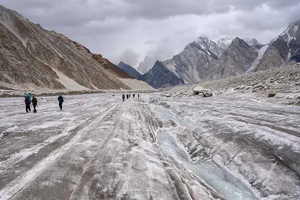
Half an hour from Paiju you reach the snout of the Baltoro Glacier, which is about 63 km long. From here the trail runs over moraine, the rubble of rock that covers the ice. Day 8 to Khoburtse is 14.7 km and the biggest single gain of the walk-in, +400 m, with lunch at Liligo facing the Trango Towers. Day 9 to Urdukas is only 6.2 km but takes 4–5 hours over rough glacier. Urdukas (4,000 m) is the last camp on solid ground, on a grassy slope with views of the Trango group, Uli Biaho and the Cathedrals.
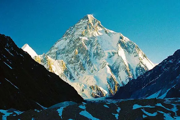
Day 10 is 12.2 km up the middle of the glacier, with Masherbrum on the right and Muztagh Tower on the left. Lunch is at Goro I (about 4,100 m) after 3–4 hours, and the camp is Goro II (4,300 m), a windy, cold site on the ice where the Younghusband Glacier joins. Day 11 is 11.8 km and +391 m to Concordia (4,691 m), where the Baltoro and the Godwin-Austen glaciers meet. K2 comes into full view on this day if the weather is clear. It often snows at Concordia, even in summer.
Days 12–13: K2 Base Camp and back
On day 12 you walk about 3 hours up the Godwin-Austen Glacier to Broad Peak Base Camp, stop for lunch, then walk about 2 more hours to K2 Base Camp (5,150 m). The Gilkey Memorial, with plaques for climbers who died in the Karakoram, is a 10–15 minute walk above it. You then walk about 5 km back down and sleep at Broad Peak Base Camp (4,850 m). In all, the day is about 16.8 km. Day 13 is an easy 7 km, about 3 hours, back to Concordia, with a free afternoon. These two days are also your last acclimatisation step: you have stood at 5,150 m and slept at 4,850 m before going up to Ali Camp.
Day 14: Concordia to Ali Camp
From Concordia the route turns south-east along the upper Baltoro, past Mitre Peak, to the Vigne Glacier. The Vigne is a white glacier with less rubble than the Baltoro and is easier underfoot, but it has small crevasses. Stay close to the guide and the crew, and use crampons if there is fresh snow. The stage is 12 km and 5–6 hours, and Ali Camp (4,950 m) is the highest night of the trek. We eat early and go to bed early, because the crossing starts in the night.
Day 15: over the Gondogoro La
About 8 km and 9–12 hours from Ali Camp over the pass (5,585 m) to Khuspang (4,680 m): see the pass day section below.
Days 16–17: down the Hushe valley
After the pass, day 16 drops 1,330 m in 18 km. You walk about an hour down the Gondogoro Glacier to Dalchangpa, with Masherbrum in view, and stop for lunch there. The trail then crosses the Gondogoro pastures to Saicho (3,350 m), the first camp with trees and warmth since Paiju; you can wash and take a shower. The long descent is hard on the knees, so trekking poles help. Day 17 is an easy 7 km down the valley to Hushe (3,150 m), the last village of the Hushe valley, in Ghanche District, where you meet fields, children and the first shops in two weeks.
Days 18–21: back to Islamabad
On day 18 the jeeps drive about 5 hours from Hushe past Khaplu and along the Shyok and Indus rivers to Skardu. On day 19 you fly to Islamabad, or drive on the Karakoram Highway if the flight is cancelled. Day 20 is a spare day in Islamabad for delays, and day 21 is the transfer to the airport.
Why a short day can take five hours
On the Baltoro you cover about 1.5–3 km an hour, not the 4–5 km an hour of a normal path. The trek averages about 13 km a day over 12 walking days, but kilometres alone tell you little about how hard a day is.
- Moraine: the glacier is covered with loose rock, and the trail climbs in and out of troughs between ice ridges. Day 9 to Urdukas is 6.2 km in 4–5 hours, about 1.4 km an hour.
- River trail: days 5 and 6 are on firm ground along the Braldu, so 20 km takes 5–8 hours, about 2.5–4 km an hour.
- Altitude: above 4,500 m every step takes more effort. Concordia to K2 Base Camp is a gentle slope, yet it takes 4–6 hours.
- Fixed ropes: on the pass day the steep sections are climbed and descended on fixed ropes, which is why 8 km takes 9–12 hours.
- Stops: the walking times include short breaks but not the lunch stop. Add about an hour for lunch on a long day.
Gondogoro La trek distance: totals and comparisons
The whole walk from Askoli to Hushe is about 155 km: about 97 km to K2 Base Camp and about 57 km from there over the pass. The same trek without the pass, walking back down the Baltoro to Askoli, is about 195 km.
| Trek | Days | On foot | Highest point | Way out |
|---|---|---|---|---|
| K2 Gondogoro La Trek | 21 from Islamabad | about 155 km | Gondogoro La, 5,585 m | Over the pass to Hushe |
| K2 Base Camp Trek | 21 from Islamabad | about 195 km | K2 Base Camp, 5,150 m | Back down the Baltoro to Askoli |
| K2 Base Camp and Gondogoro La Pass Trek | 15 from Skardu, trek only | about 155 km | Gondogoro La, 5,585 m | Over the pass to Hushe |
Both 21-day treks have the same number of days. The pass route saves about 40 km of walking, but it uses the time for the crossing, which is the longest day, and for the extra night at Ali Camp. The distances in the K2 Base Camp Trek column come from our K2 Base Camp Trek itinerary. For the full price of each trek, see K2 trek cost.
How far is it from Skardu?
From Skardu you drive 5–7 hours by jeep to Askoli, then walk about 97 km, 8 days with a rest day, to K2 Base Camp. On the way back from Hushe the drive to Skardu takes about 5 hours. Islamabad to Skardu is a flight of about an hour, or two long days by road on the Karakoram Highway.
Distance from Askoli, camp by camp
Adding up the day plan gives the distance you have walked by each camp. It is useful for knowing how far you are from the road at any point.
| Camp | Day | Height | Km from Askoli | Km to the nearest road |
|---|---|---|---|---|
| Jhola | 5 | 3,200 m | about 20 | about 20, back to Askoli |
| Paiju | 6–7 | 3,400 m | about 40 | about 40, back to Askoli |
| Khoburtse | 8 | 3,800 m | about 55 | about 55, back to Askoli |
| Urdukas | 9 | 4,000 m | about 61 | about 61, back to Askoli |
| Goro II | 10 | 4,300 m | about 74 | about 74, back to Askoli |
| Concordia | 11 | 4,691 m | about 85 | about 85, back to Askoli |
| K2 Base Camp | 12 | 5,150 m | about 97 | about 97, back to Askoli |
| Ali Camp | 14 | 4,950 m | about 121 | about 33 over the pass to Hushe |
| Khuspang | 15 | 4,680 m | about 129 | about 25, on to Hushe |
| Saicho | 16 | 3,350 m | about 147 | about 7, on to Hushe |
| Hushe | 17 | 3,150 m | about 155 | road head |
Ali Camp is the point furthest from any road: about 33 km over the pass, or about 97 km back the way you came. That is why the decision on the pass is made there, and why your guide watches your health closely on the way up.
The pass day: Ali Camp to Khuspang
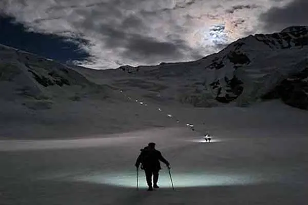
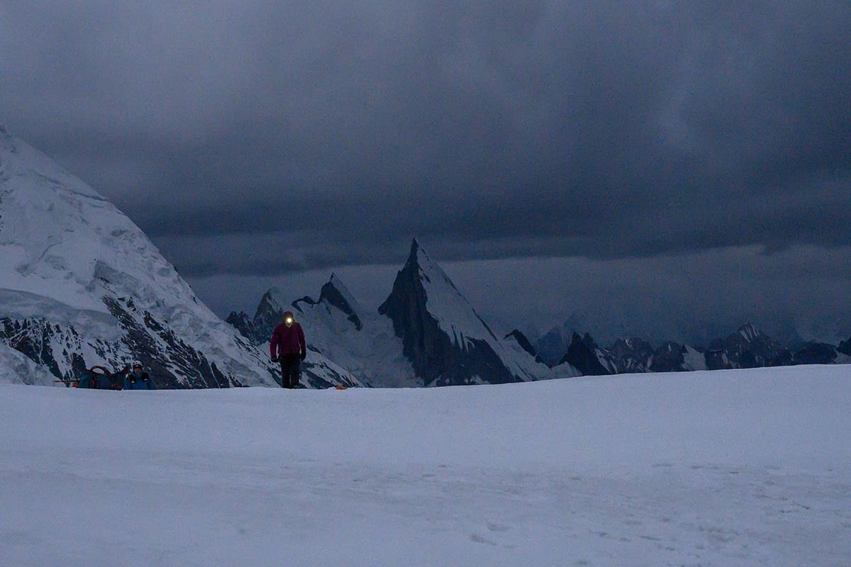
Day 15 is the longest and hardest day of the trek. You leave Ali Camp (4,950 m) in the night, climb 635 m to the top of the Gondogoro La (5,585 m) on fixed ropes, then descend 905 m on a steep, rocky slope to Khuspang (4,680 m). The distance is only about 8 km, but it takes 9–12 hours.
- Why at night: the snow is firm when it is cold, which makes the climb steadier and the fixed ropes easier to use, and there is less falling rock on the descent before the sun warms the slope.
- Fixed ropes: ropes are fixed on the steep sections each season, and you clip in with a harness. They are usually in place from mid to late June.
- Weather: the crossing depends on snow and weather, so the itinerary has a spare day at the end.
- The view: from the top, on a clear morning, you can see K2, Broad Peak and the Gasherbrums.
- More on how hard it is: Gondogoro La difficulty. When to go: Best time for the Gondogoro La.
The pass day in numbers
| Section | Distance | Time | Height |
|---|---|---|---|
| Ali Camp → top of the Gondogoro La | about 3 km | about 3 hours on fixed ropes | 4,950 → 5,585 m (+635 m) |
| Top of the pass → Khuspang | about 5 km | the rest of the day | 5,585 → 4,680 m (−905 m) |
| Whole day | about 8 km | 9–12 hours | highest point 5,585 m |
The split of the 8 km between the climb and the descent is approximate; the hours and heights come from our day plan. What the climb and the descent are like, the gear you need and who the crossing suits are covered in Gondogoro La difficulty.
If the pass cannot be crossed
The crossing always depends on snow and weather, and our guide decides at Ali Camp. If conditions on the pass are too risky, we do not cross: the group walks back down the Baltoro to Askoli instead, as on the K2 Base Camp Trek. From Ali Camp that is about 97 km (12 km back to Concordia and about 85 km down the Baltoro) instead of about 33 km over the pass to Hushe: about 64 km more, and about 6 walking days instead of 3, so the trip may run past the spare day in Islamabad.
Heights of every camp and the pass
These are the heights we use on all our pages. Each was checked against the SRTM and Copernicus elevation maps.
| Place | Height | Note |
|---|---|---|
| Askoli | 3,000 m (9,843 ft) | Last village; the walk starts |
| Jhola | 3,200 m (10,499 ft) | First camp |
| Paiju | 3,400 m (11,155 ft) | Rest and acclimatisation day |
| Khoburtse | 3,800 m (12,467 ft) | Camp at the edge of the glacier |
| Urdukas | 4,000 m (13,123 ft) | Last camp on solid ground |
| Goro I | 4,100 m (13,451 ft) | Lunch stop on day 10 |
| Goro II | 4,300 m (14,108 ft) | Camp in the middle of the glacier |
| Concordia | 4,691 m (15,390 ft) | Meeting of the Baltoro and Godwin-Austen glaciers |
| Broad Peak Base Camp | 4,850 m (15,912 ft) | Night of day 12 |
| K2 Base Camp | 5,150 m (16,896 ft) | Visited on day 12 |
| Ali Camp | 4,950 m (16,240 ft) | Highest camp, below the pass |
| Gondogoro La | 5,585 m (18,323 ft) | The pass, highest point of the trek |
| Khuspang | 4,680 m (15,354 ft) | First camp after the pass |
| Saicho | 3,350 m (10,991 ft) | Camp in the Hushe valley |
| Hushe | 3,150 m (10,335 ft) | Village where the walk ends |

Why other sources give different heights
You will find other figures for the same camps, sometimes 100–200 m apart. There are four reasons. Camps on a glacier move as the ice flows and melts, by tens of metres a year. Old figures were often round numbers in feet: older lists give Hushe as about 3,050 m (10,000 ft), while modern elevation maps put the village at about 3,150 m. Many lists are copied from one another, so one early mistake spreads. And phone or watch GPS heights can be 20–50 m out. Our figures are rounded to the nearest 50 m for glacier camps, except settled points such as Concordia (4,691 m) and the pass.
Altitude profile: height gain and loss
From Askoli to Hushe you climb about 3,040 m and descend about 2,890 m, counting the height from camp to camp. The real figures are higher, because the trail on the glacier goes up and down all day, but these numbers show the shape of the trek.
| Section | Days | Up | Down |
|---|---|---|---|
| Askoli to Concordia | 5–11 | +1,691 m | small losses on the moraine |
| Concordia to K2 Base Camp and back | 12–13 | +459 m | −459 m |
| Concordia to Ali Camp | 14 | +259 m | – |
| Ali Camp over the pass to Khuspang | 15 | +635 m | −905 m |
| Khuspang to Hushe | 16–17 | – | −1,530 m |
| Total | 5–17 | about +3,040 m | about −2,890 m |
Two things stand out. The way up is gradual: no night on the walk-in is more than 400 m higher than the night before. The way down is steep: in three days you lose 2,435 m, from the top of the pass to Hushe. Plan your training for both, with long uphill walks and long downhill walks under a light pack.
Nights at altitude
- Nights at 3,000 m or higher: 14, from Askoli on day 4 to Hushe on day 17.
- Nights at 4,000 m or higher: 7 (Urdukas, Goro II, Concordia twice, Broad Peak Base Camp, Ali Camp and Khuspang).
- Nights above 4,600 m: 5, from day 11 to day 15.
- Highest night: Ali Camp, 4,950 m. Highest point: the Gondogoro La, 5,585 m, for less than an hour.
Acclimatisation before the pass
The itinerary follows the usual medical rule for altitude: above 3,000 m, sleep no more than about 500 m higher each night, with a rest day every three to four days. The largest jump in sleeping height on this trek is 400 m, from Paiju to Khoburtse.
- By the time you reach the pass you have spent 11 nights at 3,000 m or higher, 10 days on the trail, and you have already been to K2 Base Camp (5,150 m).
- Rest days in Skardu (day 3) and at Paiju (day 7) help your body adjust.
- Ali Camp (4,950 m) is the highest night of the trek. Drink plenty of water and tell your guide about any headache, dizziness or nausea.
- The treatment for serious altitude sickness is to go down. On this route the fastest way down from Ali Camp is back to Concordia, not over the pass.
- Training and preparation: K2 Base Camp Trek guide.
The mountains you see on each stage
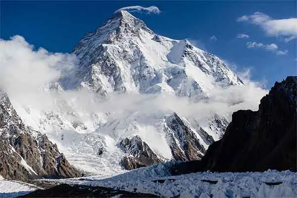
From the top of the Gondogoro La, on a clear dawn, you can see four 8,000 m peaks: K2 (8,611 m), Broad Peak (8,051 m), Gasherbrum I (8,080 m) and Gasherbrum II (8,035 m). The walk up the Baltoro passes dozens more.
| Stage | Main peaks in view |
|---|---|
| Paiju and the lower Baltoro (days 6–8) | Paiju Peak, the Trango Towers, Uli Biaho, the Cathedrals |
| Urdukas to Goro II (days 9–10) | Masherbrum (7,821 m), Muztagh Tower, Gasherbrum IV, first views of Broad Peak |
| Concordia (days 11, 13) | K2, Broad Peak, Gasherbrum IV, Mitre Peak, Marble Peak, Chogolisa (7,665 m), Baltoro Kangri |
| K2 and Broad Peak Base Camps (day 12) | K2 and Broad Peak close above you |
| Gondogoro La (day 15) | K2, Broad Peak, Gasherbrum I and II behind; Laila Peak (6,096 m) ahead |
| Khuspang to Saicho (days 15–16) | Laila Peak, Masherbrum from its south side |
If you want to go higher than the pass, the Hushe side is the base for several trekking peaks: see the Laila Peak Expedition and our list of trekking peaks in Pakistan.
A short history of the route
The Baltoro was first surveyed by Europeans in 1861, but the trekking route from Concordia over the Gondogoro La to Hushe was only established in 1986. The names on the map record that history.
- 1835–1838: the British traveller Godfrey Vigne (1801–1863) explored Kashmir and Baltistan. The Vigne Glacier, which leads to the pass, was later named after him by the mountaineer Martin Conway.
- 1861: Henry Haversham Godwin-Austen, a surveyor of the Great Trigonometrical Survey, reached the Baltoro Glacier and mapped its upper part. The glacier that leads to K2 Base Camp carries his name.
- Concordia: early explorers named the glacier junction after the Konkordiaplatz, a meeting of glaciers in the Bernese Alps of Switzerland.
- 1960: Masherbrum (7,821 m), above the Hushe valley, was first climbed by an American–Pakistani expedition. Hushe became the base for climbs in the area.
- 1986: a route was established linking Concordia with the Hushe valley over the Gondogoro La. It soon became the classic way to finish a K2 trek.
- 1993: the Central Karakoram National Park was declared. It covers about 10,500 km², including the Baltoro and the Gondogoro La, and its fee is included in our trek price.
More on the people and villages at each end: Askoli valley and Hushe valley.
Common planning mistakes
Most problems on this trek come from reading the numbers too literally. These are common planning mistakes.
- Judging a day by its kilometres. The 6.2 km to Urdukas and the 8 km pass day are among the slowest stages. Plan by hours and height, not distance.
- Training only for the climb. The 2,435 m of descent from the pass to Hushe in three days is what tires most legs. Train with long downhill walks.
- Booking the flight home too tight. Skardu flights depend on the weather. Our itinerary has a spare day in Islamabad on day 20; do not book an onward flight before day 21.
- Arriving without crampon practice. The pass is crossed in crampons on fixed ropes; see Gondogoro La difficulty for how to prepare.
- Packing too much. A porter carries up to 16 kg of your personal luggage, with extra at USD 12 per kg. Carry only a day pack with water, layers and snacks yourself.
- Expecting a phone signal. There is no internet after Askoli. Concordia has a solar-powered signal tower that works only some of the time. Our guide carries a satellite phone for emergencies.
What our team does on the trek
On our fixed departures a group of 4 to 12 trekkers walks with a licensed local guide, cooks and a porter team from Askoli to Hushe. Here is what that means day to day.
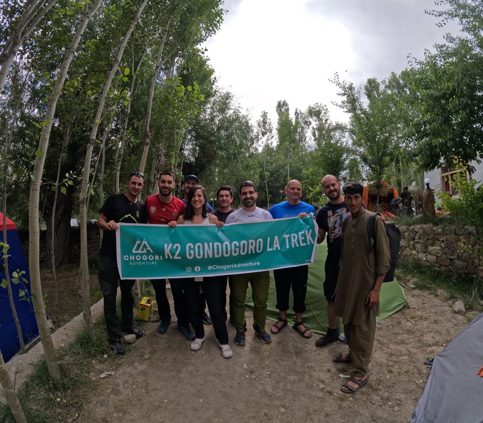
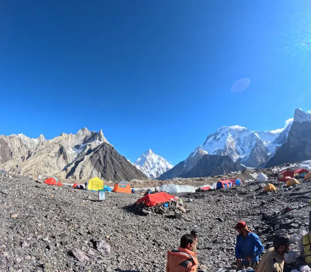
A Chogori K2 Gondogoro La Trek group at camp in Askole
- You sleep in twin-sharing tents, with a mess tent and toilet tents. A woman travelling alone gets a separate tent.
- Our cooks prepare all meals on the trek, and you get boiled water, snacks, biscuits and dried fruit every day.
- Your guide checks on you every day. Tell the guide at once about any headache, dizziness or nausea.
- On the pass day our guide and crew cross with the local rescue team who look after the fixed ropes on the pass. The guide decides on the day whether to cross.
- Our guides are local, government-licensed and English-speaking, and most of them are trained in first aid. A basic first aid kit and a satellite phone go with every group.
Fixed departures run from June to early October and cost USD 2,300 per person from Islamabad, with the trekking permit and park fees included. The crossing is most reliable from the end of June to the end of August. Dates and details are on the K2 Gondogoro La Trek page. For practical advice on visas, permits and travel in the country, read Before you trek in Pakistan.
Other treks over the Gondogoro La
The map and table above are for the 21-day K2 Gondogoro La Trek from Islamabad. The same route over the pass is also part of the 15-day K2 Base Camp and Gondogoro La Pass Trek from Skardu and the Karakoram K2 Trek. On the trek-only version you arrive in Skardu two days before the start date with your original passport, which is needed for the permit in this restricted zone. Hushe, where the walk ends, is worth a visit in its own right: Hushe Valley. If you only want to see the Hushe side, the Laila Peak Base Camp Trek goes up the same valley to Khuspang without crossing the pass.
Frequently asked questions
How high is the Gondogoro La?
The Gondogoro La is 5,585 m (18,323 ft) high. It is the highest point of the K2 Gondogoro La Trek, 435 m higher than K2 Base Camp (about 5,150 m) and 635 m above Ali Camp, where you sleep the night before. Two separate elevation maps read 5,588 m and 5,576 m at the pass.
How long is the K2 Gondogoro La Trek?
About 155 km on foot, from Askoli up the Baltoro Glacier to K2 Base Camp and over the Gondogoro La to Hushe. Our trek takes 21 days from Islamabad, with 13 days on the trail: 12 walking days and a rest day at Paiju. Most days are 4 to 8 hours of walking.
How long does it take to cross the Gondogoro La?
The pass day, from Ali Camp over the Gondogoro La to Khuspang, is about 8 km and takes 9–12 hours: 635 m up on fixed ropes and 905 m down. You start around midnight, reach the top at about dawn after roughly 3 hours of climbing, and are in camp by late morning or afternoon.
How far is Ali Camp from Concordia?
About 12 km, 5–6 hours on foot, and 259 m higher. The route follows the upper Baltoro past Mitre Peak onto the Vigne Glacier, which has small crevasses, so you stay close to the crew. Ali Camp, at 4,950 m, is the last camp before the pass and the highest night of the trek.
Is the Gondogoro La route shorter than going back the same way?
Yes. From K2 Base Camp to Hushe over the pass is about 57 km, while walking back down the Baltoro to Askoli is about 97 km. The whole trek is about 155 km instead of about 195 km. But the pass day is much harder and needs fixed ropes, a harness, crampons and good weather.
When can you cross the Gondogoro La?
The best time to cross is from the end of June to the end of August; from mid-June to the end of September the crossing is still feasible. Our fixed departures run from June to early October. The fixed ropes on the pass are usually in place from mid to late June, and the crossing always depends on snow and weather.
Where does the Gondogoro La Trek end?
In Hushe (3,150 m), the last village of the Hushe valley in Ghanche District. You reach it on day 17 after an easy 7 km walk from Saicho. On day 18 a jeep takes you about 5 hours back to Skardu, and on day 19 you fly to Islamabad.
Is there a map of the Gondogoro La Trek?
Yes, the route map on this page shows every camp, its height and the days you sleep there, from Islamabad over the Gondogoro La to Hushe, with a chart of your sleeping height each night. It is a schematic, not to scale. The same map is on our K2 Gondogoro La Trek page.
How much height do you gain on the Gondogoro La trek?
Counting from camp to camp, you climb about 3,040 m and descend about 2,890 m between Askoli (3,000 m) and Hushe (3,150 m). The real totals are higher because the glacier trail goes up and down. The biggest single climb is 635 m on the pass day, and the biggest descent is 1,330 m from Khuspang to Saicho.
What is the hardest day of the Gondogoro La trek?
Day 15, the crossing. It starts around midnight at 4,950 m, climbs 635 m on fixed ropes to 5,585 m and drops 905 m down a slope of about 50 degrees to Khuspang, in 9–12 hours. For more on the difficulty and who the trek suits, see our Gondogoro La difficulty guide.
How far is it from Skardu to K2 Base Camp?
From Skardu you drive 5–7 hours by jeep to Askoli, then walk about 97 km to K2 Base Camp. On our itinerary that walk takes 8 days, including a rest day at Paiju, with the first sight of K2 on the way to Concordia. There is no road beyond Askoli.
How far is Concordia from K2 Base Camp?
About 11.8 km, 4–6 hours on foot up the Godwin-Austen Glacier, with a lunch stop at Broad Peak Base Camp after about 3 hours. K2 Base Camp is 459 m higher than Concordia (4,691 m). On our trek you sleep at Broad Peak Base Camp, about 5 km below, and return to Concordia the next day.
Plan your trek
- K2 Gondogoro La Trek: dates, itinerary and price
- Gondogoro La difficulty
- Best time for the Gondogoro La
- K2 Base Camp height, distance and map
- K2 Base Camp Trek guide: difficulty, best time, weather and preparation
- Baltoro Glacier trekking tips
- All our K2 treks, prices and guides in one place: the K2 hub
About the author
Imtiyaz Ahmed Shigri founded Chogori Adventure in Skardu in 2015. Our guides are local, government-licensed and English-speaking, and most of them are trained in first aid. We are licensed by the Department of Tourist Services (licence no. 2494) and the Gilgit-Baltistan tourism department (licence DTS-GB-055), and we are a member of the Pakistan Association of Tour Operators, with offices in Skardu and Islamabad.
Rated 4.9 out of 5 from 47 reviews on Google (November 2026). Read our reviews on Google