Hunza Valley, Pakistan: Where It Is and How to Visit
By Imtiyaz Ahmed Shigri, founder of Chogori Adventure, Skardu · Updated November 2026
Hunza Valley is a mountain valley on the Hunza River in Gilgit-Baltistan, the far north of Pakistan. Its main town, Karimabad (about 2,450 m), lies on the Karakoram Highway about 100 km north of Gilgit, and the valley runs north to the Khunjerab Pass (4,693 m) on the border with China. Hunza is known for the view of Rakaposhi (7,788 m), the old forts of Baltit and Altit, Attabad Lake, the Passu Cones and its apricot orchards. This guide explains where Hunza is, how to get there, what the weather is like each month, who lives there and when to go.
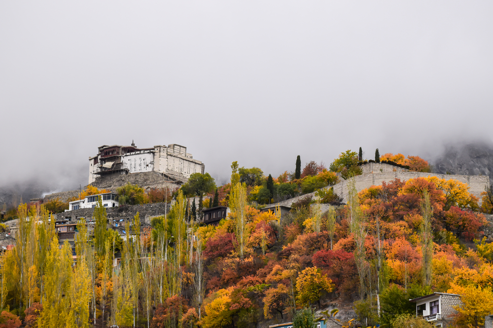
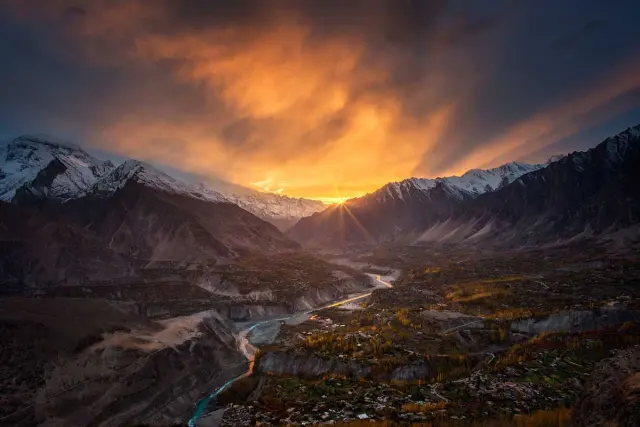
Hunza Valley, with Karimabad on the slopes above the Hunza River.
Hunza Valley at a glance
| Fact | |
|---|---|
| Where | Gilgit-Baltistan, northern Pakistan |
| District | Hunza District (created in 2015); headquarters Karimabad, also called Baltit |
| Main town and height | Karimabad, about 2,450 m (Baltit Fort 2,448 m) |
| River | Hunza River, flowing south into the Gilgit River and then the Indus |
| Road | Karakoram Highway (KKH), from Islamabad to the Chinese border |
| Border | China at the Khunjerab Pass (4,693 m); Afghanistan's Wakhan Corridor beyond the Chapursan valley |
| Nearest airport | Gilgit, about 2 to 2.5 hours by road |
| From Islamabad by road | About two days, usually with a night in Chilas |
| Languages | Burushaski, Wakhi, Shina; Urdu widely understood |
| Best months | April, May to June, September to early November |
Where is Hunza Valley?
Hunza lies in the Karakoram mountains of Gilgit-Baltistan, the northernmost region of Pakistan. The valley follows the Hunza River for more than 150 km, from its source streams near the Chinese border down to the point near Gilgit where it joins the Gilgit River. The Karakoram Highway runs the whole length of the valley.
Travellers usually divide it into three parts:
- Lower Hunza, between Gilgit and Karimabad, with villages such as Aliabad and the Rakaposhi viewpoint.
- Central Hunza, around Karimabad, Altit and Ganish, with the old forts and the best-known views.
- Upper Hunza (Gojal), north of Attabad Lake: Gulmit, Hussaini, Passu, Sost and the side valleys of Shimshal and Chapursan. Gojal borders China at the Khunjerab Pass and Afghanistan beyond the Chapursan valley.
Across the river from Karimabad lies Nagar, a separate district with its own valleys (Hopar, Minapin). Rakaposhi stands on the Nagar side. Many people use "Hunza" for both sides, and the older name for the whole area is Hunza-Nagar.
A short history of Hunza
For centuries Hunza was a small mountain kingdom, also known as Kanjut, ruled by its own Mirs. The first seat of the rulers was Altit Fort; they later moved to Baltit Fort above today's Karimabad. The valley lay on a branch of the old Silk Road between Kashgar and Kashmir, and Ganish, below Karimabad, is the oldest settlement on that route in Hunza.

Baltit Fort in Karimabad, Hunza
In 1891, after the Anglo-Burusho War, Hunza became a princely state under British India, while keeping its own ruler. Until the early 20th century it also sent tribute to Qing China. After the partition of 1947, Hunza joined Pakistan in November 1947. It remained a princely state, with the Mir as ruler, until 1974, when it became the last princely state in Pakistan to be abolished. In 2015 Hunza became a separate district, with its headquarters at Karimabad.
The biggest change of the last century came with the Karakoram Highway, built between 1959 and 1979 and opened to the public in 1986. It brought road travel, trade and tourism to a valley that had been reached only on foot or by horse. In January 2010 a huge landslide at Attabad blocked the Hunza River and created Attabad Lake; the highway now passes the lake through a series of tunnels.
How to get to Hunza
By road from Islamabad
The classic route is the Karakoram Highway along the Indus. It is a long drive, so most trips take two days, with a night in Chilas, and reach Karimabad on the second afternoon. In summer, when the Babusar Pass (4,173 m) is open, the road through the Kaghan Valley and Naran is a scenic alternative. Our Hunza Tour follows this route and comes back the same way.
By air to Gilgit
Hunza has no airport. The nearest is Gilgit, with flights from Islamabad of about one hour. Flights depend on clear weather and are often delayed or cancelled, so allow a spare day. From Gilgit it is about 2 to 2.5 hours by road to Karimabad.
From Skardu
From Skardu the road follows the Indus west to the Karakoram Highway and then north to Hunza, about 7 to 8 hours. This is how our Skardu Hunza Tour links Baltistan and Hunza. For distances, road conditions and transport options, see our Skardu to Hunza travel guide.
From Fairy Meadows
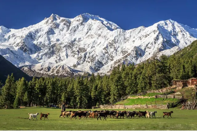
Hunza also combines well with Fairy Meadows and the view of Nanga Parbat: after the walk down to Raikot Bridge it is about 4 hours north on the Karakoram Highway to Karimabad. See our Fairy Meadows and Hunza Trip and Karakoram Highway Tour.
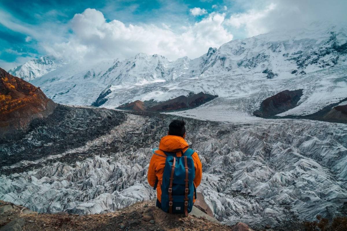
A trekker above the glacier below Rakaposhi (7,788 m).
Hunza weather by month
Hunza has a dry mountain climate: warm, sunny summer days, cool nights, and cold winters with snow on the mountains. There is no weather station in Karimabad with long-term published records, so the table below gives the official averages for Gilgit (Pakistan Meteorological Department, about 1,500 m) and an approximate figure for Karimabad. Karimabad is about 950 m higher, so it is usually around 6 °C cooler, day and night.
| Month | Gilgit average high / low | Karimabad (approximate) | What to expect |
|---|---|---|---|
| Jan | 10 / -3 °C | about 4 / -9 °C | Cold, snow on the peaks |
| Feb | 13 / 0 °C | about 7 / -6 °C | Cold |
| Mar | 18 / 5 °C | about 12 / -1 °C | Cool; blossom starts at the end of the month |
| Apr | 24 / 9 °C | about 18 / 3 °C | Apricot and cherry blossom |
| May | 29 / 12 °C | about 23 / 6 °C | Mild, green fields |
| Jun | 34 / 15 °C | about 28 / 9 °C | Warm days; Ginani harvest festival (21 June) |
| Jul | 36 / 18 °C | about 30 / 12 °C | Warm; best for higher walks |
| Aug | 35 / 18 °C | about 29 / 12 °C | Warm; occasional rain |
| Sep | 32 / 12 °C | about 26 / 6 °C | Clear and pleasant |
| Oct | 26 / 6 °C | about 20 / 0 °C | Autumn colours begin |
| Nov | 18 / 0 °C | about 12 / -6 °C | Golden poplars early in the month, then cold |
| Dec | 12 / -2 °C | about 6 / -8 °C | Cold, short days |
Weather in the mountains can change quickly. Even in summer, bring a warm layer for the evenings and for viewpoints such as the Eagle's Nest (about 2,800 m).
Best time to visit Hunza
- April: apricot and cherry blossom across the valley, usually from late March in the lower villages to mid-April higher up. Nights are still cold.
- May to June: green fields, mild days and long evenings. On 21 June villages celebrate Ginani, the traditional harvest festival.
- July to August: the warmest months in the valley and the best time for treks to higher meadows and base camps. Rain is more likely, and landslides can close the road for a few hours or more.
- September to early November: clear skies and settled weather, then the poplars and orchards turn gold, usually from mid-October to early November.
- Winter (December to February): quiet and very cold, with snow. Some hotels close, and the Khunjerab Pass border crossing is closed.
Our group dates for Hunza follow these seasons. The Hunza Tour and the Fairy Meadows and Hunza Trip run in spring, summer and autumn.
People, languages and culture
Hunza was a small princely state, ruled for centuries by its Mirs from the forts of Altit and later Baltit, until 1974. Today most people are Ismaili Muslims. Education is valued highly, and literacy, including among women, is high compared with many rural areas of Pakistan.
Who lives in Hunza?
The Burusho people live mainly in Central and Lower Hunza and in Nagar. The Wakhi people live in Upper Hunza (Gojal), close to the Pamir and the Wakhan Corridor, with whom they share their language and much of their way of life. There are also Shina-speaking villages in the lower valley.
Languages
- Burushaski is a language isolate: it has no proven relationship to any other language in the world. It is spoken in Hunza, Nagar, Yasin and parts of Ishkoman.
- Wakhi, an Eastern Iranian language, is spoken in Gojal.
- Shina is spoken in some villages of Lower Hunza.
- Urdu, the national language, is understood almost everywhere, and many people working in tourism speak good English.
Food and festivals
Hunza is known for apricots: fresh in summer, dried for winter and pressed for oil. Walnuts, mulberries and cherries are grown on the terraced fields. Local dishes include chapshoro, a meat-filled bread, and soups made with home-made noodles. The two best-known festivals are Navroz (the spring new year, around 21 March) and Ginani, the harvest festival on 21 June.

A traditional house in Karimabad.
River, peaks and glaciers
The Hunza River is formed in Upper Hunza where the Chapursan and Khunjerab streams meet. It is fed by glaciers and flows south past Sost, Passu, Gulmit and Karimabad, then joins the Gilgit River near Gilgit; the Gilgit River flows on into the Indus.
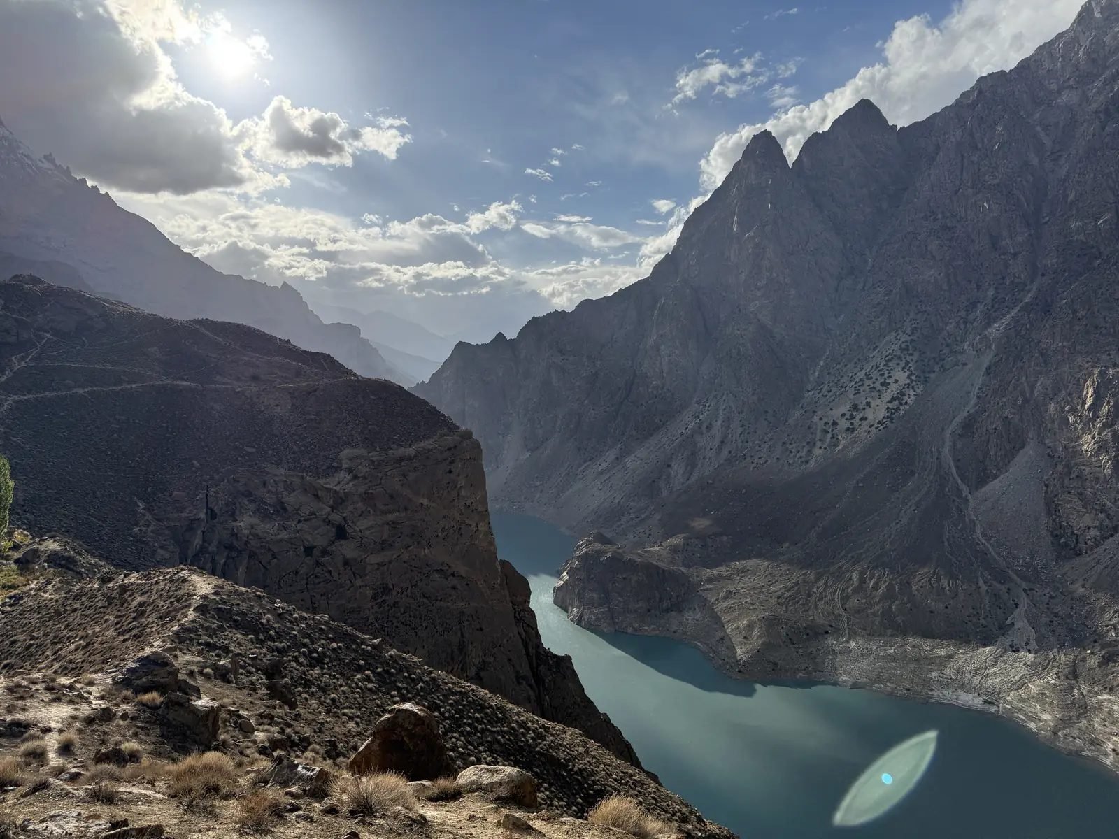
Attabad Lake in its gorge, Upper Hunza
Main peaks seen from Hunza
| Peak | Height | Where |
|---|---|---|
| Batura Sar | 7,795 m | Batura Muztagh above Passu; the 25th-highest mountain on Earth |
| Rakaposhi | 7,788 m | Nagar side, facing Karimabad; rises almost 6,000 m from its base |
| Shispare | 7,611 m | Above the Hopar and Passu glaciers |
| Passu Sar | 7,478 m | Above Passu village |
| Ultar Sar | 7,388 m | Directly above Karimabad |
| Ladyfinger (Bublimotin) | about 6,000 m | The rock needle next to Ultar Sar, seen from Karimabad |
| Passu Cones (Tupopdan) | about 6,100 m | The jagged "cathedral" peaks above Passu |
Glaciers and lakes
- Batura Glacier, about 57 km long, is one of the longest glaciers outside the polar regions. It reaches the Karakoram Highway near Passu.
- Passu Glacier comes down close to Passu village and can be seen from the highway; a short walk leads to its edge.
- Attabad Lake formed in January 2010, when a huge landslide blocked the Hunza River. Its blue water is now one of the most visited sights in Hunza; the highway passes it through a series of tunnels.

Morning mist over the peaks near Karimabad.
What Hunza is known for
These are the sights most visitors come for. Each one is described in more detail in our guide to the 10 best places to visit in Hunza.
- Baltit Fort, the old palace of the Mirs above Karimabad, on UNESCO's tentative World Heritage list since 2004.
- Altit Fort, about 1,100 years old and the oldest monument in Gilgit-Baltistan; its restoration won a UNESCO Asia-Pacific Heritage Award in 2011.
- The Eagle's Nest viewpoint above Duikar (about 2,800 m), for sunrise or sunset over Rakaposhi, Ultar Sar and Ladyfinger.
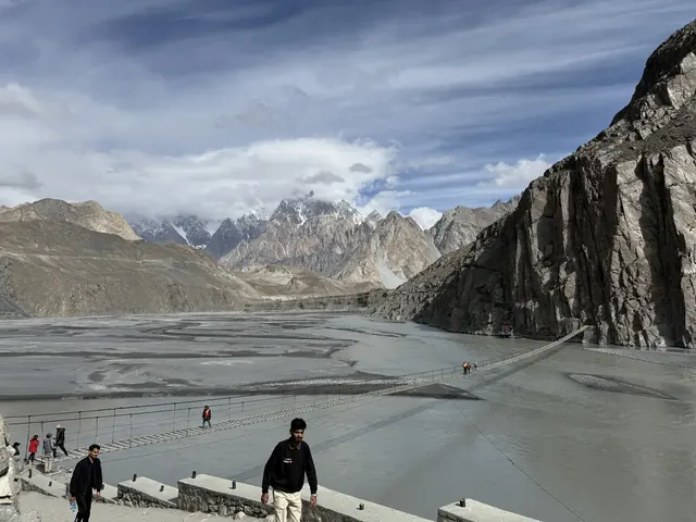
- Attabad Lake, the Hussaini suspension bridge and the Passu Cones in Upper Hunza.
- The Khunjerab Pass (4,693 m) on the border with China, at the top of the Karakoram Highway.
- Ganish, one of the oldest settlements in the valley, with its old watchtowers and carved mosques.
Villages and areas of Hunza
Hunza is not one town but a chain of villages along the river. These are the ones most visitors see, from south to north:
- Aliabad, the administrative and commercial centre of the district, on the Karakoram Highway: banks, shops, petrol and the hospital.
- Karimabad (Baltit), the main town for visitors, on the slope below Baltit Fort, with its bazaar, cafés and handicraft shops.
- Altit, the old village around Altit Fort, with the royal garden and narrow lanes above the river.
- Ganish, at least 1,000 years old and the first settlement on the Silk Road in Hunza, with watchtowers, carved wooden mosques and an old water reservoir; it won a UNESCO Asia-Pacific Heritage Award in 2003.
- Duikar, high above Altit, home of the Eagle's Nest viewpoint (about 2,800 m).
- Gulmit, the old centre of Upper Hunza (Gojal), a Wakhi town with traditional houses, a small museum and a polo ground.
- Hussaini, known for its long pedestrian suspension bridge over the Hunza River.
- Passu, below the Passu Cones (Tupopdan, 6,106 m) and next to the Passu and Batura glaciers.
- Sost, the last town before China, with the customs and immigration post for the Khunjerab border.
- Shimshal, a remote valley east of Passu; Shimshal village, at about 3,113 m, is the highest settlement in the district.
- Chapursan, a long Wakhi valley in the far north-west, close to the Afghan border.

Baltit Fort above Karimabad.
Trekking in and near Hunza
Hunza and Nagar are surrounded by some of the best short and medium treks in the Karakoram. These are the ones we run:
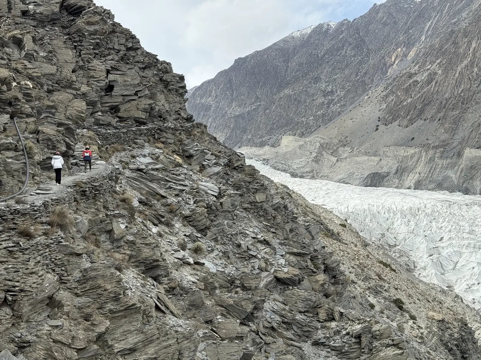
The trail above the Passu glacier
- Rush Lake (about 4,694 m) above the Hopar valley in Nagar, with views of Spantik and the Hispar peaks: our Rush Lake Trek.
- Rakaposhi Base Camp from Minapin, through forest and meadows below the north face of Rakaposhi: our Rakaposhi and Nanga Parbat Base Camp Trek.
- Passu Glacier and the suspension bridges in Upper Hunza, as part of our Gilgit-Baltistan Trekking Adventure.
If you prefer not to trek, the Hunza Tour and the Karakoram Highway Tour show the valley by road, with short walks to the forts and viewpoints.
Where to stay in Hunza
Most visitors stay in Karimabad: Baltit Fort, the bazaar and many cafés are within walking distance, and the views of Rakaposhi and Ultar Sar are among the best in the valley. Aliabad, on the main road a few kilometres south, is busier but practical, with banks and shops. In Upper Hunza, Gulmit and Passu are quieter bases for walks to the glaciers and the Hussaini bridge.
There is a wide choice, from family-run guesthouses to larger hotels. In the blossom season (April) and in October, popular places fill up early, so book ahead. On our tours we use comfortable hotels in Karimabad with views over the valley.
Hunza in winter
From December to February Hunza is quiet and cold, with snow on the mountains and often in the villages. Many visitors from Pakistan come for the snow and for winter events on the frozen parts of Attabad Lake and the high valleys. Days are short, some hotels and cafés close, and the Khunjerab Pass border crossing is closed. If you visit in winter, bring proper winter clothing and allow extra time on the roads.
Best viewpoints and photography tips
- Eagle's Nest (Duikar, about 2,800 m): the classic spot for sunrise or sunset over Rakaposhi, Ultar Sar, Ladyfinger and the whole valley.
- Baltit Fort and Karimabad: the best light on the fort is in the morning; the terraces and poplars below it make a good frame.
- Altit Fort from the river side: the fort sits on a cliff about 300 m above the Hunza River.
- Rakaposhi viewpoint at Ghulmet in Nagar, on the drive into Hunza: the whole north face fills the view.
- Attabad Lake from the viewpoints above the tunnels, where the colour of the water is strongest around midday.
- The Passu Cones from the Karakoram Highway near Hussaini and Passu, best in late afternoon light.
Ask before you photograph people, especially women and elders, and ask before flying a drone near homes, fields and the forts.
A 3-day plan for Hunza
Day 1: Karimabad, Baltit and Altit
Start with Baltit Fort in the morning light, then walk down through the old lanes of Karimabad to the bazaar. After lunch, visit Altit Fort and the royal garden, and walk through Altit village. Finish at the Eagle's Nest above Duikar for sunset over Rakaposhi and Ultar Sar.
Day 2: Upper Hunza
Drive north on the Karakoram Highway through the tunnels to Attabad Lake. Continue to Gulmit for the old Wakhi houses, then cross (or just look at) the Hussaini suspension bridge. Have lunch in Passu below the Passu Cones and walk to the edge of the Passu Glacier before driving back to Karimabad.
Day 3: Ganish, the Khunjerab Pass or a short walk
Walk through Ganish, the oldest village in Hunza, with its watchtowers and carved mosques. Then choose: a long day trip to the Khunjerab Pass (4,693 m) on the Chinese border, about 4 hours each way from Karimabad and open roughly from spring to late autumn; or a gentle walk along the old water channels above Karimabad. Our Fairy Meadows and Hunza Trip offers the Khunjerab Pass on request, and our Karakoram Highway Tour includes it.
Getting around Hunza
The Karakoram Highway links every main village, so getting around is easy. A car or jeep with a local driver is the most flexible way to see Upper Hunza and the viewpoints. Shared vans run along the highway between Aliabad, Karimabad and the villages of Gojal. In Karimabad, Altit and Ganish, walking is the best way to explore: the old lanes are narrow and steep, and many sights are only a few minutes apart.
Food to try in Hunza
- Chapshoro: bread filled with minced meat and onion, baked or fried, the best-known Hunza dish.
- Apricots in every form: fresh in July, dried for the winter, in soups and cakes, and pressed for apricot-kernel oil.
- Walnut and apricot cakes, served in the cafés of Karimabad with local tea.
- Soups with home-made noodles and dishes made with buckwheat and local wheat flour.
- Mulberries and cherries in early summer, straight from the orchards.
Hunza food is simple and based on what grows in the valley. Vegetarian meals are easy to find; just ask.
Altitude and health
Karimabad lies at about 2,450 m and Passu at about 2,450 m, heights at which most people feel fine after a day or two. The Khunjerab Pass is much higher, at 4,693 m: many visitors feel short of breath or get a headache there, so walk slowly, drink water, and do not stay long if you feel unwell. If you are coming from sea level, take the first afternoon in Hunza easy, and bring sun cream and sunglasses, because the mountain sun is strong.
How many days do you need in Hunza?
Plan at least three nights in Hunza, plus the travel days to get there. With three nights you can see Karimabad, the Baltit and Altit forts and the Eagle's Nest on one day, and Attabad Lake, Hussaini and Passu on another, with time to spare for weather or a slow morning.
- 4 to 5 days (flying to Gilgit): two or three nights in Hunza, enough for the main sights if flights run on time.
- 7 to 8 days (by road from Islamabad): two days each way on the Karakoram Highway and three nights in Hunza. This is our Hunza Tour.
- 10 days or more: add Fairy Meadows and Nanga Parbat, Skardu, or a short trek such as Rush Lake or Rakaposhi Base Camp.
Practical tips for visiting Hunza
- Dress modestly: long sleeves and long trousers or skirts are respectful everywhere; remove shoes when entering homes and prayer halls.
- Ask before photographing people, especially women and elders.
- Bring warm layers even in summer: evenings at 2,500 m and viewpoints at 2,800 m are cool.
- Carry some cash in Pakistani rupees for small shops, entry tickets and tips in villages.
- Allow spare time on the Karakoram Highway and for flights to Gilgit; mountain weather causes delays.
- Respect privacy: ask before flying a drone near homes, fields and the forts.
Frequently asked questions
Where is Hunza Valley?
In Gilgit-Baltistan, the far north of Pakistan. The valley follows the Hunza River north from near Gilgit towards the Khunjerab Pass on the border with China. Its main town, Karimabad, is about 100 km north of Gilgit on the Karakoram Highway.
Which part of Pakistan is Hunza in?
The northern region of Gilgit-Baltistan. Hunza is one of its districts, with its headquarters at Karimabad (also called Baltit).
Which river flows through Hunza Valley?
The Hunza River. It is formed where the Chapursan and Khunjerab streams meet in Upper Hunza, flows south through the valley and joins the Gilgit River near Gilgit; the Gilgit River then joins the Indus.
How far is Hunza from Gilgit?
Karimabad is about 100 km from Gilgit, around 2 to 2.5 hours by road on the Karakoram Highway.
How far is Hunza from Islamabad?
By road it takes about two days on the Karakoram Highway, usually with a night in Chilas. The faster way is a flight from Islamabad to Gilgit (about 1 hour, weather permitting) and then the drive to Karimabad.
Can you go to Hunza by air?
Not directly: Hunza has no airport. The nearest airport is Gilgit, about 2 to 2.5 hours away by road. Skardu airport is another option, about 7 to 8 hours from Hunza by road.
What is the best month to visit Hunza Valley?
April for the blossom, May to June and September for settled weather, and October to early November for the autumn colours. July and August are warm in the valley and good for higher walks.
Does it snow in Hunza?
Yes. Winter (December to February) is cold, with snow on the mountains and sometimes in Karimabad itself. The Karakoram Highway normally stays open, but the Khunjerab Pass border crossing closes for the winter.
What language is spoken in Hunza?
Mostly Burushaski, a language isolate with no known relatives, and Wakhi in Upper Hunza (Gojal). Shina is spoken in some lower villages. Urdu is widely understood, and many people in tourism speak English.
How high is Hunza Valley?
Karimabad lies at about 2,450 m and Passu at about 2,450 m. Shimshal village, the highest settlement in the district, is at about 3,113 m, and the Khunjerab Pass on the Chinese border is at 4,693 m.
Do I need a permit to visit Hunza?
No special permit is needed to visit Hunza; you only need a Pakistan visa, which you apply for online at visa.nadra.gov.pk.
Is Hunza the same as Nagar?
No. Hunza and Nagar face each other across the Hunza River and were separate kingdoms; today they are separate districts. Karimabad and Altit are in Hunza; Rakaposhi, Minapin and Hopar are on the Nagar side.
When did Hunza become part of Pakistan?
The ruler of Hunza joined Pakistan in November 1947. Hunza kept its own Mir until 1974, when it became the last princely state in Pakistan to be abolished.
What is the Karakoram Highway?
The road that runs about 1,300 km from Hasan Abdal in Punjab to the Khunjerab Pass on the Chinese border. It runs the full length of the Hunza Valley.
What is Attabad Lake?
A lake in Upper Hunza that formed in January 2010, when a landslide at Attabad village blocked the Hunza River. Today visitors come for its blue water and boat rides; the Karakoram Highway passes it through tunnels.
Where should I stay in Hunza?
Karimabad is the most convenient base, close to Baltit Fort and the bazaar. Aliabad has more shops on the main road, and Gulmit or Passu are quieter bases for Upper Hunza.
What is Hunza Valley famous for?
Its view of Rakaposhi (7,788 m) and other high peaks, the old forts of Baltit and Altit, Attabad Lake, the Passu Cones, apricot orchards and blossom, and the warm welcome of its people.
About the author
Imtiyaz Ahmed Shigri founded Chogori Adventure in Skardu in 2015. Our guides are local, government-licensed and English-speaking, and most of them are trained in first aid. We are licensed by the Department of Tourist Services (licence no. 2494) and the Gilgit-Baltistan tourism department (licence DTS-GB-055), and we are a member of the Pakistan Association of Tour Operators, with offices in Skardu and Islamabad.
Rated 4.9 out of 5 from 47 reviews on Google (November 2026). Read our reviews on Google