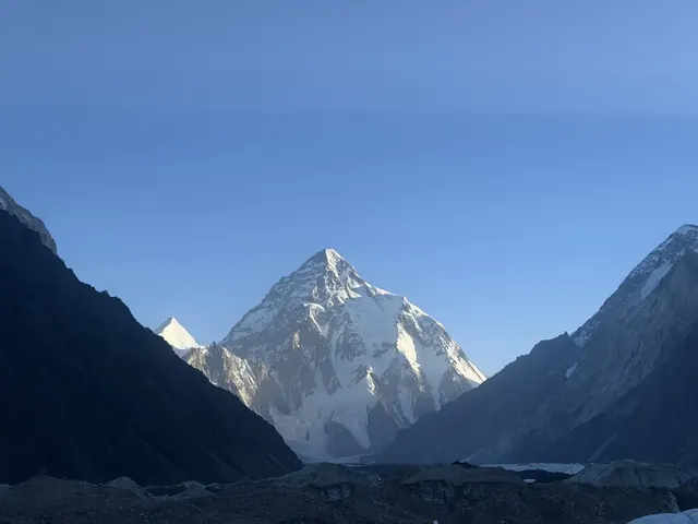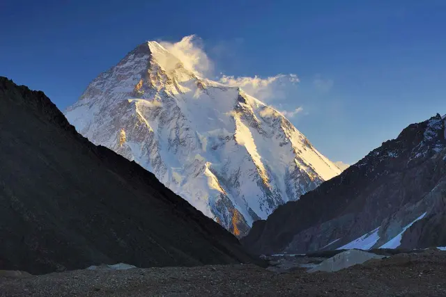
Places to Visit in Hunza: 15 Top Sights and Things to Do
By Imtiyaz Ahmed Shigri, founder of Chogori Adventure, Skardu · Updated November 2026
The best places to visit in Hunza are Karimabad and Baltit Fort, Altit Fort, the Eagle's Nest viewpoint, Attabad Lake, Gulmit, the Hussaini suspension bridge, the Passu Cones and the Khunjerab Pass on the Chinese border. Most lie along the Karakoram Highway within an hour or two of Karimabad, the main town (about 2,450 m). Hunza is one part of Gilgit-Baltistan; our Gilgit-Baltistan travel guide covers the rest of the region. This guide describes 15 places to visit in Hunza and nearby Nagar, how far each one is from Karimabad, how long to spend there, the best time to go and practical tips, with suggested 2-, 3- and 5-day plans.

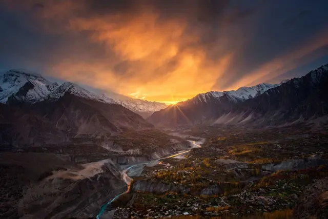
Dawn over Karimabad, the main town of Hunza.
The 15 places at a glance
| Place | Area | From Karimabad | Time needed |
|---|---|---|---|
| 1. Karimabad | Central Hunza | — | half a day |
| 2. Baltit Fort | Karimabad | in town | 1–2 hours |
| 3. Altit Fort | Central Hunza | about 3 km | 1–2 hours |
| 4. Eagle's Nest (Duikar) | Central Hunza | about 7 km | sunrise or sunset |
| 5. Ganish | Central Hunza | a few km | 1 hour |
| 6. Rakaposhi viewpoint | Nagar side, south of Karimabad | on the highway | 30 minutes |
| 7. Nagar and the Hopar Glacier | Nagar | about 1 hour | half a day |
| 8. Attabad Lake | Upper Hunza | about 31 km | 1–3 hours |
| 9. Gulmit | Upper Hunza | about 34 km | 1–2 hours |
| 10. Hussaini suspension bridge | Upper Hunza | about 39 km | 1 hour |
| 11. Passu Cones | Upper Hunza | about 49 km | 1 hour |
| 12. Passu Glacier and Borith Lake | Upper Hunza | about 50 km | half a day |
| 13. Sost | Upper Hunza | about 90 km | stop on the way |
| 14. Khunjerab Pass | Chinese border | about 170 km | full day |
| 15. Shimshal and Chapursan | side valleys | long jeep rides | overnight or more |
Distances are road distances from Karimabad, rounded. For an overview of the valley, its people and weather, see our Hunza Valley guide.
Central Hunza
1. Karimabad
The main town · about 2,450 m
Karimabad, the old Baltit, is the heart of Hunza and the base for most visitors. Its bazaar climbs the slope below Baltit Fort, with handicraft shops, cafés known for walnut and apricot cake, and views across the valley to Rakaposhi. Old stone lanes and water channels run between the houses and orchards.
Walk the lanes early in the morning, when the valley is quiet and the light falls on the peaks.
- Best for: views, cafés, handicrafts
- Tip: wander the old lanes behind the bazaar, and look up at Ultar Sar and Ladyfinger Peak above the town
2. Baltit Fort
In Karimabad · about 2,450 m
Baltit Fort, the old palace of the Mirs of Hunza, stands on the slope above Karimabad. Conservation work found that its core structures date to the 8th century, and its architecture shows Tibetan influence. Restored and now a museum, it has been on UNESCO's tentative World Heritage list since 2004. Guided tours take you through the old rooms, the royal quarters and the roof, with views over the whole valley.
- Time needed: 1–2 hours
- Tip: visit in the morning light, then walk down through the old lanes to the bazaar

Baltit Fort, the old palace of the Mirs of Hunza.
3. Altit Fort
About 3 km from Karimabad
Altit Fort stands on a cliff above the Hunza River. Its Shikari Tower is around 1,100 years old, making it the oldest monument in Gilgit-Baltistan, and it was the first seat of the rulers of Hunza before they moved to Baltit. Its restoration won a UNESCO Asia-Pacific Heritage Award in 2011. The old village of Altit and the royal garden around it are a pleasure to walk through.
- Time needed: 1–2 hours with the village
- Tip: combine it with Baltit Fort on the same morning
4. Eagle's Nest (Duikar)
About 7 km from Karimabad · about 2,800 m
Above the village of Duikar, the Eagle's Nest viewpoint looks over the whole Hunza and Nagar valleys. At sunrise and sunset, the light moves across Rakaposhi (7,788 m), Ultar Sar, Ladyfinger Peak and the Golden Peak. A road climbs from Altit, and there are small hotels and cafés near the top.
- Best time: sunrise or sunset
- Tip: bring a warm layer; it is about 350 m higher than Karimabad and cool even in summer
5. Ganish
Below Karimabad, by the Karakoram Highway
Ganish is at least 1,000 years old and the first settlement on the Silk Road in Hunza. Its old quarter has watchtowers, carved wooden mosques and an old water reservoir, and its conservation won a UNESCO Asia-Pacific Heritage Award in 2003. A short guided walk through the lanes shows how Hunza villages were built and defended.
- Time needed: about 1 hour
- Tip: ask a local guide to explain the carvings and the old defence system

A traditional house in Karimabad.
Lower Hunza and Nagar
6. Rakaposhi viewpoint
On the Karakoram Highway at Ghulmet, south of Karimabad
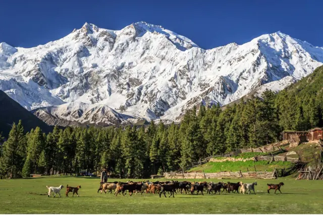
On the way into Hunza from Gilgit, the highway passes the viewpoint at Ghulmet in Nagar, where Rakaposhi (7,788 m) rises almost 6,000 m from the valley floor. It is one of the classic stops on the Karakoram Highway, with small cafés facing the mountain.
- Time needed: 30 minutes
- Tip: stop on the way in or out of Hunza; the morning light is often clearest
7. Nagar and the Hopar Glacier
About an hour from Karimabad
Across the river from Hunza, the Nagar valley leads to the villages of Hopar, where viewpoints look down on the Bualtar (Hopar) Glacier. Hopar is also the start of the trek to Rush Lake (4,694 m); see our Rush Lake Trek. Minapin in Nagar is the start of the walk to Rakaposhi Base Camp, part of our Rakaposhi and Nanga Parbat Base Camp Trek.
- Time needed: half a day
- Tip: combine Hopar with lunch in Nagar for a quieter side of the valley
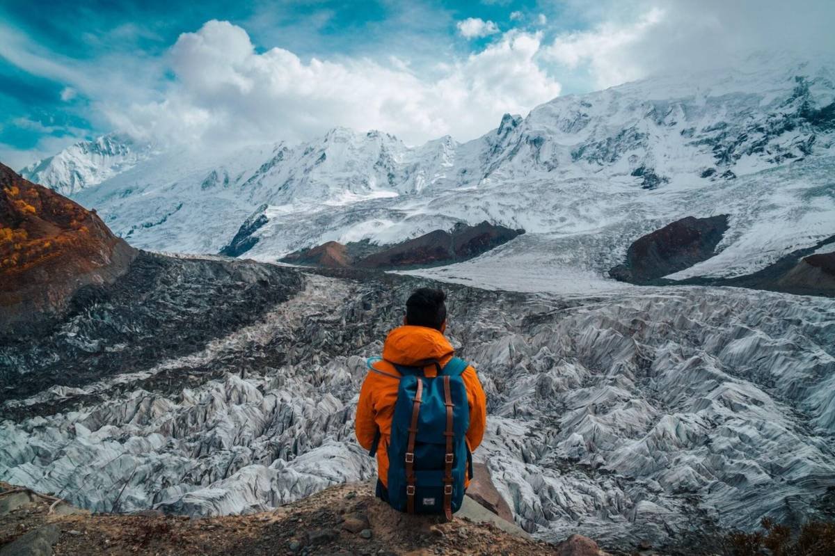
On the way to Rakaposhi Base Camp from Minapin in Nagar.
Upper Hunza (Gojal)
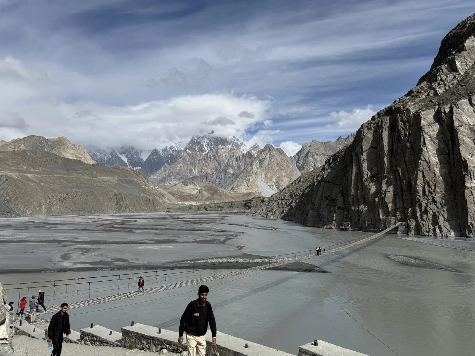
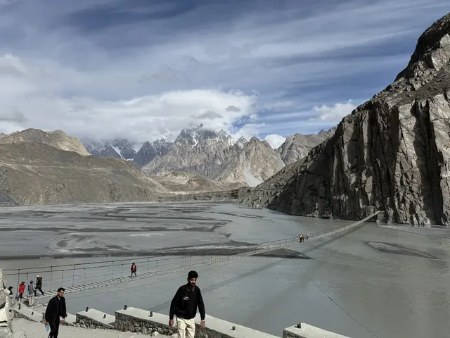
The Hussaini suspension bridge with the Passu Cones behind
8. Attabad Lake
About 31 km from Karimabad
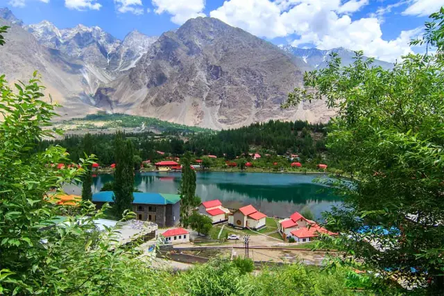
Attabad Lake formed in January 2010, when a huge landslide at Attabad blocked the Hunza River. Today its turquoise water is one of the most visited sights in northern Pakistan. The Karakoram Highway runs along the lake through a series of tunnels, and small resorts along the shore offer boat rides.
- Time needed: 1–3 hours
- Best time: midday light for the colour of the water
- Tip: in the coldest weeks of winter, the edges of the lake can freeze

Attabad Lake in Upper Hunza, formed in 2010.
9. Gulmit
About 34 km from Karimabad
Gulmit is the old centre of Upper Hunza (Gojal), a Wakhi town with traditional houses, a small museum and a polo ground. It is a quieter base than Karimabad, with good walks among orchards and fields and views of the peaks above the Ghulkin Glacier.
- Time needed: 1–2 hours, or a night
- Tip: visit the museum and an old Wakhi house to see how families lived
10. Hussaini suspension bridge
About 39 km from Karimabad
Near Hussaini village, a long pedestrian suspension bridge crosses the Hunza River. Its widely spaced planks and the wind make it one of the most photographed sights in Hunza, with the Passu Cones in the background. Many visitors walk across; others just watch from the bank.
- Time needed: about 1 hour
- Tip: cross slowly and only if you feel comfortable; it sways in the wind
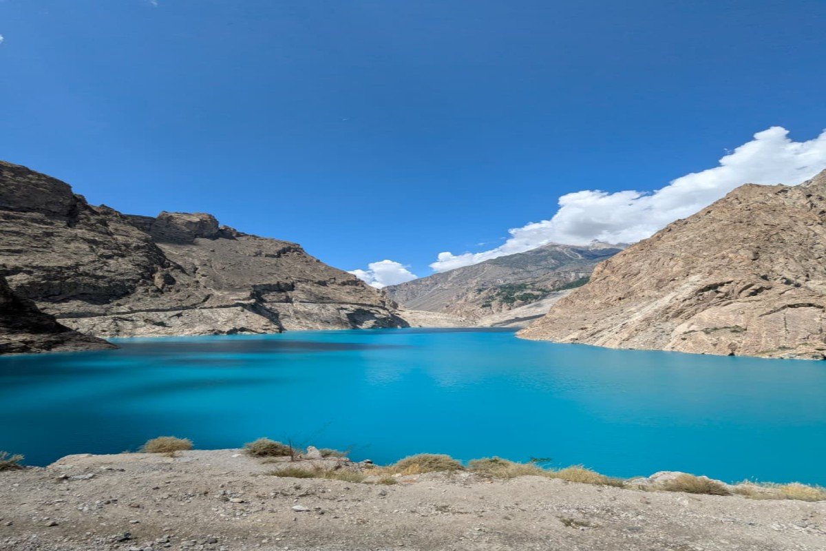
The turquoise water of Attabad Lake on a clear September day.
11. Passu Cones
About 49 km from Karimabad
Above Passu village rise the jagged, cathedral-like peaks of Tupopdan (about 6,106 m), known as the Passu Cones. They are one of the iconic views of the Karakoram Highway. Nearby stand Passu Sar (7,478 m) and the peaks of the Batura range.
- Time needed: about 1 hour, longer for photos
- Best time: late afternoon light
12. Passu Glacier and Borith Lake
Around Passu, about 50 km from Karimabad
The Passu Glacier comes down close to the village, and a short walk leads to its edge. Nearby, Borith Lake (about 2,600 m) is a small lake among fields and pastures, often frozen in midwinter. The long Batura Glacier, about 57 km, reaches the highway just north of Passu. Our Gilgit-Baltistan Trekking Adventure includes a walk on the Passu Glacier and across the suspension bridges.
- Time needed: half a day
- Tip: good walking shoes; the paths cross moraine and stony ground
13. Sost
About 90 km from Karimabad
Sost is the last town before China, with the customs and immigration post for the Khunjerab border crossing. Travellers to the Khunjerab Pass pass through, and it is a place for a tea stop or a simple meal.
- Time needed: a short stop
- Tip: if you are going to the Khunjerab Pass, start early to have time at the top
14. Khunjerab Pass
About 170 km from Karimabad · 4,693 m
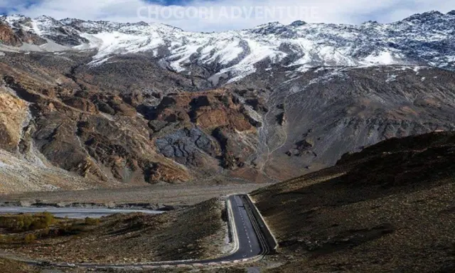
At the top of the Karakoram Highway, the Khunjerab Pass (4,693 m) marks the border with China, inside Khunjerab National Park. The road climbs through wide, high valleys, and at the top there is a border gate, snow for much of the year and thin air. It is a full day trip from Karimabad, about 4 hours each way, and the border crossing closes in winter. Our Karakoram Highway Tour includes it.
- Time needed: full day
- Tip: walk slowly at the top; many people feel short of breath at this height
15. Shimshal and Chapursan
Side valleys of Upper Hunza
For travellers with more time, two remote side valleys lead away from the highway. Shimshal, east of Passu, is reached by a long jeep road; its village, at about 3,113 m, is the highest settlement in the district and the start of the trek to the Shimshal Pass. Chapursan, in the far north-west beyond Sost, is a long Wakhi valley close to the Afghan border, with quiet villages and pastures.
- Time needed: at least one night each
- Tip: travel with a local driver; roads are rough and weather-dependent

Yaks by the lake at the Shimshal Pass, at the head of the Shimshal valley.
Things to do in Hunza
- Walk the old villages of Karimabad, Altit and Ganish, with their lanes, water channels and orchards.
- Watch sunrise or sunset over Rakaposhi from the Eagle's Nest.
- Take a boat on Attabad Lake.
- Cross the Hussaini bridge, or just watch others try.
- Walk to the edge of the Passu Glacier and around Borith Lake.
- Drive to the Khunjerab Pass on the Chinese border.
- Shop for handicrafts: woven caps, embroidered textiles, carved wood and gemstones in Karimabad.
- Eat local: chapshoro, apricot soup, walnut cake and apricots fresh in summer or dried in winter.
- Trek to Rush Lake or Rakaposhi Base Camp in summer.
Suggested plans
2 days
Day 1: Karimabad, Baltit Fort, Altit Fort and sunset at the Eagle's Nest. Day 2: Attabad Lake, Gulmit, the Hussaini bridge and the Passu Cones.
3 days
As above, plus a third day for the Khunjerab Pass, or Ganish in the morning and Nagar with the Hopar Glacier in the afternoon.
5 days
Add a night in Gulmit or Passu for walks to the Passu Glacier and Borith Lake, and a day in Nagar or a night in Shimshal. Our Hunza Tour gives you three nights in Hunza in an 8-day trip from Islamabad; the Fairy Meadows and Hunza Trip and Skardu Hunza Tour combine Hunza with Fairy Meadows or Skardu.

Sunset over the Hunza valley.
A walking day in Karimabad and Altit
Central Hunza is best seen on foot, and one unhurried day covers its three oldest places. Start early at Baltit Fort, when the morning sun lights Rakaposhi across the valley, and join a guided tour of the rooms and the roof. Walk down through the old lanes of Karimabad, past houses with carved wooden doors and the water channels that carry glacier water from the Ultar Nala to the fields.
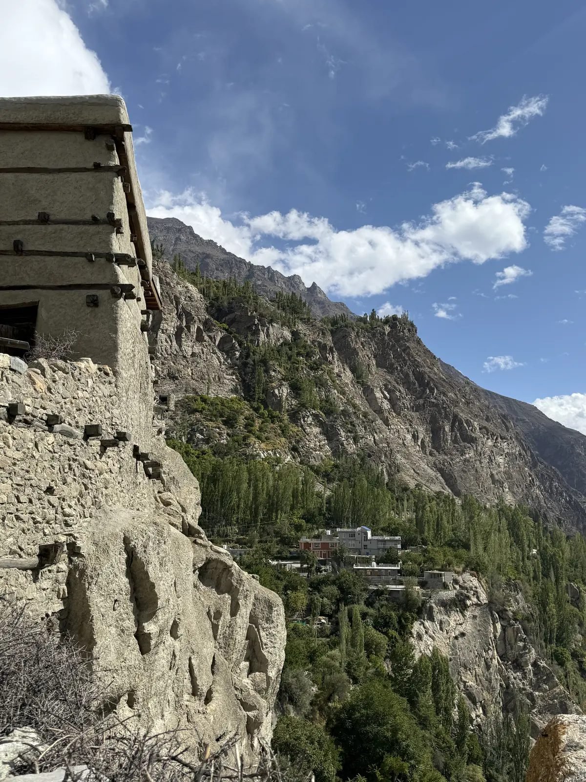
Altit Fort on its cliff above the Hunza river
After a café break in the bazaar, follow the road or the field paths to Altit, about 3 km away. Visit Altit Fort and the royal garden, then walk through the old village below it, where families still dry apricots on the flat roofs in summer. In the late afternoon, drive the 7 km up to the Eagle's Nest above Duikar for sunset over Rakaposhi, Diran and the peaks of Nagar, and come back to Karimabad for dinner.
The lanes are steep in places, so wear comfortable shoes and take your time; at about 2,450 m, even short climbs feel harder than at home.
Hunza in each season

Autumn fields and orchards along the Hunza River.
Spring (March to May). The valley wakes up in late March, and in early to mid April the apricot and cherry trees flower, first in the lower villages and then higher up. Days are mild and nights cool; fresh snow often still lies on the high peaks, which makes for the best photographs of the year.
Summer (June to August). Fields turn green and fruit ripens: cherries and mulberries in June, apricots in July. This is the season for treks such as Rush Lake and Rakaposhi Base Camp, and for the Khunjerab Pass, when the border road is fully open. It is also the busiest time, with many Pakistani families on holiday.
Autumn (September to November). Skies are often at their clearest, and from mid-October the poplars, apricot trees and fields turn yellow, orange and red. Late October and early November are favourites with photographers. Nights grow cold, and the Khunjerab crossing closes as winter approaches.
Winter (December to February). Hunza is cold, quiet and often white with snow. Some hotels close, and Borith Lake and the edges of Attabad Lake can freeze. Roads in the main valley usually stay open, but snow and landslides can cause delays, so keep spare days in your plans.
Best time to visit
| Season | What to expect |
|---|---|
| April | Apricot and cherry blossom across the valley; cool nights |
| May–June | Green fields, mild days, long evenings |
| July–August | The warmest months; good for treks and the Khunjerab Pass |
| September–early November | Clear skies, then golden poplars and orchards from mid-October |
| December–March | Cold and quiet; frozen lakes, many hotels closed, Khunjerab border closed |
For winter travel, read our guide to winter in Pakistan.
Getting around Hunza
The Karakoram Highway, the road that links almost every place in this guide.
The Karakoram Highway links almost every place on this list, so a car or jeep with a local driver is the most practical way to see Hunza; for Shimshal, Chapursan and Nagar's side roads, a 4x4 is best. Shared vans run along the highway between Aliabad, Karimabad and the villages of Upper Hunza. In Karimabad, Altit and Ganish, walking is the way to explore. To reach Hunza from Skardu, see our Skardu to Hunza guide.
Where to stay
Karimabad has the widest choice and puts you within walking distance of Baltit Fort and the bazaar; the Eagle's Nest area has hotels with sunrise views. In Upper Hunza, Gulmit and Passu are quieter bases close to Attabad Lake, the Hussaini bridge and the glaciers. In the blossom season (April) and in October, book ahead.
Tips for visiting Hunza
- Dress modestly and ask before photographing people, especially women and elders.
- Carry cash in Pakistani rupees for entry tickets and small shops.
- Bring warm layers: evenings are cool, and the Eagle's Nest and the Khunjerab Pass are much colder.
- Start early for the Khunjerab Pass and allow a full day.
- Respect fields and water channels; walk on paths.
- Keep a spare day in your plans for weather on the Karakoram Highway.
Why Hunza is special
Few valleys combine so much in so small an area: some of the highest mountains on Earth seen from village terraces, castles more than a thousand years old, a lake born in a landslide, Wakhi and Burusho cultures side by side, and a road that climbs to the border with China. Most of it is within an hour or two of Karimabad, which is why so many visitors stay longer than they planned.
A short history of Hunza
For centuries Hunza was a small mountain state ruled by its own Mirs, first from Altit Fort and later from Baltit Fort. Its villages controlled a branch of the old trade routes between the Indus valley and Central Asia, and the forts, watchtowers and fortified villages you see today, at Altit, Baltit and Ganish, grew out of that history. The neighbouring state of Nagar, across the river, had its own rulers, and the two were often rivals.
Hunza joined Pakistan after 1947 and kept its own ruler until 1974, when the princely states of the region were dissolved and it became part of what is now Gilgit-Baltistan. The building of the Karakoram Highway in the 1960s and 1970s, opened to travellers in the 1980s, turned a valley reached on foot and by mule into one of the most visited places in northern Pakistan. The restoration of Baltit, Altit and Ganish by local trusts, with international support, has kept that history visible for visitors.
People, languages and culture
Hunza is home to several communities. In central Hunza around Karimabad and Altit, most people speak Burushaski, a language not related to any other known language. In Upper Hunza (Gojal), from Gulmit to Sost and in Shimshal and Chapursan, most people are Wakhi, sharing their language with the Wakhan corridor of Afghanistan and neighbouring parts of Tajikistan and China. Shina is spoken in parts of lower Hunza and Nagar. Most people in Hunza are Ismaili Muslims, while Nagar is mainly Shia.
Visitors are struck by the strong community life: village councils, shared water channels, well-kept schools and a high rate of education, including for girls. Music and dance appear at weddings and festivals, and in spring the valley marks the season of planting and blossom. Many young people speak good English and work in tourism, so it is easy to find a local guide who can explain the places you visit.
Food to try in Hunza
Hunza food is simple, seasonal and built on what the valley grows: wheat and buckwheat, apricots, apples, cherries, mulberries, walnuts and almonds, potatoes and dairy. Look for these dishes in local cafés and family-run restaurants:
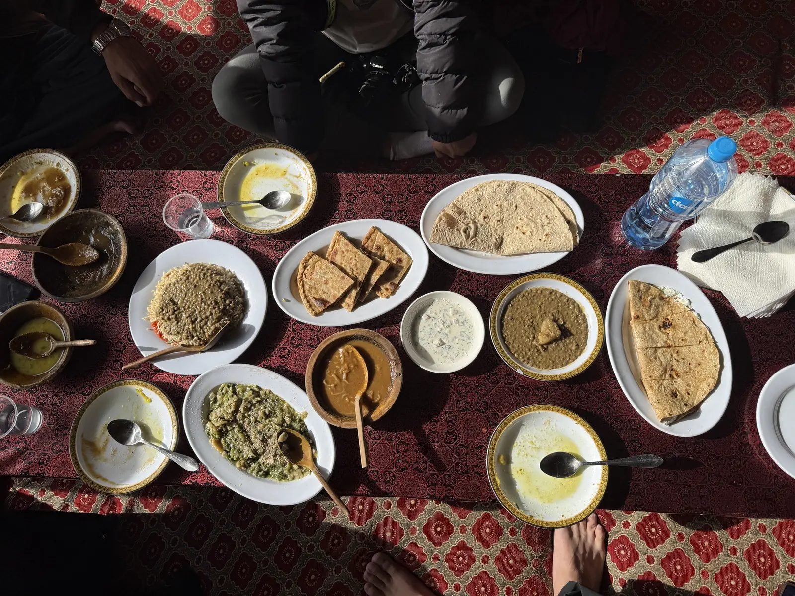
A spread of Hunza dishes on the table
- Chapshoro: a round bread stuffed with minced meat, onions and spices, baked or fried; the best-known Hunza dish.
- Diram fiti: a sweet bread made from sprouted wheat flour, often eaten with apricot oil or butter.
- Harissa and soups: thick, warming soups with home-made noodles, wheat and meat, especially welcome in the cold months.
- Apricots in every form: fresh in summer, dried for the winter, cooked into soups and pressed for oil.
- Walnut and apricot cake: sold in Karimabad cafés and a favourite with visitors.
- Local tea: salty or sweet milk tea, and herbal teas from mountain plants.
Fresh fruit is at its best from June (cherries and mulberries) to August and September (apricots, apples and walnuts). Dried apricots, walnuts and apricot oil make good gifts to take home.
Photography tips
- Morning and evening light is best for the peaks: Rakaposhi from Karimabad, the Eagle's Nest at sunrise and the Passu Cones in late afternoon.
- Attabad Lake shows its strongest colour around midday, when the sun is high.
- Blossom (April) and autumn colours (late October) are the two most photogenic seasons; book early for both.
- Ask before you photograph people, especially women and elders, and respect a no.
- Drones need permission; do not fly near the Khunjerab border post or over villages.
- Carry spare batteries: they drain quickly in the cold at the Eagle's Nest and the Khunjerab Pass.
Altitude and health
Karimabad sits at about 2,450 m and most of the places in this guide are between 2,400 m and 2,800 m, where most visitors feel only mild effects, such as shortness of breath on steep lanes. The Khunjerab Pass, at 4,693 m, is different: you gain more than 2,000 m in a few hours by road. Walk slowly at the top, drink water, and limit your time there to what feels comfortable. If you have a heart or lung condition, ask your doctor before you go.
Drink bottled, boiled or filtered water, and carry basic medicines. Pharmacies are found in Aliabad and Karimabad; the main hospitals are in Aliabad and Gilgit.
Money, phones and internet
Carry cash in Pakistani rupees. There are ATMs in Aliabad and Karimabad, but they can run out of money or go offline, and cards are accepted only in some hotels. Mobile networks cover Karimabad, Aliabad and most of the highway; the signal is weak or absent in side valleys such as Shimshal and Chapursan and near the Khunjerab Pass. Most hotels in Karimabad offer Wi-Fi, though speeds vary and power cuts are common in winter.
Responsible travel
- Use the bins in town or carry your rubbish back; plastic does not decompose at this altitude.
- Stay on paths through fields and orchards, and do not pick fruit without asking.
- Do not block or step into the water channels that feed the villages.
- Buy local: handicrafts, dried fruit and meals from family-run places keep money in the valley.
- Dress modestly in villages and around mosques and shrines.
Frequently asked questions
What are the best places to visit in Hunza?
Karimabad with Baltit Fort, Altit Fort, the Eagle's Nest viewpoint, Attabad Lake, Gulmit, the Hussaini suspension bridge, the Passu Cones and the Khunjerab Pass on the Chinese border. Ganish, Borith Lake and the Rakaposhi viewpoint are also worth a stop.
How many days do you need in Hunza?
At least three nights: one day for Karimabad, Baltit, Altit and the Eagle's Nest, one for Attabad Lake, Gulmit, Hussaini and Passu, and one for the Khunjerab Pass or a short walk.
How far is Attabad Lake from Karimabad?
About 31 km by road, around 45 minutes on the Karakoram Highway through the tunnels.
How far is the Khunjerab Pass from Karimabad?
About 170 km, around 4 hours each way. It is a full day trip, and the border crossing closes for the winter.
Is Baltit Fort open to visitors?
Yes. Baltit Fort is a museum, visited on guided tours; there is an entry fee.
What is the Eagle's Nest in Hunza?
A viewpoint above the village of Duikar, at about 2,800 m and about 7 km by road from Karimabad, famous for sunrise and sunset over Rakaposhi, Ultar Sar and Ladyfinger.
Can you cross the Hussaini bridge?
Many visitors walk across the Hussaini suspension bridge over the Hunza River. Its planks are widely spaced and it sways in the wind, so cross slowly and only if you feel comfortable.
What is the best time to visit Hunza?
April for the blossom, May to June and September for settled weather, and October to early November for autumn colours. Winter is cold and quiet.
Where should I stay in Hunza?
Karimabad is the most convenient base; Gulmit and Passu are quieter bases for Upper Hunza.
Which is older, Baltit Fort or Altit Fort?
Altit Fort, whose Shikari Tower is around 1,100 years old, is older; the rulers of Hunza later moved to Baltit Fort.
What are the Passu Cones?
The jagged "cathedral" peaks of Tupopdan (about 6,106 m) above Passu village, seen from the Karakoram Highway in Upper Hunza.
Do I need a permit for the Khunjerab Pass?
A day trip to the pass needs no trekking permit. Khunjerab is a national park: visitors need a permit from the Gilgit-Baltistan Wildlife Department, and the park entry fee applies.
What is Hunza famous for?
Its mountain views, especially of Rakaposhi and Ultar Sar, its old forts, Attabad Lake, the Passu Cones, apricot orchards and blossom, and the hospitality of its people.
Can I visit Hunza on a tour?
Yes. Our Hunza Tour (8 days from Islamabad) covers the main sights, and our Fairy Meadows and Hunza Trip and Karakoram Highway Tour add Fairy Meadows and the Khunjerab Pass.
What should I eat in Hunza?
Chapshoro (meat-filled bread), apricots in every form, walnut and apricot cakes, soups with home-made noodles and local tea.
What languages are spoken in Hunza?
Burushaski in central Hunza, Wakhi in Upper Hunza (Gojal), and Shina in parts of lower Hunza and Nagar. Urdu is widely understood, and many young people speak English.
Are there ATMs in Hunza?
Yes, in Aliabad and Karimabad, but they can be out of cash or offline, so carry enough Pakistani rupees for entry fees, meals and small shops.
Is there mobile signal in Hunza?
Yes, in Karimabad, Aliabad and along most of the Karakoram Highway; it is weak or absent in Shimshal, Chapursan and near the Khunjerab Pass.
When is apricot blossom in Hunza?
Usually in early to mid April, depending on the year and the height of the village; the lower villages blossom first.
How far is Passu from Karimabad?
About 49 km, around an hour by road, passing Attabad Lake, Gulmit and Hussaini on the way.
About the author
Imtiyaz Ahmed Shigri founded Chogori Adventure in Skardu in 2015. Our guides are local, government-licensed and English-speaking, and most of them are trained in first aid. We are licensed by the Department of Tourist Services (licence no. 2494) and the Gilgit-Baltistan tourism department (licence DTS-GB-055), and we are a member of the Pakistan Association of Tour Operators, with offices in Skardu and Islamabad.
Rated 4.9 out of 5 from 47 reviews on Google (November 2026). Read our reviews on Google